 |
|
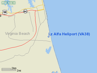
Location & QuickFacts
| FAA Information Effective: | 2008-09-25 |
| Airport Identifier: | VA38 |
| Airport Status: | Operational |
| Longitude/Latitude: | 075-57-52.7430W/36-47-35.5380N
-75.964651/36.793205 (Estimated) |
| Elevation: | 10 ft / 3.05 m (Estimated) |
| Land: | 0 acres |
| From nearest city: | 3 nautical miles S of Virginia Beach, VA |
| Location: | Virginia Beach County, VA |
| Magnetic Variation: | 09W (1985) |
Owner & Manager
| Ownership: | Navy owned |
| Owner: | Naval Special Warfare Dev Grp |
| Address: | Naval Facility Dam Neck
Virginia Beach, VA 23461-2299 |
| Phone number: | 804-433-7960 |
| Address: |
|
Airport Operations and Facilities
| Airport Use: | Private |
| Wind indicator: | Yes |
| Segmented Circle: | No |
| Control Tower: | No |
| Sectional chart: | Washington |
| Region: | AEA - Eastern |
| Boundary ARTCC: | ZDC - Washington |
| Tie-in FSS: | DCA - Leesburg |
| FSS on Airport: | No |
| FSS Toll Free: | 1-800-WX-BRIEF |
Runway Information
Helipad H1
| Dimension: | 100 x 100 ft / 30.5 x 30.5 m |
| Surface: | ASPH, |
| |
Runway H1 |
Runway |
| Traffic Pattern: | Left | Left |
|
Radio Navigation Aids
| ID |
Type |
Name |
Ch |
Freq |
Var |
Dist |
| PVG | NDB | Portsmouth | | 241.00 | 10W | 23.2 nm |
| EY | NDB | Chesi | | 233.00 | 09W | 23.2 nm |
| PJS | NDB | Henry | | 375.00 | 09W | 32.6 nm |
| RK | NDB | Waley | | 249.00 | 10W | 35.0 nm |
| LLW | NDB | Woodville | | 254.00 | 10W | 35.7 nm |
| FAF | NDB | Felker | | 226.00 | 08W | 37.7 nm |
| BDB | NDB | Accomack | | 336.00 | 11W | 47.4 nm |
| NTU | TACAN | Oceana | 113X | | 10W | 3.9 nm |
| NGU | TACAN | Chambers | 048X | | 10W | 17.4 nm |
| LFI | TACAN | Langley | 070X | | 10W | 25.8 nm |
| ECG | VOR/DME | Elizabeth City | 072X | 112.50 | 07W | 33.8 nm |
| ORF | VORTAC | Norfolk | 116X | 116.90 | 07W | 12.8 nm |
| CCV | VORTAC | Cape Charles | 059X | 112.20 | 10W | 33.4 nm |
Remarks
- PRVDD RADIO COMMUNICATIONS ARE MAINTAINED WITH THE NAVAL STATION ATCT & SPECIFIC CLEARANCES OBTAINED WHILE OPERATING WITHIN THE ATA. LOA WITH NAVAL AIR STATION OCEANA VA BEACH VA.
Images and information placed above are from
http://www.airport-data.com/airport/VA38/
We thank them for the data!
| General Info
|
| Country |
United States
|
| State |
VIRGINIA
|
| FAA ID |
VA38
|
| Latitude |
36-47-35.538N
|
| Longitude |
075-57-52.743W
|
| Elevation |
10 feet
|
| Near City |
VIRGINIA BEACH
|
We don't guarantee the information is fresh and accurate. The data may
be wrong or outdated.
For more up-to-date information please refer to other sources.
|
|


