|
|
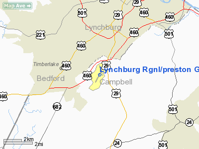
Lynchburg Rgnl/preston Glenn Fld Airport |
Lynchburg Regional Airport
Preston Glenn Field |
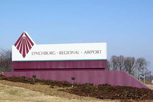 |
| Lynchburg Regional Airport main signage off U.S. 29 |
| IATA: LYH – ICAO: KLYH |
| Summary |
| Operator |
City of Lynchburg |
| Serves |
Lynchburg, Virginia |
| Location |
Lynchburg, Virginia |
| Elevation AMSL |
938 ft / 285.9 m |
| Coordinates |
37°19′36.06″N 79°12′01.55″W / 37.3266833°N 79.2004306°W / 37.3266833; -79.2004306 |
| Website |
Lynchburg Regional Airport |
| Runways |
| Direction |
Length |
Surface |
| ft |
m |
| 4/22 |
7,100 |
2,164 |
Asphalt |
| 17/35 |
3,387 |
1,032 |
Asphalt |
| Federal Aviation Administration |
Lynchburg Regional Airport (IATA: LYH, ICAO: KLYH), also known as Preston Glenn Field, is a public airport located five miles (8 km) southwest of the city of Lynchburg in Campbell County, Virginia, USA. The airport has two runways and is mostly used for general aviation, but is also served by two commercial airlines.
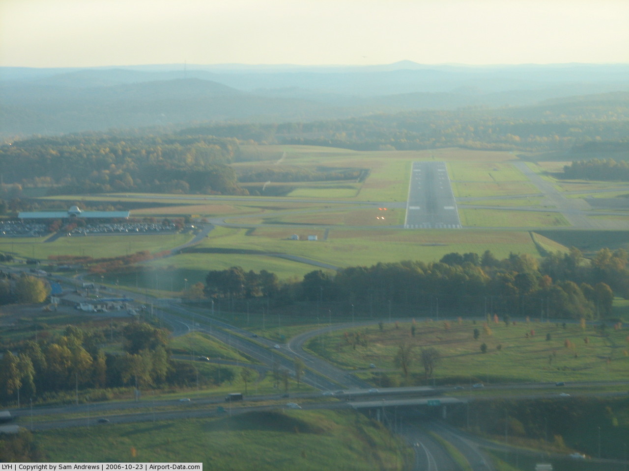
The new extended runway opened on August 12, 2007. It was extended by 1,301 feet (397 m) from 5,799 feet (1,768 m) to 7,100 feet (2,200 m).
Airlines
| Airlines |
Destinations |
| Delta Connection operated by Atlantic Southeast Airlines |
Atlanta |
| US Airways Express operated by Piedmont Airlines |
Charlotte |
The above content comes from Wikipedia and is published under free licenses – click here to read more.
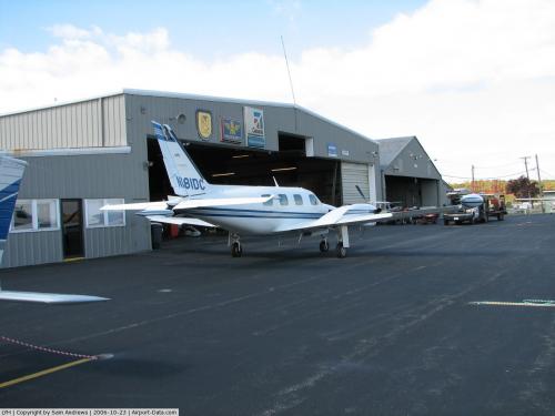 |
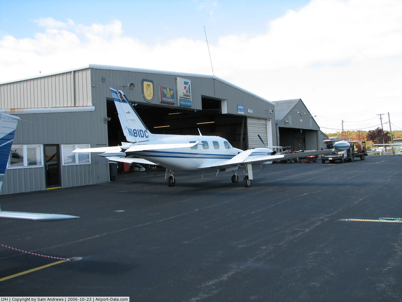
(Click on the photo to enlarge) |
 |
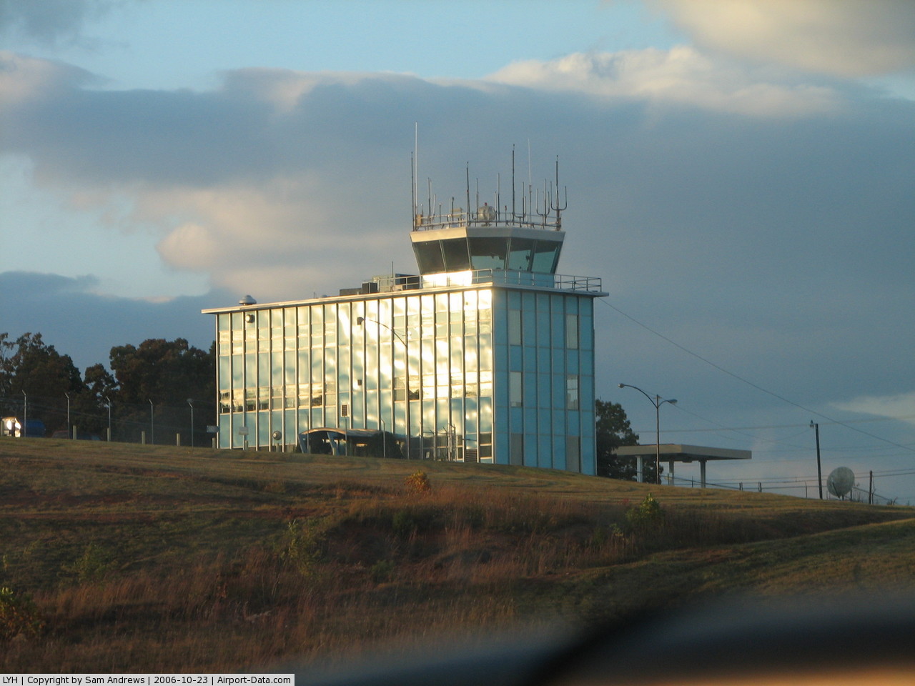
(Click on the photo to enlarge) |
 |
(Click on the photo to enlarge) |
Location & QuickFacts
| FAA Information Effective: | 2008-09-25 |
| Airport Identifier: | LYH |
| Airport Status: | Operational |
| Longitude/Latitude: | 079-12-01.5500W/37-19-31.4000N
-79.200431/37.325389 (Estimated) |
| Elevation: | 938 ft / 285.90 m (Surveyed) |
| Land: | 872 acres |
| From nearest city: | 5 nautical miles SW of Lynchburg, VA |
| Location: | Campbell County, VA |
| Magnetic Variation: | 09W (2005) |
Owner & Manager
| Ownership: | Publicly owned |
| Owner: | City Of Lynchburg |
| Address: | 4308 Wards Rd Suite 100
Lynchburg, VA 24505 |
| Phone number: | 434-455-6090 |
| Manager: | Mark Courtney |
| Address: | 4308 Wards Rd Suite 100
Lynchburg, VA 24502 |
| Phone number: | 434-455-6090 |
Airport Operations and Facilities
| Airport Use: | Open to public |
| Wind indicator: | Yes |
| Segmented Circle: | No |
| Control Tower: | Yes |
| Lighting Schedule: | DUSK-DAWN
WHEN ATCT CLSD ACTVT HIRL RY 04/22; MALSR RY 04 & TWY LGTS - CTAF. MIRL RY 17/35; REIL RYS 17 & 35 & PAPI RYS 17 & 35 UNAVBL WHEN ATCT CLSD. |
| Beacon Color: | Clear-Green (lighted land airport) |
| Landing fee charge: | No |
| Sectional chart: | Cincinnati |
| Region: | AEA - Eastern |
| Boundary ARTCC: | ZDC - Washington |
| Tie-in FSS: | DCA - Leesburg |
| FSS on Airport: | No |
| FSS Toll Free: | 1-800-WX-BRIEF |
| NOTAMs Facility: | LYH (NOTAM-d service avaliable) |
| Certification type/date: | I A S 05/1973
PPR 12 HRS FOR UNSKED ACR OPNS WITH MORE THAN 30 PSGR SEATS. CALL ARFF 434-582-1157. |
| Federal Agreements: | NGHVY3 |
Airport Communications
| CTAF: | 127.650 |
| Unicom: | 122.950 |
Airport Services
| Fuel available: | 100LLA |
| Airframe Repair: | MAJOR |
| Power Plant Repair: | MAJOR |
| Bottled Oxygen: | HIGH |
| Bulk Oxygen: | NONE |
Runway Information
Runway 04/22
| Dimension: | 7100 x 150 ft / 2164.1 x 45.7 m |
| Surface: | ASPH, Good Condition |
| Surface Treatment: | Saw-cut or plastic Grooved |
| Weight Limit: | Single wheel: 90000 lbs.
Dual wheel: 108000 lbs.
Dual tandem wheel: 170000 lbs. |
| Edge Lights: | High |
| |
Runway 04 |
Runway 22 |
| Longitude: | 079-12-28.6906W | 079-11-47.6885W |
| Latitude: | 37-18-52.9843N | 37-19-55.0712N |
| Elevation: | 894.00 ft | 938.00 ft |
| Alignment: | 28 | 127 |
| ILS Type: | ILS
| |
| Traffic Pattern: | Left | Left |
| Markings: | Precision instrument, Good Condition
MARKINGS FADED. | Non-precision instrument, Good Condition
MARKINGS FADED. |
| Crossing Height: | 55.00 ft | 45.00 ft |
| VASI: | 4-light PAPI on left side | 4-light PAPI on left side |
| Visual Glide Angle: | 3.00° | 3.00° |
| RVR Equipment: | touchdown | |
| Approach lights: | MALSR | |
| Runway End Identifier: | | Yes |
| Obstruction: | , 50:1 slope to clear | 20 ft gnd, 850.0 ft from runway, 550 ft left of centerline, 32:1 slope to clear |
| Decleard distances: | Take off run available 7100.00 ft
Take off distance available 7100.00 ft
Actual stop distance available 6800.00 ft
Landing distance available 6800.00 ft
| Take off run available 7100.00 ft
Take off distance available 7100.00 ft
Actual stop distance available 7100.00 ft
Landing distance available 7100.00 ft
|
|
Runway 17/35
| Dimension: | 3386 x 75 ft / 1032.1 x 22.9 m |
| Surface: | ASPH, Good Condition |
| Weight Limit: | Single wheel: 25000 lbs.
Dual wheel: 35000 lbs.
Dual tandem wheel: 55000 lbs. |
| Edge Lights: | Medium |
| |
Runway 17 |
Runway 35 |
| Longitude: | 079-12-03.3705W | 079-11-49.7963W |
| Latitude: | 37-20-02.7552N | 37-19-31.0815N |
| Elevation: | 922.00 ft | 921.00 ft |
| Alignment: | 127 | 127 |
| Traffic Pattern: | Left | Left |
| Markings: | Non-precision instrument, Fair Condition
MARKINGS FADED | Non-precision instrument, Fair Condition
MARKINGS FADED |
| Crossing Height: | 20.00 ft | 20.00 ft |
| VASI: | 2-light PAPI on left side | 2-light PAPI on left side |
| Visual Glide Angle: | 4.00° | 4.00° |
| Runway End Identifier: | Yes | Yes |
|
Radio Navigation Aids
| ID |
Type |
Name |
Ch |
Freq |
Var |
Dist |
| LY | NDB | Bojar | | 385.00 | 08W | 4.3 nm |
| VIT | NDB | Vinton | | 277.00 | 06W | 33.4 nm |
| FVX | NDB | Farmville | | 367.00 | 07W | 36.5 nm |
| CNQ | NDB | Callahan | | 379.00 | 05W | 46.0 nm |
| ODR | VOR | Woodrum | | 114.90 | 06W | 37.2 nm |
| DAN | VOR | Danville | | 113.10 | 06W | 45.9 nm |
| MOL | VOR/DME | Montebello | 100X | 115.30 | 05W | 34.9 nm |
| LYH | VORTAC | Lynchburg | 029X | 109.20 | 05W | 4.6 nm |
| SBV | VORTAC | South Boston | 041X | 110.40 | 05W | 40.1 nm |
| ROA | VORTAC | Roanoke | 031X | 109.40 | 04W | 41.6 nm |
Remarks
- TWY G UNCONTROLLED-NOT VISIBLE FROM ATCT.
- BIRDS AND OTHER WILDLIFE ON & INVOF ARPT.
- RY 17/35 CLSD TO AIR CARRIER & ACFT OVER 12500 LBS W/O PPR.
- TWY G CLSD TO AIR CARRIER AND ACFT OVER 12500 LBS.
Images and information placed above are from
http://www.airport-data.com/airport/LYH/
We thank them for the data!
| General Info
|
| Country |
United States
|
| State |
VIRGINIA
|
| FAA ID |
LYH
|
| Latitude |
37-19-36.067N
|
| Longitude |
079-12-01.550W
|
| Elevation |
938 feet
|
| Near City |
LYNCHBURG
|
We don't guarantee the information is fresh and accurate. The data may
be wrong or outdated.
For more up-to-date information please refer to other sources.
|
|