 |
|
 |
(Click on the photo to enlarge) |
 |
(Click on the photo to enlarge) |
 |
(Click on the photo to enlarge) |
 |
(Click on the photo to enlarge) |
 |
(Click on the photo to enlarge) |
 |
(Click on the photo to enlarge) |
 |
(Click on the photo to enlarge) |
 |
(Click on the photo to enlarge) |
 |
(Click on the photo to enlarge) |
 |
(Click on the photo to enlarge) |
 |
(Click on the photo to enlarge) |
 |
(Click on the photo to enlarge) |
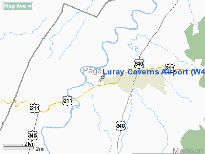
Location & QuickFacts
| FAA Information Effective: | 2008-09-25 |
| Airport Identifier: | W45 |
| Airport Status: | Operational |
| Longitude/Latitude: | 078-30-02.1000W/38-40-01.4000N
-78.500583/38.667056 (Estimated) |
| Elevation: | 902 ft / 274.93 m (Surveyed) |
| Land: | 95 acres |
| From nearest city: | 2 nautical miles W of Luray, VA |
| Location: | Page County, VA |
| Magnetic Variation: | 09W (1995) |
Owner & Manager
| Ownership: | Publicly owned |
| Owner: | Luray Page Co Arpt Comsn |
| Address: | 270 Circle View Road
Luray, VA 22835 |
| Phone number: | 540-743-7339 |
| Manager: | Kenneth Lee Painter |
| Address: | Po Box 748
Luray, VA 22835 |
| Phone number: | 540-743-6070 |
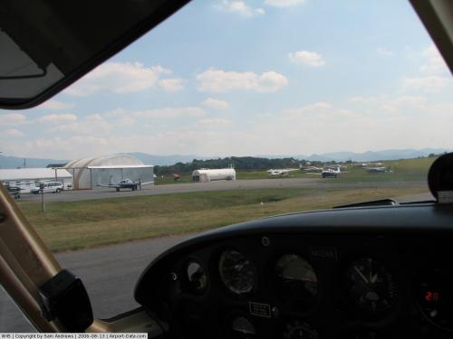
Airport Operations and Facilities
| Airport Use: | Open to public |
| Wind indicator: | Yes |
| Segmented Circle: | Yes |
| Control Tower: | No |
| Lighting Schedule: | DUSK-DAWN
ACTVT MIRL RY 04/22 - CTAF. |
| Beacon Color: | Clear-Green (lighted land airport) |
| Landing fee charge: | No |
| Sectional chart: | Washington |
| Region: | AEA - Eastern |
| Boundary ARTCC: | ZDC - Washington |
| Tie-in FSS: | DCA - Leesburg |
| FSS on Airport: | No |
| FSS Toll Free: | 1-800-WX-BRIEF |
| NOTAMs Facility: | DCA (NOTAM-d service avaliable) |
| Federal Agreements: | N |
Airport Communications
| CTAF: | 122.800 |
| Unicom: | 122.800 |
Airport Services
| Fuel available: | 100LL |
| Airframe Repair: | NONE |
| Power Plant Repair: | NONE |
Runway Information
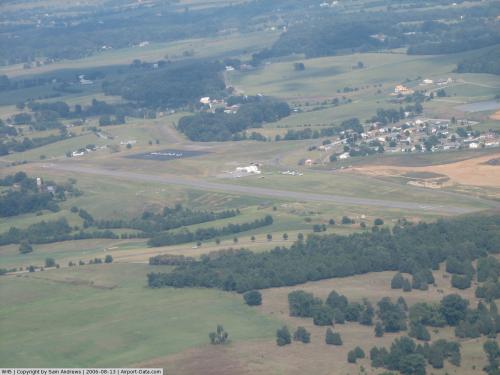
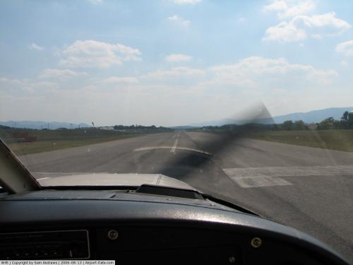
Runway 04/22
| Dimension: | 3125 x 75 ft / 952.5 x 22.9 m |
| Surface: | ASPH, Fair Condition |
| Weight Limit: | Single wheel: 12000 lbs. |
| Edge Lights: | Medium |
| |
Runway 04 |
Runway 22 |
| Longitude: | 078-30-13.2240W | 078-29-50.8570W |
| Latitude: | 38-39-48.6950N | 38-40-14.1250N |
| Elevation: | 903.00 ft | 902.00 ft |
| Alignment: | 35 | 127 |
| Traffic Pattern: | Left | Right |
| Markings: | Basic, Poor Condition
RY 04 MARKINGS FADED. | Basic, Poor Condition
RY 22 MARKINGS FADED. |
| VASI: | system of panels on left side that may or may not be lighted | system of panels on left side that may or may not be lighted |
| Visual Glide Angle: | 3.00° | 3.00° |
| Obstruction: | 11 ft tree, 520.0 ft from runway, 73 ft right of centerline, 29:1 slope to clear | 5 ft trees, 309.0 ft from runway, 120 ft right of centerline, 21:1 slope to clear |
|
Radio Navigation Aids
| ID |
Type |
Name |
Ch |
Freq |
Var |
Dist |
| LUA | NDB | Caverns | | 245.00 | 09W | 2.4 nm |
| VBW | NDB | Bridgewater | | 241.00 | 07W | 28.2 nm |
| MSQ | NDB | Nailr | | 351.00 | 10W | 30.8 nm |
| CJR | NDB | Culpeper | | 252.00 | 09W | 31.3 nm |
| TZ | NDB | Cogan | | 364.00 | 10W | 32.3 nm |
| GDX | NDB | Goodwin Lake | | 227.00 | 08W | 35.8 nm |
| AZS | NDB | Azalea Park | | 336.00 | 08W | 39.5 nm |
| IQK | NDB | Louisa | | 382.00 | 09W | 49.2 nm |
| ESL | VOR/DME | Kessel | 045X | 110.80 | 06W | 40.6 nm |
| LDN | VORTAC | Linden | 090X | 114.30 | 06W | 17.8 nm |
| CSN | VORTAC | Casanova | 110X | 116.30 | 06W | 29.9 nm |
| GVE | VORTAC | Gordonsville | 103X | 115.60 | 06W | 42.6 nm |
Remarks
- TAXI ON HARD SFCS ONLY.
- DEER AND BIRDS ON AND INVOF ARPT
- RGT TFC FOR LNDG TO SW.
Images and information placed above are from
http://www.airport-data.com/airport/W45/
We thank them for the data!
| General Info
|
| Country |
United States
|
| State |
VIRGINIA
|
| FAA ID |
W45
|
| Latitude |
38-40-01.400N
|
| Longitude |
078-30-02.100W
|
| Elevation |
902 feet
|
| Near City |
LURAY
|
We don't guarantee the information is fresh and accurate. The data may
be wrong or outdated.
For more up-to-date information please refer to other sources.
|
|


