 |
|
| Lonesome Pine Airport |
| IATA: LNP – ICAO: KLNP – FAA LID: LNP |
| Summary |
| Airport type |
Public |
| Operator |
The Cumberland Airport Commission |
| Location |
Wise, Virginia |
| Elevation AMSL |
2,684 ft / 818.1 m |
| Coordinates |
36°59′15″N 082°31′48″W / 36.9875°N 82.53°W / 36.9875; -82.53Coordinates: 36°59′15″N 082°31′48″W / 36.9875°N 82.53°W / 36.9875; -82.53 |
| Runways |
| Direction |
Length |
Surface |
| ft |
m |
| 6/24 |
5,280 |
1,609 |
Asphalt (grooved) |
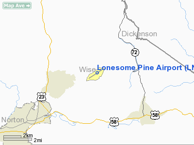
Lonesome Pine Airport (IATA: LNP, ICAO: KLNP, FAA LID: LNP) is a public airport located three miles (5 km) northeast of the central business district (CBD) of Wise, a town in Wise County, Virginia, USA. This general aviation airport covers 417 acres (169 ha) and has one runway. It was once served with commercial airline service on Appalachian Airlines.
The above content comes from Wikipedia and is published under free licenses – click here to read more.
Location & QuickFacts
| FAA Information Effective: | 2008-09-25 |
| Airport Identifier: | LNP |
| Airport Status: | Operational |
| Longitude/Latitude: | 082-31-48.0000W/36-59-15.1000N
-82.530000/36.987528 (Estimated) |
| Elevation: | 2684 ft / 818.08 m (Surveyed) |
| Land: | 417 acres |
| From nearest city: | 3 nautical miles NE of Wise, VA |
| Location: | Wise County, VA |
| Magnetic Variation: | 06W (2000) |
Owner & Manager
| Ownership: | Publicly owned |
| Owner: | The Cumberland Arpt Comsn
DONNIE ROSE, CHAIRMAN. |
| Address: | Po Box 1752
Wise, VA 24293 |
| Phone number: | 276-395-6751 |
| Manager: | Bob Spera |
| Address: | 6225 Airport Rd.
Wise, VA 24293 |
| Phone number: | 276-328-5300
AFT HRS FEE ($35 FOR FUEL) 276-328 9089. |
Airport Operations and Facilities
| Airport Use: | Open to public |
| Wind indicator: | Yes |
| Segmented Circle: | Yes |
| Control Tower: | No |
| Lighting Schedule: | DUSK-DAWN
ACTVT MIRL RY 06/24, ODALS RY 24, & REILS RY 06 & 24 - CTAF. |
| Beacon Color: | Clear-Green (lighted land airport) |
| Landing fee charge: | No |
| Sectional chart: | Cincinnati |
| Region: | AEA - Eastern |
| Boundary ARTCC: | ZID - Indianapolis |
| Tie-in FSS: | DCA - Leesburg |
| FSS on Airport: | No |
| FSS Toll Free: | 1-800-WX-BRIEF |
| NOTAMs Facility: | LNP (NOTAM-d service avaliable) |
| Federal Agreements: | NGY |
Airport Communications
| CTAF: | 123.000 |
| Unicom: | 123.000 |
Airport Services
| Fuel available: | 100LLA |
| Bottled Oxygen: | NONE |
| Bulk Oxygen: | NONE |
Runway Information
Runway 06/24
| Dimension: | 5280 x 100 ft / 1609.3 x 30.5 m |
| Surface: | ASPH, Good Condition |
| Surface Treatment: | Saw-cut or plastic Grooved |
| Weight Limit: | Single wheel: 42000 lbs.
Dual wheel: 55000 lbs.
Dual tandem wheel: 100000 lbs. |
| Edge Lights: | Medium |
| |
Runway 06 |
Runway 24 |
| Longitude: | 082-32-15.0221W | 082-31-20.9606W |
| Latitude: | 36-59-00.5366N | 36-59-29.5915N |
| Elevation: | 2670.00 ft | 2684.00 ft |
| Alignment: | 56 | 127 |
| ILS Type: | | LOC/DME
|
| Traffic Pattern: | Left | Left |
| Markings: | Non-precision instrument, Fair Condition
RY END MKGS FADED AND WORN. | Non-precision instrument, Poor Condition
RY END MKGS FADED AND WORN. |
| Crossing Height: | 40.00 ft | 40.00 ft |
| VASI: | 2-light PAPI on left side | 2-light PAPI on right side |
| Visual Glide Angle: | 3.00° | 3.00° |
| Approach lights: | | ODALS
NSTD ODALS; 5 LGT CONFIGN. |
| Runway End Identifier: | Yes | Yes |
| Obstruction: | 14 ft tree, 207.0 ft from runway, 87 ft left of centerline
TREE 13 FT HT 369 FT FM RY END 42 FT LT. | 37 ft trees, 1068.0 ft from runway, 135 ft right of centerline, 23:1 slope to clear |
|
Radio Navigation Aids
| ID |
Type |
Name |
Ch |
Freq |
Var |
Dist |
| LQV | NDB | Long Hollow | | 252.00 | 03W | 31.1 nm |
| VJ | NDB | Whine | | 236.00 | 05W | 31.8 nm |
| BO | NDB | Booie | | 221.00 | 04W | 35.4 nm |
| RVN | NDB | Rogersville | | 329.00 | 04W | 36.2 nm |
| EZT | NDB | Elizabethton | | 275.00 | 02W | 42.3 nm |
| JJO | NDB | Mountain City | | 396.00 | 04W | 48.3 nm |
| GZG | VOR/DME | Glade Spring | 039X | 110.20 | 02W | 23.8 nm |
| AZQ | VOR/DME | Hazard | 049X | 111.20 | 04W | 42.7 nm |
| HMV | VORTAC | Holston Mountain | 093X | 114.60 | 04W | 38.3 nm |
Remarks
- RY 06/24 - THREE INCH GRADUAL DIP STARTING 2000 FT FROM THLD RY 24 CONTINUING FOR 300 FT.
Images and information placed above are from
http://www.airport-data.com/airport/LNP/
We thank them for the data!
| General Info
|
| Country |
United States
|
| State |
VIRGINIA
|
| FAA ID |
LNP
|
| Latitude |
36-59-15.100N
|
| Longitude |
082-31-48.000W
|
| Elevation |
2684 feet
|
| Near City |
WISE
|
We don't guarantee the information is fresh and accurate. The data may
be wrong or outdated.
For more up-to-date information please refer to other sources.
|
|


