 |
|
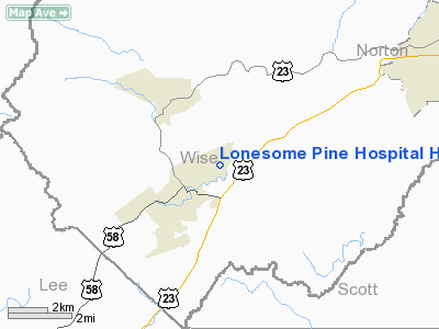
Lonesome Pine Hospital Heliport |
Location & QuickFacts
| FAA Information Effective: | 2008-09-25 |
| Airport Identifier: | VG50 |
| Airport Status: | Operational |
| Longitude/Latitude: | 082-45-13.5000W/36-52-37.7000N
-82.753750/36.877139 (Estimated) |
| Elevation: | 1596 ft / 486.46 m (Estimated) |
| Land: | 0 acres |
| From nearest city: | 0 nautical miles of Big Stone Gap, VA |
| Location: | Wise County, VA |
| Magnetic Variation: | 06W (2000) |
Owner & Manager
| Ownership: | Privately owned |
| Owner: | Wellmont Health System |
| Address: | 1905 American Way
Kingsport, TN 37660 |
| Phone number: | 423-224-5040 |
| Manager: | Paul Bishop |
| Address: | 1990 Holton Ave East
Big Stone Gap, VA 24219 |
| Phone number: | 540-523-8637 |
Airport Operations and Facilities
| Airport Use: | Private
MEDICAL USE. |
| Wind indicator: | Yes |
| Segmented Circle: | No |
| Control Tower: | No |
| Sectional chart: | Cincinnati |
| Region: | AEA - Eastern |
| Boundary ARTCC: | ZID - Indianapolis |
| Tie-in FSS: | DCA - Leesburg |
| FSS Toll Free: | 1-800-WX-BRIEF |
Runway Information
Helipad H1
| Dimension: | 50 x 50 ft / 15.2 x 15.2 m |
| Surface: | CONC, |
| |
Runway H1 |
Runway |
| Traffic Pattern: | Left | Left |
|
Radio Navigation Aids
| ID |
Type |
Name |
Ch |
Freq |
Var |
Dist |
| LQV | NDB | Long Hollow | | 252.00 | 03W | 18.5 nm |
| RVN | NDB | Rogersville | | 329.00 | 04W | 26.1 nm |
| BO | NDB | Booie | | 221.00 | 04W | 31.3 nm |
| VJ | NDB | Whine | | 236.00 | 05W | 39.7 nm |
| EZT | NDB | Elizabethton | | 275.00 | 02W | 41.0 nm |
| DYQ | NDB | Dulaney | | 263.00 | 04W | 45.0 nm |
| GZG | VOR/DME | Glade Spring | 039X | 110.20 | 02W | 32.6 nm |
| AZQ | VOR/DME | Hazard | 049X | 111.20 | 04W | 39.4 nm |
| HMV | VORTAC | Holston Mountain | 093X | 114.60 | 04W | 40.1 nm |
Remarks
- PRVDD 8:1 INGRESS/EGRESS WITH APPROPRIATE MKGS, LGTD WINDSOCK FOR NIGHT OPNS, CONTROL VEHICULAR TFC, VFR ONLY.
Images and information placed above are from
http://www.airport-data.com/airport/VG50/
We thank them for the data!
| General Info
|
| Country |
United States
|
| State |
VIRGINIA
|
| FAA ID |
VG50
|
| Latitude |
36-52-37.700N
|
| Longitude |
082-45-13.500W
|
| Elevation |
1596 feet
|
| Near City |
BIG STONE GAP
|
We don't guarantee the information is fresh and accurate. The data may
be wrong or outdated.
For more up-to-date information please refer to other sources.
|
|


