 |
|
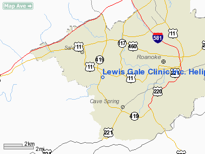
Lewis Gale Clinic Inc. Heliport |
Location & QuickFacts
| FAA Information Effective: | 2008-09-25 |
| Airport Identifier: | 1VA2 |
| Airport Status: | Operational |
| Longitude/Latitude: | 080-01-53.1400W/37-15-45.4890N
-80.031428/37.262636 (Estimated) |
| Elevation: | 1070 ft / 326.14 m (Estimated) |
| Land: | 0 acres |
| From nearest city: | 0 nautical miles N of Salem, VA |
| Location: | Roanoke County, VA |
| Magnetic Variation: | 06W (1985) |
Owner & Manager
| Ownership: | Privately owned |
| Owner: | Lewis Gale Hospital |
| Address: | 1802 Braeburn Drive
Salem, VA 24153 |
| Phone number: | 703-774-9241 |
| Manager: | Administrator |
| Address: | Lewis Gale Clinic
Roanoke, VA 24018 |
| Phone number: | 703-774-9241 |
Airport Operations and Facilities
| Airport Use: | Private
MEDICAL USE. |
| Wind indicator: | Yes |
| Segmented Circle: | No |
| Control Tower: | No |
| Lighting Schedule: | DUSK-DAWN |
| Landing fee charge: | No |
| Sectional chart: | Cincinnati |
| Region: | AEA - Eastern |
| Boundary ARTCC: | ZDC - Washington |
| Tie-in FSS: | DCA - Leesburg |
| FSS on Airport: | No |
| FSS Toll Free: | 1-800-WX-BRIEF |
Airport Services
| Airframe Repair: | NONE |
| Power Plant Repair: | NONE |
Runway Information
Helipad H1
| Dimension: | 40 x 40 ft / 12.2 x 12.2 m |
| Surface: | ASPH, |
| Edge Lights: | High |
| |
Runway H1 |
Runway |
| Traffic Pattern: | Left | Left |
|
Radio Navigation Aids
| ID |
Type |
Name |
Ch |
Freq |
Var |
Dist |
| CNQ | NDB | Callahan | | 379.00 | 05W | 6.1 nm |
| VIT | NDB | Vinton | | 277.00 | 06W | 8.0 nm |
| TEC | NDB | Tech | | 368.00 | 06W | 18.1 nm |
| LW | NDB | Bushi | | 346.00 | 06W | 37.5 nm |
| LY | NDB | Bojar | | 385.00 | 08W | 37.7 nm |
| UV | NDB | Bales | | 396.00 | 07W | 40.8 nm |
| HLX | NDB | Hillsville | | 269.00 | 06W | 48.4 nm |
| ODR | VOR | Woodrum | | 114.90 | 06W | 4.5 nm |
| LWB | VOR/DME | Greenbrier | 107Y | 116.05 | 08W | 40.0 nm |
| ROA | VORTAC | Roanoke | 031X | 109.40 | 04W | 5.2 nm |
| PSK | VORTAC | Pulaski | 115X | 116.80 | 06W | 34.3 nm |
| LYH | VORTAC | Lynchburg | 029X | 109.20 | 05W | 38.0 nm |
Remarks
- TO SERVE HOSP IN CONNECTION WITH EMERGENCY CASES ONLY.
Images and information placed above are from
http://www.airport-data.com/airport/1VA2/
We thank them for the data!
| General Info
|
| Country |
United States
|
| State |
VIRGINIA
|
| FAA ID |
1VA2
|
| Latitude |
37-15-45.489N
|
| Longitude |
080-01-53.140W
|
| Elevation |
1070 feet
|
| Near City |
SALEM
|
We don't guarantee the information is fresh and accurate. The data may
be wrong or outdated.
For more up-to-date information please refer to other sources.
|
|


