|
 |
|
||||
|
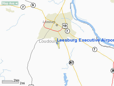
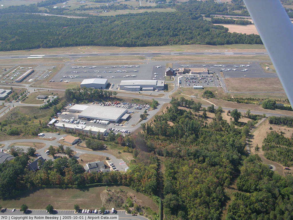
Leesburg Executive Airport at Godfrey Field (IATA: JYO, ICAO: KJYO, FAA LID: JYO) is a town-owned public-use airport located three nautical miles (6 km) south of the central business district of Leesburg, a town in Loudoun County, Virginia, United States. It is a busy general aviation airport in the Washington, D.C. area, and a reliever for nearby Washington Dulles International Airport. HistoryLeesburg Executive Airport was built in 1963 to replace an earlier grass field on the eastern edge of the town, which was owned & used by radio personality Arthur Godfrey for his private DC-3 aircraft. Godfrey sold the field and shared a portion of the funds with the Town of Leesburg, which used the proceeds to help fund a new airport 2 miles south of town. The town used matching funds from the FAA. Originally named Godfrey Field, it is now known as Leesburg Executive Airport at Godfrey Field. In 1986, the Federal Aviation Administration (FAA) consolidated its 308 Flight Service Stations into 61 'automated' stations (to be known as "AFSS"). The Flight Service Station at Leesburg was scheduled to close, but local lobbying convinced the FAA to rent space from the town and locate an AFSS at the airport. In 1993, when the airport operator went bankrupt, the Town of Leesburg assumed direct operation of the airport, lengthening the runway twice to an eventual length of 5,500 feet (1,700 m) to support business jets and adding a localizer approach and automated weather observation equipment to support all-weather operations. The airport is currently a designated general aviation reliever airport for Dulles International, 10 miles (17 km) to the southeast, and in 2008 hosted 231 aircraft based on the field and an average of 265 aircraft operations per day. The FAA has funded an ILS installation that is planned for completion in 2011. Facilities and aircraftLeesburg Executive Airport covers an area of 214 acres (87 ha) at an elevation of 389 feet (119 m) above mean sea level. It has one asphalt paved runway designated 17/35 which measures 5,500 by 100 feet (1,676 x 30 m). For the 12-month period ending August 12, 2006, the airport had 96,878 aircraft operations, an average of 265 per day: 99% general aviation, 1% air taxi and <1% military. At that time there were 184 aircraft based at this airport: 85% single-engine, 12% multi-engine, 1% jet and 2% helicopter. Special Flight Rules Area - Formerly the DC Air Defense Identification ZoneLeesburg Executive is located on the outer boundary of the 30 nautical mile (55.6 km) Special Flight Rules Area, formerly known as the Air Defense Identification Zone (ADIZ) instituted around Washington, D.C. prior to the commencement of the Iraq War in February of 2003. The ADIZ presents very little differences for IFR flights, but special procedures are still required for all VFR aircraft arriving at and departing from the airport. Due to a special triangular cut-out in the ADIZ circle, they are less onerous than procedures for other ADIZ airports. ManagementThe airport is owned by the Town of Leesburg, a corporate entity within the Commonwealth of Virginia. The airport is managed by an airport director who is also a Department Manager within the Town staff. An appointed commission provides oversight for policies and procedures to the Director, as well as advice and counsel to the Town Council. The above content comes from Wikipedia and is published under free licenses – click here to read more.
Location & QuickFacts
Owner & Manager
Airport Operations and Facilities
Airport Communications
Airport Services
Runway InformationRunway 17/35
Radio Navigation Aids
Remarks
Images and information placed above are from We thank them for the data!
We don't guarantee the information is fresh and accurate. The data may
be wrong or outdated.
|
||||||||||||||||||||||||||||||||||||||||||||||||||||||||||||||||||||||||||||||||||||||||||||||||||||||||||||||||||||||||||||||||||||||||||||||||||||||||||||||||||||||||||||||||||||||||||||||||||||||||||||||||||||||||||||||||||||||||||||||||||||||||||||||||||||||||||||||||||||||||||||||||||||||||||||||||||||||||||||||||||||||||||||||||||||||||||||||||||||||||||||||||||||||||||||||||||||||||||||||||||||||||||||||||||||||||||||||||||||||||||||||||

 |
|
Copyright 2004-2026 © by Airports-Worldwide.com, Vyshenskoho st. 36, Lviv 79010, Ukraine Legal Disclaimer |