 |
|
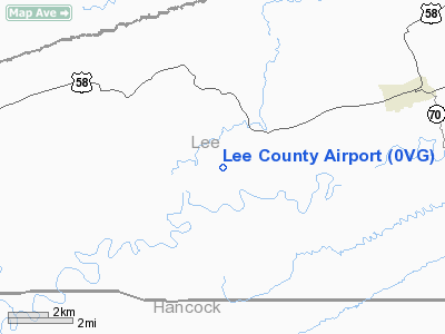
Location & QuickFacts
| FAA Information Effective: | 2008-09-25 |
| Airport Identifier: | 0VG |
| Airport Status: | Operational |
| Longitude/Latitude: | 083-13-04.2000W/36-39-14.7000N
-83.217833/36.654083 (Estimated) |
| Elevation: | 1411 ft / 430.07 m (Estimated) |
| Land: | 328 acres |
| From nearest city: | 5 nautical miles SW of Jonesville, VA |
| Location: | Lee County, VA |
| Magnetic Variation: | 06W (2005) |
Owner & Manager
| Ownership: | Publicly owned |
| Owner: | Lee County, Virginia |
| Address: | Po Box 367
Jonesville, VA 24263 |
| Phone number: | 276-346-7714 |
| Manager: | D. Dane Poe
COUNTY ADMINISTRATOR. |
| Address: | Po Box 367
Jonesville, VA 24263 |
| Phone number: | 276-346-7714 |
Airport Operations and Facilities
| Airport Use: | Open to public |
| Wind indicator: | Yes |
| Segmented Circle: | Yes |
| Control Tower: | No |
| Lighting Schedule: | DUSK-DAWN
ACTVT MIRL RY 07/25, PAPI RYS 07 & 25, & REIL RYS 07 & 25 - CTAF. |
| Beacon Color: | Clear-Green (lighted land airport) |
| Sectional chart: | Cincinnati |
| Region: | AEA - Eastern |
| Traffic Pattern Alt: | 1000 ft |
| Boundary ARTCC: | ZTL - Atlanta |
| Tie-in FSS: | DCA - Leesburg |
| FSS Toll Free: | 1-800-WX-BRIEF |
| NOTAMs Facility: | DCA (NOTAM-d service avaliable) |
| Federal Agreements: | NGY |
Airport Communications
Airport Services
Runway Information
Runway 07/25
| Dimension: | 5000 x 75 ft / 1524.0 x 22.9 m |
| Surface: | ASPH, Good Condition |
| Weight Limit: | Single wheel: 30000 lbs. |
| Edge Lights: | Medium |
| |
Runway 07 |
Runway 25 |
| Longitude: | 083-13-30.8511W | 083-12-37.6430W |
| Latitude: | 36-39-02.3710N | 36-39-27.0399N |
| Elevation: | 1366.00 ft | 1411.00 ft |
| Alignment: | 60 | 127 |
| Traffic Pattern: | Left | Left |
| Markings: | Non-precision instrument, Good Condition
MARKINGS VARY BETWEEN GOOD AND FAIR CONDITION DUE TO DISCOLORATION. | Non-precision instrument, Good Condition
MARKINGS VARY BETWEEN GOOD AND FAIR CONDITION DUE TO DISCOLORATION. |
| Crossing Height: | 40.00 ft | 40.00 ft |
| VASI: | 2-light PAPI on left side | 2-light PAPI on left side |
| Visual Glide Angle: | 3.00° | 3.00° |
| Runway End Identifier: | Yes | Yes |
| Obstruction: | 50 ft tree, 2372.0 ft from runway, 470 ft left of centerline, 43:1 slope to clear | 14 ft tree, 489.0 ft from runway, 215 ft left of centerline, 20:1 slope to clear |
|
Radio Navigation Aids
| ID |
Type |
Name |
Ch |
Freq |
Var |
Dist |
| LQV | NDB | Long Hollow | | 252.00 | 03W | 7.6 nm |
| RVN | NDB | Rogersville | | 329.00 | 04W | 20.0 nm |
| DYQ | NDB | Dulaney | | 263.00 | 04W | 34.9 nm |
| JXT | NDB | Jefferson | | 346.00 | 04W | 35.0 nm |
| BO | NDB | Booie | | 221.00 | 04W | 38.1 nm |
| JAU | NDB | Jacksboro | | 204.00 | 03W | 49.4 nm |
| AZQ | VOR/DME | Hazard | 049X | 111.20 | 04W | 44.4 nm |
| LOZ | VORTAC | London | 108X | 116.10 | 03W | 48.6 nm |
Images and information placed above are from
http://www.airport-data.com/airport/0VG/
We thank them for the data!
| General Info
|
| Country |
United States
|
| State |
VIRGINIA
|
| FAA ID |
0VG
|
| Latitude |
36-39-14.710N
|
| Longitude |
083-13-04.260W
|
| Elevation |
1411 feet
|
| Near City |
JONESVILLE
|
We don't guarantee the information is fresh and accurate. The data may
be wrong or outdated.
For more up-to-date information please refer to other sources.
|
|


