|
 |
|
||||
|
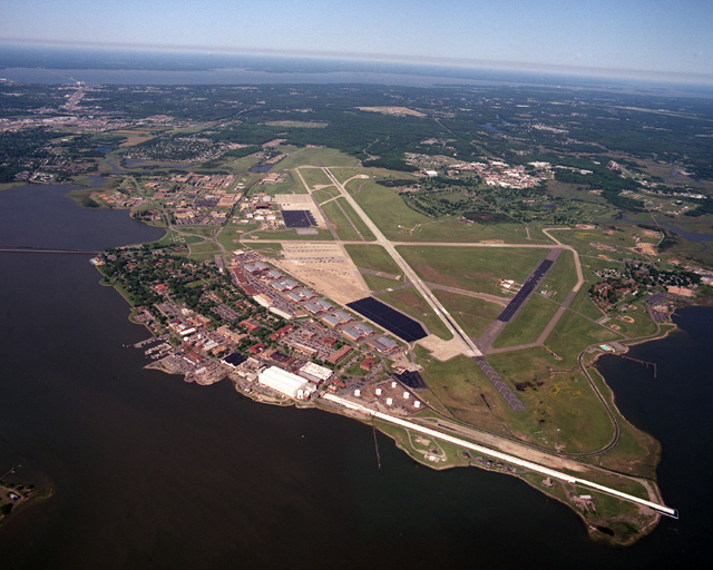
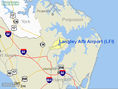
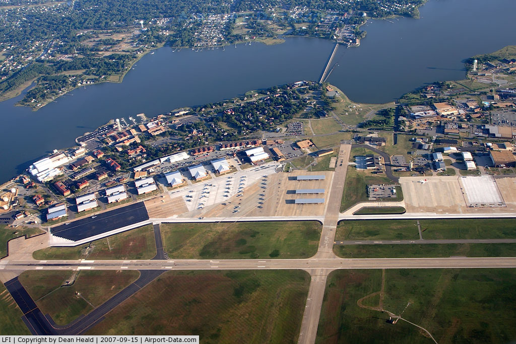
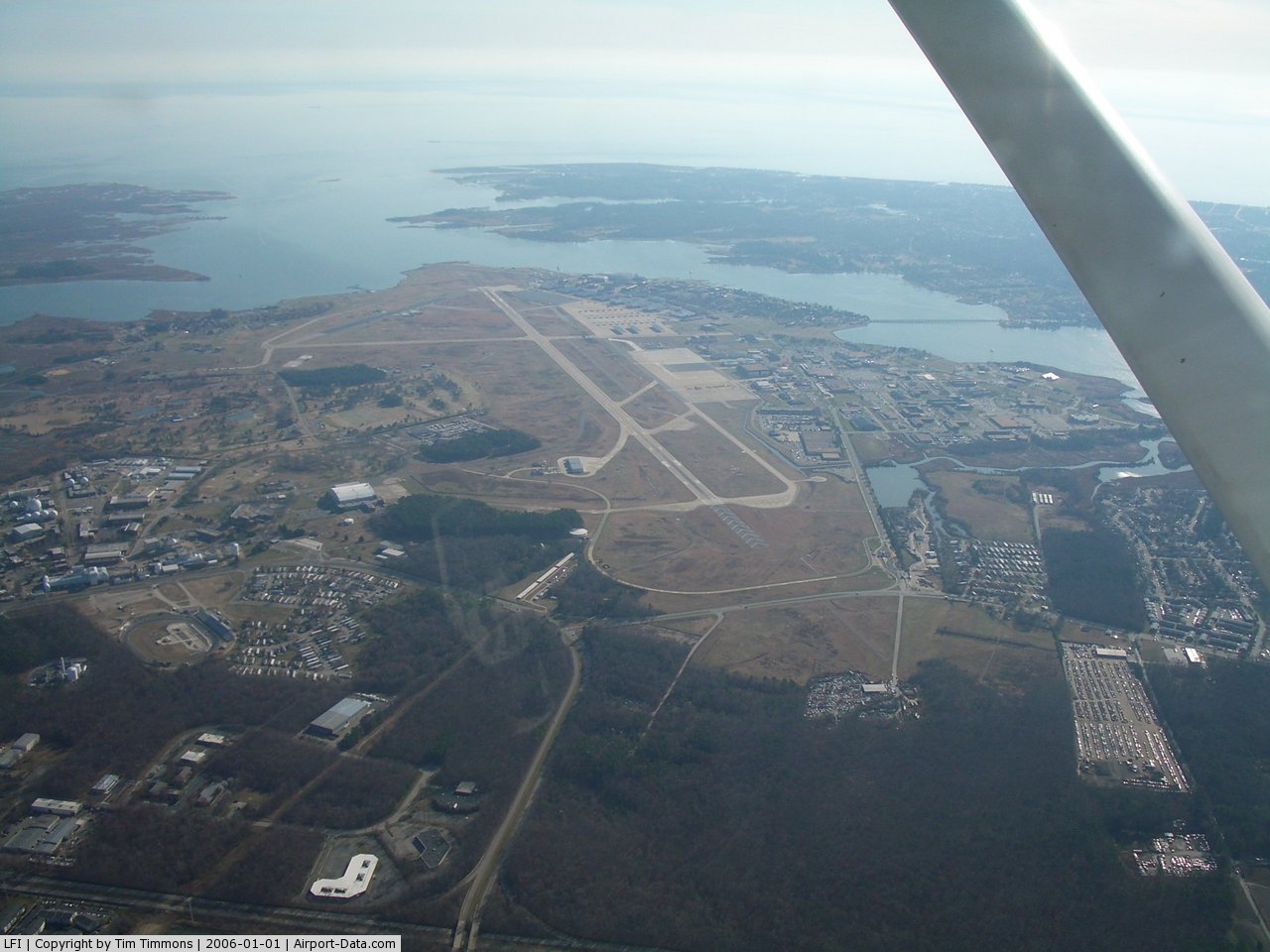
Langley Air Force Base (IATA: LFI, ICAO: KLFI, FAA LID: LFI) is located three nautical miles (6 km) north of the central business district of the city of Hampton, Virginia, United States. In January 2010, Langley realigned with Fort Eustis in Newport News, Virginia to become Joint Base Langley-Eustis. Langley is the home of the United States Air Force's 633d Air Base Wing (633 ABW), 1st Fighter Wing (1 FW) and the 480th Intelligence Surveillance and Reconnaissance Wing (480 ISRW). It also hosts the Global Cyberspace Integration Center field operating agency, the 192D Fighter Wing of the Virginia Air National Guard and Headquarters Air Combat Command (ACC). The base is one of the oldest facilities of the Air Force, being established on Dec. 30, 1916, prior to America's entry to World War I by the Army Air Service, named for aviation pioneer Samuel Pierpont Langley. It was used during World War I as a flying field; balloon station; observers’school; photography school; experimental engineering department, and for aerial coast defense. 633d Air Base WingThe 633d Air Base Wing (633 ABW) is the host at Langley AFB. Beginning in late January 2010, the 633 ABW will serve as the support unit for Joint Base Langley-Eustis, the realignment consolidation of Langley AFB and Fort Eustis as directed by BRAC 2005. Originally designated the 633d Combat Support Group, the 633d Air Base Wing was established and activated Mar. 14, 1966 and organized April 8, 1966. It was originally assigned to the 13th Air Force as part of Pacific Air Forces (PACAF) at Pleiku Air Base 62, South Vietnam, and later at Andersen AFB, Guam. During the Vietnam War, Airmen of the 633 ABW participated in numerous campaigns, air offensives and Operations Arc Light, Bullet Shot and Linebacker. On Oct. 1, 1989, the Wing aligned under the 13th AF, activated on Andersen AFB and became the host unit, providing services for various tenant units. This marked the transfer of Andersen AFB control from Strategic Air Command to PACAF. In August 1990, 633 ABW personnel began shipping more than 37,000 tons of munitions to forces in the Persian Gulf during Operations Desert Shield and Desert Storm - more than 30,000 tons went by sealift, and more than 2,200 troops and 2,200 tons of cargo processed aboard 200 aircraft. Operation Fiery Vigil spun into action June 1991, when 633 ABW personnel cared for more than 20,000 American evacuees and 1,100 pets following the eruption of Mount Pinatubo, Philippines. On Oct. 1, 1994, the 633 ABW was inactivated and the 36th ABW was activated in keeping with the policy of the Air Force Chief of Staff to maintain the most highly decorated and longest-serving Air Force units on active-duty. On Jan. 7, 2010, the 9th Air Force reactivated the 633 ABW and declared it to be the host unit for Langley AFB, Va. 1st Fighter WingThe 1st Fighter Wing, under various designations, was the host unit at Langley from June 30, 1975 until Jan. 7, 2010, when it was relieved of host unit duties by the newly re-activated 633d Air Base Wing. Fighter squadrons of the 1st Fighter Wing's Operations Group are:
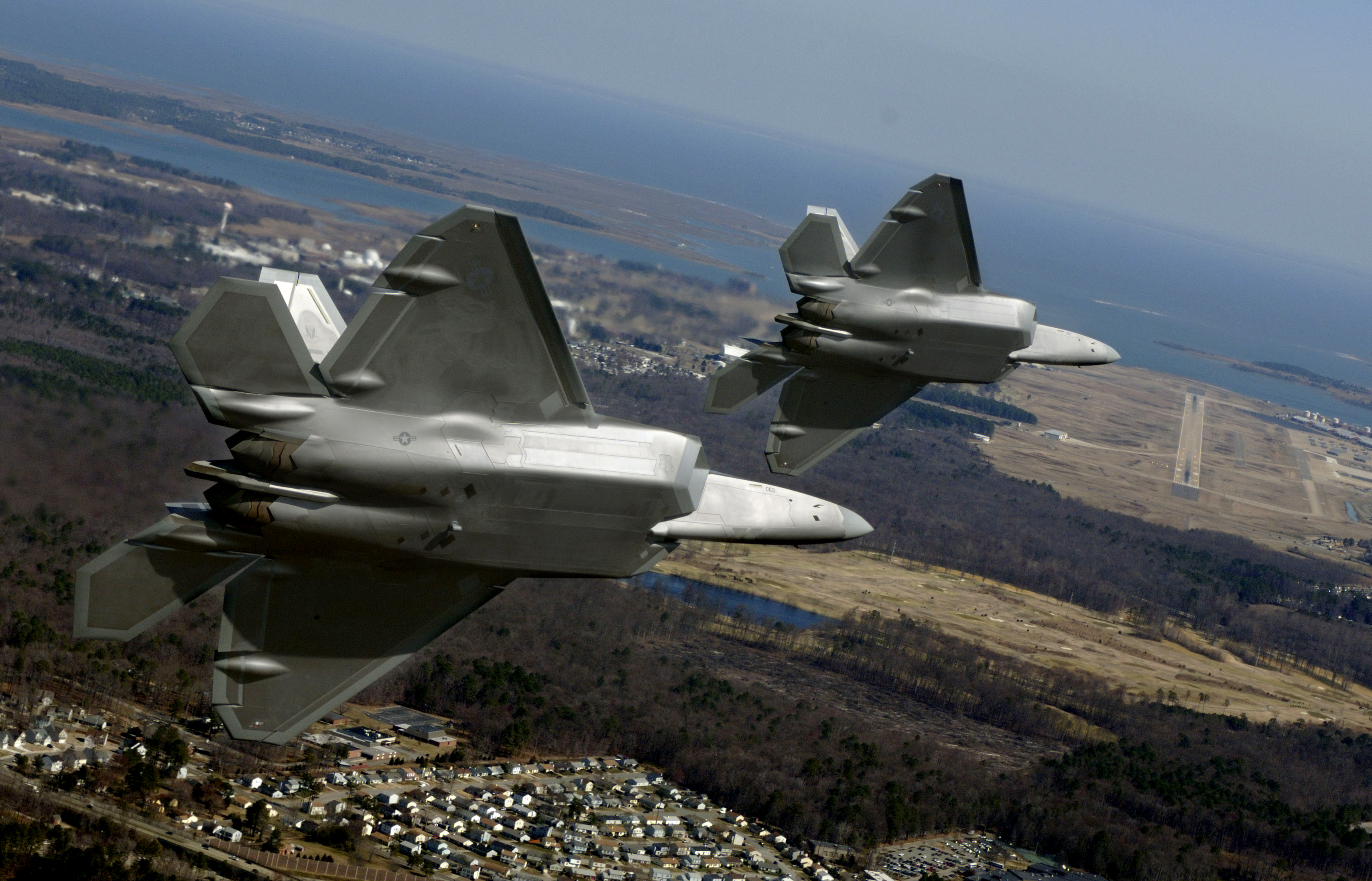
1st Fighter Wing F-22As and F-15Cs are all tail coded "FF". The 1st Tactical Fighter Wing (1 TFW) was the first operational unit in the Tactical Air Command (TAC) to fly the F-15A/B Eagle. In May 2005, Langley became the home of 26 F-22 Raptors assigned to the 27th Fighter Squadron of the 1st Fighter Wing. In December 2005, the 94th Fighter Squadron started to convert to the F-22A . The 27th FS flew the first F-22A operational mission in January 2006 in support of Operation Noble Eagle (ONE). On Aug. 7, 1990, the 1st Tactical Fighter Wing, deployed to Saudi Arabia in support of Operation Desert Shield, was the first USAF unit to establish air superiority over Saudi Arabia. Throughout both Operations Desert Shield and Desert Storm, the wing flew more than 6,200 sorties and nearly 25,000 flying hours. The wing also recorded an aerial victory when Capt. Steve Tate of the 71 FS shot down an Iraqi Dassault Mirage F1. From the end of Operation Desert Storm until the commencment of Operation Iraqi Freedom, squadrons of the 1 FW routinely deployed to Turkey in support of Operation Northern Watch, or to Saudi Arabia in support of Operation Southern Watch, enforcing the northern and southern "no-fly" zones over Iraq. In 2003, the 1 FW deployed again to Southwest Asia in order to provide air superiority during actual combat operations. Deploying in support of Operation Iraqi Freedom, the wing flew more than 360 training and combat sorties. Other historical firsts for the 1st Fighter Wing are:
480th Intelligence Surveillance and Reconnaissance WingAt Langley, the 480th Intelligence Surveillance and Reconnaissance Wing is the Air Force lead wing for Distributed Common Ground System (DCGS) operations, geospatial intelligence and intelligence products for combat mission planning and execution. The 497th Intelligence Group is a warfighting unit leveraging the most robust national/DoD intelligence, surveillance and reconnaissance air, space and ground systems architecture. The 497 IG also operates Deployable Ground Station-1 of the Air Force Distributed Common Ground System, projecting global vigilance and providing persistent world-class timely and tailored multi-discipline intelligence analysis to the warfighter while directing reachback/distributed operations. 192d Fighter WingThe 192d Fighter Wing is a Virginia Air National Guard unit co-located with the active duty 1st Fighter Wing at Joint Base Langley-Eustis, Virginia. The 192d FW has a dual mission—federally, the mission is to maintain a well-trained, well-equipped unit to be available for prompt mobilization during war and provide assistance during national emergencies (such as natural disasters or civil disturbances). Under the state mission, the 192d FW provides protection of life, property and preserves peace, order and public safety. These missions are accomplished through emergency relief support during natural disasters such as floods, earthquakes and forest fires; search and rescue operations; support to civil defense authorities; maintenance of vital public services and counterdrug operations. HistoryOverviewAir PowerLangley Air Force Base was the first military base built in the United States specifically for air power, having been acquired by the fledgling Aviation Section of the U.S. Army Signal Corps in December 1916. Major base operating units at Langley have been:
United States Air Force Tactical Air Command
Continental Air Command
Tactical Air Command
Military Airlift Command
Tactical Air Command, and later Air Combat Command
Headquarters, Tactical Air Command (TAC) was established at Langley on 1 May 1946. Headquarters, Air Combat Command (ACC) replaced Tactical Air Command when TAC inactivated on 1 June 1992. Wind TunnelThe wind tunnel at Langley is located on the banks of the Little Back River and measures 434 feet by 222 feet. It opened in 1931, and was the first in the United states to be able to test whole airplanes within it. The first aircraft its engineers tested was the US Navy's Vought O3U-1 Corsair. The facility went on to test many other airplanes over the course of 78 years. The Langley wind tunnel, which uses two 4,000 horsepower engines to turn two propellers to create air flow, is now considered obsolete, however. The last aircraft to be tested there is the Boeing X-48C. NASA has leased the facility to Old Dominion University in the short term but plans to raze it and replace it with a parking lot. Other proposals, such as a museum, have been considered and rejected for a number of reasons; the base is a secure facility for one, and for another, Hurricane Isabel caused significant damage, precluding the docking of boats at the building. OriginsIn 1916, the National Advisory Council for Aeronautics (NACA), predecessor to NASA, established the need for a joint airfield and proving ground for Army, Navy and NACA aircraft. NACA determined that the site must be near water for over-water flying, be flat and relatively clear for expansion and the landing and take-off of aircraft and near an Army post. Fifteen locations were scouted before the site near Hampton was selected. In 1917, the new proving ground was designated Langley Field. Several buildings had been constructed on the field by late 1918. Aircraft at the base at that time included the JN-4 Curtis Jenny, used by Langley's School of Aerial Photography, and the de Havilland DH-4 bomber, both used during World War I. Although short-lived, hydrogen-filled dirigibles played an important role in Langley's early history and a portion of the base is still referred to as the LTA (lighter-than-air) area. Brigadier General Billy Mitchell led bombing runs from Langley over war prize German warships anchored off the coast of Virginia. These first successful tests set the precedent for the airplane's new role of strategic bombardment. At the outbreak of World War II, Langley began to develop special detector equipment used in antisubmarine warfare. On May 25, 1946 the headquarters of the newly formed Tactical Air Command were established at Langley. The arrival of Tactical Air Command and jet aircraft marked the beginning of a new era in the history of the field, and in January 1948 Langley Field officially became Langley Air Force Base. On June 1, 1992, Langley became the headquarters of the newly formed Air Combat Command. F-22 Raptor Demo TeamIn addition to its usual complement of aircraft, Langley AFB is also home to the F-22 Raptor Demo Team. This team, who travels all over the world performing different maneuvers used in air combat, is used to help recruit for the United States Air Force. Performing in airshows and other special events all around the world, the squadron is the only demonstration team in the world to use the F-22 Raptor. Airpower over Hampton RoadsAirpower over Hampton Roads is a recurring airshow held at Langley Air Force Base in spring. Many demonstrations take place, including the F-22 Raptor Demonstration, Aerobatics, and parachute demos. BRAC 2005The BRAC 2005 commission recommended an expansion of Langley Air Force Base.
In popular culture
The above content comes from Wikipedia and is published under free licenses – click here to read more.
Location & QuickFacts
Owner & Manager
Airport Operations and Facilities
Airport Services
Runway InformationRunway 08/26
Radio Navigation Aids
Remarks
Images and information placed above are from We thank them for the data!
We don't guarantee the information is fresh and accurate. The data may
be wrong or outdated.
|
||||||||||||||||||||||||||||||||||||||||||||||||||||||||||||||||||||||||||||||||||||||||||||||||||||||||||||||||||||||||||||||||||||||||||||||||||||||||||||||||||||||||||||||||||||||||||||||||||||||||||||||||||||||||||||||||||||||||||||||||||||||||||||||||||||||||||||||||||||||||||||||||||||||||||||||||||||||||||||||||||||||||||||||||||||||||||||||||||||||||||||||||||||||||

 |
|
Copyright 2004-2026 © by Airports-Worldwide.com, Vyshenskoho st. 36, Lviv 79010, Ukraine Legal Disclaimer |