 |
|
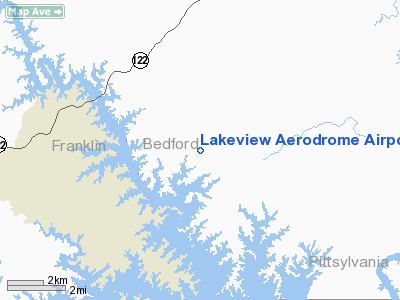
Lakeview Aerodrome Airport |
Location & QuickFacts
| FAA Information Effective: | 2008-09-25 |
| Airport Identifier: | VA68 |
| Airport Status: | Operational |
| Longitude/Latitude: | 079-36-10.1090W/37-07-07.5150N
-79.602808/37.118754 (Estimated) |
| Elevation: | 1020 ft / 310.90 m (Estimated) |
| Land: | 0 acres |
| From nearest city: | 4 nautical miles S of Moneta, VA |
| Location: | Bedford County, VA |
| Magnetic Variation: | 07W (1985) |
Owner & Manager
| Ownership: | Privately owned |
| Owner: | Kevin Murray |
| Address: | 1900 Skyway Dr
Moneta, VA 24121 |
| Phone number: | 540-297-6754 |
| Manager: | Kevin Murray |
| Address: | 1900 Skyway Dr
Moneta, VA 24121 |
| Phone number: | 540-297-6754 |
Airport Operations and Facilities
| Airport Use: | Private |
| Wind indicator: | Yes |
| Segmented Circle: | No |
| Control Tower: | No |
| Sectional chart: | Cincinnati |
| Region: | AEA - Eastern |
| Boundary ARTCC: | ZDC - Washington |
| Tie-in FSS: | DCA - Leesburg |
| FSS Toll Free: | 1-800-WX-BRIEF |
Airport Services
Runway Information
Runway 04/22
| Dimension: | 1600 x 60 ft / 487.7 x 18.3 m |
| Surface: | TURF, |
| |
Runway 04 |
Runway 22 |
| Traffic Pattern: | Left | Right |
| Displaced threshold: | 0.00 ft | 225.00 ft |
| Obstruction: | | 15 ft road, 75.0 ft from runway |
|
Radio Navigation Aids
| ID |
Type |
Name |
Ch |
Freq |
Var |
Dist |
| OQA | FAN MARKER | Rockingham County | | | | 43.0 nm |
| VIT | NDB | Vinton | | 277.00 | 06W | 14.3 nm |
| LY | NDB | Bojar | | 385.00 | 08W | 19.3 nm |
| CNQ | NDB | Callahan | | 379.00 | 05W | 27.9 nm |
| UV | NDB | Bales | | 396.00 | 07W | 35.2 nm |
| TEC | NDB | Tech | | 368.00 | 06W | 38.7 nm |
| SIF | NDB | Slammer | | 423.00 | 07W | 44.9 nm |
| ODR | VOR | Woodrum | | 114.90 | 06W | 21.8 nm |
| DAN | VOR | Danville | | 113.10 | 06W | 35.4 nm |
| LYH | VORTAC | Lynchburg | 029X | 109.20 | 05W | 19.4 nm |
| ROA | VORTAC | Roanoke | 031X | 109.40 | 04W | 26.1 nm |
| SBV | VORTAC | South Boston | 041X | 110.40 | 05W | 38.9 nm |
Remarks
- VFR USE ONLY; RY 22 DSPLCD TO ENSURE 20:1 CLNC OVER ROAD TFC PAT N OF RY COORDINATE USE WITH SMITH MT LAKE ARPT.
Images and information placed above are from
http://www.airport-data.com/airport/VA68/
We thank them for the data!
| General Info
|
| Country |
United States
|
| State |
VIRGINIA
|
| FAA ID |
VA68
|
| Latitude |
37-07-07.515N
|
| Longitude |
079-36-10.109W
|
| Elevation |
1020 feet
|
| Near City |
MONETA
|
We don't guarantee the information is fresh and accurate. The data may
be wrong or outdated.
For more up-to-date information please refer to other sources.
|
|


