 |
|
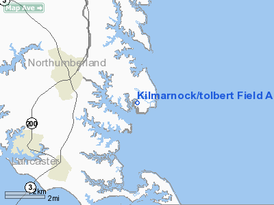
Kilmarnock/tolbert Field Airport |
Location & QuickFacts
| FAA Information Effective: | 2008-09-25 |
| Airport Identifier: | 5VA9 |
| Airport Status: | Closed Indefinitely |
| Longitude/Latitude: | 076-19-05.8000W/37-41-33.4810N
-76.318278/37.692634 (Estimated) |
| Elevation: | 7 ft / 2.13 m (Estimated) |
| Land: | 120 acres |
| From nearest city: | 3 nautical miles SE of Kilmarnock, VA |
| Location: | Northumberland County, VA |
| Magnetic Variation: | 10W (1985) |
Owner & Manager
| Ownership: | Privately owned |
| Owner: | John T. Tolbert |
| Address: | Rt 1, Box 450
Kilmarnock, VA 22482 |
| Phone number: | 804-435-1274 |
| Manager: | John T. Tolbert |
| Address: | Rt 1, Box 450
Kilmarnock, VA 22482 |
| Phone number: | 804-435-1274 |
Airport Operations and Facilities
| Airport Use: | Private |
| Segmented Circle: | No |
| Control Tower: | No |
| Landing fee charge: | No |
| Sectional chart: | Washington |
| Region: | AEA - Eastern |
| Boundary ARTCC: | ZDC - Washington |
| Tie-in FSS: | DCA - Leesburg |
| FSS on Airport: | No |
| FSS Toll Free: | 1-800-WX-BRIEF |
Airport Services
| Airframe Repair: | NONE |
| Power Plant Repair: | NONE |
Runway Information
Runway 18/36
| Dimension: | 2000 x 60 ft / 609.6 x 18.3 m |
| Surface: | TURF, Fair Condition
STANDING WATER ON RY. |
| |
Runway 18 |
Runway 36 |
| Traffic Pattern: | Left | Left |
| Obstruction: | 20 ft tree, 20 ft right of centerline | 20 ft trees, 0.0 ft from runway, 20 ft left of centerline |
|
Radio Navigation Aids
| ID |
Type |
Name |
Ch |
Freq |
Var |
Dist |
| BDB | NDB | Accomack | | 336.00 | 11W | 25.8 nm |
| PJS | NDB | Henry | | 375.00 | 09W | 34.7 nm |
| NHK | NDB | Patuxent | | 400.00 | 10W | 35.9 nm |
| FAF | NDB | Felker | | 226.00 | 08W | 36.2 nm |
| LFI | TACAN | Langley | 070X | | 10W | 36.5 nm |
| NGU | TACAN | Chambers | 048X | | 10W | 45.3 nm |
| HCM | VORTAC | Harcum | 025X | 108.80 | 07W | 23.8 nm |
| CCV | VORTAC | Cape Charles | 059X | 112.20 | 10W | 25.8 nm |
| PXT | VORTAC | Patuxent | 123X | 117.60 | 10W | 36.0 nm |
| HPW | VORTAC | Hopewell | 057X | 112.00 | 06W | 43.9 nm |
| SWL | VORTAC | Snow Hill | 071X | 112.40 | 08W | 46.1 nm |
| ORF | VORTAC | Norfolk | 116X | 116.90 | 07W | 48.5 nm |
| RIC | VORTAC | Richmond | 088X | 114.10 | 09W | 49.1 nm |
Remarks
- (ARPT STATUS) ARPT CLSD INDEFLY.
- VFR ONLY.
Images and information placed above are from
http://www.airport-data.com/airport/5VA9/
We thank them for the data!
| General Info
|
| Country |
United States
|
| State |
VIRGINIA
|
| FAA ID |
5VA9
|
| Latitude |
37-41-33.481N
|
| Longitude |
076-19-05.800W
|
| Elevation |
7 feet
|
| Near City |
KILMARNOCK
|
We don't guarantee the information is fresh and accurate. The data may
be wrong or outdated.
For more up-to-date information please refer to other sources.
|
|


