 |
|
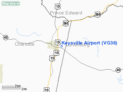
Location & QuickFacts
| FAA Information Effective: | 2008-09-25 |
| Airport Identifier: | VG36 |
| Airport Status: | Operational |
| Longitude/Latitude: | 078-27-45.9800W/37-02-17.5440N
-78.462772/37.038207 (Estimated) |
| Elevation: | 627 ft / 191.11 m (Surveyed) |
| Land: | 0 acres |
| From nearest city: | 1 nautical miles E of Keysville, VA |
| Location: | Charlotte County, VA |
| Magnetic Variation: | 08W (1985) |
Owner & Manager
| Ownership: | Privately owned |
| Owner: | S. H. Brookes |
| Address: |
Keysville, VA 23947 |
| Phone number: | 804-736-8025 |
| Manager: | Grover Sheldon |
| Address: |
Keysville, VA 23947 |
Airport Operations and Facilities
| Airport Use: | Private |
| Wind indicator: | Yes |
| Segmented Circle: | No |
| Control Tower: | No |
| Landing fee charge: | No |
| Sectional chart: | Washington |
| Region: | AEA - Eastern |
| Traffic Pattern Alt: | 800 ft |
| Boundary ARTCC: | ZDC - Washington |
| Tie-in FSS: | DCA - Leesburg |
| FSS on Airport: | No |
| FSS Toll Free: | 1-800-WX-BRIEF |
Airport Services
| Airframe Repair: | NONE |
| Power Plant Repair: | NONE |
Runway Information
Runway E/W
| Dimension: | 1850 x 350 ft / 563.9 x 106.7 m |
| Surface: | TURF, |
| |
Runway E |
Runway W |
| Traffic Pattern: | Right | Right |
|
Radio Navigation Aids
| ID |
Type |
Name |
Ch |
Freq |
Var |
Dist |
| FVX | NDB | Farmville | | 367.00 | 07W | 19.0 nm |
| BKT | NDB | Blackstone | | 326.00 | 09W | 20.8 nm |
| MBV | NDB | Mecklenburg/dcmsnd | | 356.00 | 08W | 28.5 nm |
| AEA | NDB | Jones | | 373.00 | 09W | 32.2 nm |
| LY | NDB | Bojar | | 385.00 | 08W | 39.7 nm |
| PTB | NDB | Petersburg | | 284.00 | 08W | 42.9 nm |
| HXO | NDB | Huntsboro | | 271.00 | 07W | 45.0 nm |
| LVL | VORTAC | Lawrenceville | 076X | 112.90 | 08W | 30.0 nm |
| SBV | VORTAC | South Boston | 041X | 110.40 | 05W | 34.4 nm |
| LYH | VORTAC | Lynchburg | 029X | 109.20 | 05W | 39.3 nm |
| FAK | VORTAC | Flat Rock | 080X | 113.30 | 06W | 42.3 nm |
Remarks
Images and information placed above are from
http://www.airport-data.com/airport/VG36/
We thank them for the data!
| General Info
|
| Country |
United States
|
| State |
VIRGINIA
|
| FAA ID |
VG36
|
| Latitude |
37-02-17.544N
|
| Longitude |
078-27-45.980W
|
| Elevation |
627 feet
|
| Near City |
KEYSVILLE
|
We don't guarantee the information is fresh and accurate. The data may
be wrong or outdated.
For more up-to-date information please refer to other sources.
|
|


