 |
|
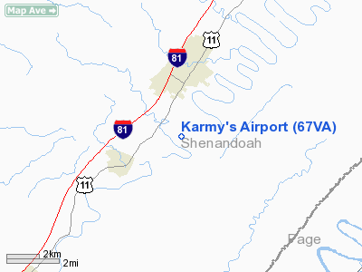
Location & QuickFacts
| FAA Information Effective: | 2008-09-25 |
| Airport Identifier: | 67VA |
| Airport Status: | Operational |
| Longitude/Latitude: | 078-31-10.0360W/38-50-15.4060N
-78.519454/38.837613 (Estimated) |
| Elevation: | 890 ft / 271.27 m (Estimated) |
| Land: | 4 acres |
| From nearest city: | 3 nautical miles S of Woodstock, VA |
| Location: | Shenandoah County, VA |
| Magnetic Variation: | 08W (1985) |
Owner & Manager
| Ownership: | Privately owned |
| Owner: | Robert J. Karmy, Md |
| Address: | 1400 Chapman Landing Rd.
Edinburg, VA 22824 |
| Phone number: | 703-459-9359 |
| Manager: | Robert J. Karmy, Md |
| Address: | 1400 Chapman Landing Rd.
Edinburg, VA 22824 |
| Phone number: | 703-459-9359 |
Airport Operations and Facilities
| Airport Use: | Private |
| Wind indicator: | Yes |
| Segmented Circle: | No |
| Control Tower: | No |
| Landing fee charge: | No |
| Sectional chart: | Washington |
| Region: | AEA - Eastern |
| Boundary ARTCC: | ZDC - Washington |
| Tie-in FSS: | DCA - Leesburg |
| FSS on Airport: | No |
| FSS Toll Free: | 1-800-WX-BRIEF |
Runway Information
Runway 04/22
| Dimension: | 1800 x 30 ft / 548.6 x 9.1 m |
| Surface: | TURF, |
| |
Runway 04 |
Runway 22 |
| Traffic Pattern: | Right | Left |
| Displaced threshold: | 0.00 ft | 755.00 ft |
| Obstruction: | | 40 ft trees, 45.0 ft from runway |
|
Radio Navigation Aids
| ID |
Type |
Name |
Ch |
Freq |
Var |
Dist |
| LUA | NDB | Caverns | | 245.00 | 09W | 8.6 nm |
| TZ | NDB | Cogan | | 364.00 | 10W | 25.8 nm |
| GDX | NDB | Goodwin Lake | | 227.00 | 08W | 33.0 nm |
| VBW | NDB | Bridgewater | | 241.00 | 07W | 35.1 nm |
| CJR | NDB | Culpeper | | 252.00 | 09W | 36.1 nm |
| MSQ | NDB | Nailr | | 351.00 | 10W | 36.9 nm |
| AZS | NDB | Azalea Park | | 336.00 | 08W | 49.7 nm |
| CBE | NDB | Cumberland | | 317.00 | 07W | 49.9 nm |
| ESL | VOR/DME | Kessel | 045X | 110.80 | 06W | 32.0 nm |
| LDN | VORTAC | Linden | 090X | 114.30 | 06W | 14.7 nm |
| CSN | VORTAC | Casanova | 110X | 116.30 | 06W | 32.9 nm |
| MRB | VORTAC | Martinsburg | 058X | 112.10 | 07W | 45.4 nm |
| AML | VORTAC | Armel | 082X | 113.50 | 08W | 49.6 nm |
Remarks
- PROVIDED NORTH RWY THRESHOLD IS DSPLCD TO PROVIDE CLEARANCE OVER ROAD & TREES.
Images and information placed above are from
http://www.airport-data.com/airport/67VA/
We thank them for the data!
| General Info
|
| Country |
United States
|
| State |
VIRGINIA
|
| FAA ID |
67VA
|
| Latitude |
38-50-15.406N
|
| Longitude |
078-31-10.036W
|
| Elevation |
890 feet
|
| Near City |
WOODSTOCK
|
We don't guarantee the information is fresh and accurate. The data may
be wrong or outdated.
For more up-to-date information please refer to other sources.
|
|


