 |
|
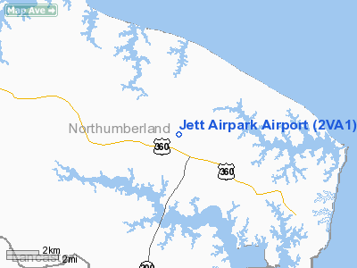
Location & QuickFacts
| FAA Information Effective: | 2008-09-25 |
| Airport Identifier: | 2VA1 |
| Airport Status: | Operational |
| Longitude/Latitude: | 076-21-18.8090W/37-53-45.4690N
-76.355225/37.895964 (Estimated) |
| Elevation: | 90 ft / 27.43 m (Estimated) |
| Land: | 8 acres |
| From nearest city: | 1 nautical miles S of Edwardsville, VA |
| Location: | Northumberland County, VA |
| Magnetic Variation: | 10W (1985) |
Owner & Manager
| Ownership: | Privately owned |
| Owner: | Judith J. Jett |
| Address: | Po Box 128
Burgess, VA 22432 |
| Phone number: | 804-580-5388 |
| Manager: | Judith J. Jett |
| Address: | Po Box 128
Burgess, VA 22432 |
| Phone number: | 804-580-5388 |
Airport Operations and Facilities
| Airport Use: | Private |
| Wind indicator: | Yes |
| Segmented Circle: | No |
| Control Tower: | No |
| Sectional chart: | Washington |
| Region: | AEA - Eastern |
| Boundary ARTCC: | ZDC - Washington |
| Tie-in FSS: | DCA - Leesburg |
| FSS on Airport: | No |
| FSS Toll Free: | 1-800-WX-BRIEF |
Runway Information
Runway 08/26
| Dimension: | 2400 x 60 ft / 731.5 x 18.3 m |
| Surface: | TURF, |
| |
Runway 08 |
Runway 26 |
| Traffic Pattern: | Left | Left |
| Displaced threshold: | 400.00 ft | 0.00 ft |
| Obstruction: | 20 ft plines, 150.0 ft from runway | |
|
Radio Navigation Aids
| ID |
Type |
Name |
Ch |
Freq |
Var |
Dist |
| NHK | NDB | Patuxent | | 400.00 | 10W | 23.6 nm |
| BDB | NDB | Accomack | | 336.00 | 11W | 32.9 nm |
| CGE | NDB | Cambridge | | 355.00 | 10W | 41.5 nm |
| PJS | NDB | Henry | | 375.00 | 09W | 46.3 nm |
| FAF | NDB | Felker | | 226.00 | 08W | 47.2 nm |
| APH | NDB | A P Hill | | 396.00 | 10W | 47.4 nm |
| LFI | TACAN | Langley | 070X | | 10W | 48.7 nm |
| PXT | VORTAC | Patuxent | 123X | 117.60 | 10W | 23.7 nm |
| HCM | VORTAC | Harcum | 025X | 108.80 | 07W | 31.8 nm |
| CCV | VORTAC | Cape Charles | 059X | 112.20 | 10W | 37.1 nm |
| SWL | VORTAC | Snow Hill | 071X | 112.40 | 08W | 43.3 nm |
| SBY | VORTAC | Salisbury | 049X | 111.20 | 12W | 48.2 nm |
| HPW | VORTAC | Hopewell | 057X | 112.00 | 06W | 49.7 nm |
Remarks
- PRVDD THAT OPNS CONDUCTED IN VFR DALGT HRS; COORDINATE WITH FEDERHART ARPT ON PATTERNS & VISUAL CHECKPOINTS, CTC MILITARY AIR TFC REP AT PATUXENT RIVER; LNDG THR OF RY 08 DSPLCD 300 FT E TO INSURE 20:1 OBSTACLE CLNC, WHEN RY IS DSPLCD, HEMISPHERICAL MKRS BE PLACED ON POWER LINES TO IDENTIFY HAZARD.
Images and information placed above are from
http://www.airport-data.com/airport/2VA1/
We thank them for the data!
| General Info
|
| Country |
United States
|
| State |
VIRGINIA
|
| FAA ID |
2VA1
|
| Latitude |
37-53-45.469N
|
| Longitude |
076-21-18.809W
|
| Elevation |
90 feet
|
| Near City |
EDWARDSVILLE
|
We don't guarantee the information is fresh and accurate. The data may
be wrong or outdated.
For more up-to-date information please refer to other sources.
|
|


