 |
|
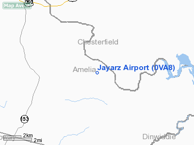
Location & QuickFacts
| FAA Information Effective: | 2008-09-25 |
| Airport Identifier: | 0VA8 |
| Airport Status: | Operational |
| Longitude/Latitude: | 077-47-28.1400W/37-17-08.9400N
-77.791150/37.285817 (Estimated) |
| Elevation: | 210 ft / 64.01 m (Estimated) |
| Land: | 40 acres |
| From nearest city: | 2 nautical miles SW of Mannboro, VA |
| Location: | Amelia County, VA |
| Magnetic Variation: | 09W (1995) |
Owner & Manager
| Ownership: | Privately owned |
| Owner: | James A Remington |
| Address: | 3713 Barrington Bridge Pl
Richmond, VA 23233 |
| Phone number: | 804-747-8280 |
| Manager: | James A Barrington |
| Address: | 3713 Barrington Bridge Pl
Richmond, VA 23223 |
| Phone number: | 804-747-8280 |
Airport Operations and Facilities
| Airport Use: | Private |
| Wind indicator: | Yes |
| Segmented Circle: | No |
| Control Tower: | No |
| Sectional chart: | Washington |
| Region: | AEA - Eastern |
| Boundary ARTCC: | ZDC - Washington |
| Tie-in FSS: | DCA - Leesburg |
| FSS Toll Free: | 1-800-WX-BRIEF |
Runway Information
Runway 14/32
| Dimension: | 1800 x 80 ft / 548.6 x 24.4 m |
| Surface: | TURF, |
| |
Runway 14 |
Runway 32 |
| Traffic Pattern: | Left | Left |
|
Radio Navigation Aids
| ID |
Type |
Name |
Ch |
Freq |
Var |
Dist |
| PTB | NDB | Petersburg | | 284.00 | 08W | 14.0 nm |
| BKT | NDB | Blackstone | | 326.00 | 09W | 15.4 nm |
| CF | NDB | Pubbs | | 392.00 | 09W | 16.4 nm |
| FVX | NDB | Farmville | | 367.00 | 07W | 31.2 nm |
| LJK | NDB | Ashey | | 280.00 | 09W | 32.8 nm |
| MBV | NDB | Mecklenburg/dcmsnd | | 356.00 | 08W | 37.9 nm |
| AKQ | NDB | Wakefield | | 274.00 | 09W | 42.0 nm |
| AEA | NDB | Jones | | 373.00 | 09W | 42.3 nm |
| ELQ | NDB | Emporia | | 261.00 | 10W | 43.8 nm |
| IQK | NDB | Louisa | | 382.00 | 09W | 44.3 nm |
| FAK | VORTAC | Flat Rock | 080X | 113.30 | 06W | 14.7 nm |
| RIC | VORTAC | Richmond | 088X | 114.10 | 09W | 26.0 nm |
| LVL | VORTAC | Lawrenceville | 076X | 112.90 | 08W | 28.6 nm |
| HPW | VORTAC | Hopewell | 057X | 112.00 | 06W | 32.4 nm |
| GVE | VORTAC | Gordonsville | 103X | 115.60 | 06W | 47.0 nm |
Remarks
- PRVDD VFR ONLY, CLEAR 20:1 APCH/DEP PATH, CLEAR RY VFR PRIMARY SFC, & IF PUBLIC UTILITY LINES IN AREA, THEY SHOULD BE MKD.
Images and information placed above are from
http://www.airport-data.com/airport/0VA8/
We thank them for the data!
| General Info
|
| Country |
United States
|
| State |
VIRGINIA
|
| FAA ID |
0VA8
|
| Latitude |
37-17-08.940N
|
| Longitude |
077-47-28.140W
|
| Elevation |
210 feet
|
| Near City |
MANNBORO
|
We don't guarantee the information is fresh and accurate. The data may
be wrong or outdated.
For more up-to-date information please refer to other sources.
|
|


