 |
|
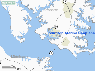
Irvington Marina Seaplane Base Airport |
Location & QuickFacts
| FAA Information Effective: | 2008-09-25 |
| Airport Identifier: | VG21 |
| Airport Status: | Operational |
| Longitude/Latitude: | 076-26-13.8130W/37-39-27.4940N
-76.437170/37.657637 (Estimated) |
| Elevation: | 0 ft / 0.00 m (Estimated) |
| Land: | 0 acres |
| From nearest city: | 1 nautical miles W of Irvington, VA |
| Location: | Lancaster County, VA |
| Magnetic Variation: | 09W (1985) |
Owner & Manager
| Ownership: | Privately owned |
| Owner: | A. W. Wylie |
| Address: | Carter Creek Rd
Irvington, VA 22480 |
| Phone number: | 804-438-5113 |
| Manager: | A. W. Wylie |
| Address: | Carter Creek Rd
Irvington, VA 22480 |
| Phone number: | 804-438-5113 |
Airport Operations and Facilities
| Airport Use: | Private |
| Wind indicator: | Yes |
| Segmented Circle: | No |
| Control Tower: | No |
| Landing fee charge: | No |
| Sectional chart: | Washington |
| Region: | AEA - Eastern |
| Boundary ARTCC: | ZDC - Washington |
| Tie-in FSS: | DCA - Leesburg |
| FSS on Airport: | No |
| FSS Toll Free: | 1-800-WX-BRIEF |
Airport Services
| Fuel available: | 100LL
EMERGENCY FUEL ONLY. |
Runway Information
Runway 04/22
| Dimension: | 3000 x 300 ft / 914.4 x 91.4 m
AND RWY 13/31 LANDING AREA NOT DEFINED; CONFINED TO CREEK. |
| Surface: | WATER, |
| |
Runway 04 |
Runway 22 |
| Traffic Pattern: | Left | Left |
|
Runway 13/31
| Dimension: | 3000 x 200 ft / 914.4 x 61.0 m
AND RWY 13/31 LANDING AREA NOT DEFINED; CONFINED TO CREEK. |
| Surface: | WATER, |
| |
Runway 13 |
Runway 31 |
| Traffic Pattern: | Left | Left |
|
Radio Navigation Aids
| ID |
Type |
Name |
Ch |
Freq |
Var |
Dist |
| BDB | NDB | Accomack | | 336.00 | 11W | 30.9 nm |
| PJS | NDB | Henry | | 375.00 | 09W | 31.7 nm |
| FAF | NDB | Felker | | 226.00 | 08W | 32.4 nm |
| NHK | NDB | Patuxent | | 400.00 | 10W | 37.8 nm |
| AKQ | NDB | Wakefield | | 274.00 | 09W | 48.7 nm |
| APH | NDB | A P Hill | | 396.00 | 10W | 49.4 nm |
| LFI | TACAN | Langley | 070X | | 10W | 34.6 nm |
| NGU | TACAN | Chambers | 048X | | 10W | 43.8 nm |
| HCM | VORTAC | Harcum | 025X | 108.80 | 07W | 18.1 nm |
| CCV | VORTAC | Cape Charles | 059X | 112.20 | 10W | 28.0 nm |
| PXT | VORTAC | Patuxent | 123X | 117.60 | 10W | 37.9 nm |
| HPW | VORTAC | Hopewell | 057X | 112.00 | 06W | 37.9 nm |
| RIC | VORTAC | Richmond | 088X | 114.10 | 09W | 43.1 nm |
| ORF | VORTAC | Norfolk | 116X | 116.90 | 07W | 47.4 nm |
Images and information placed above are from
http://www.airport-data.com/airport/VG21/
We thank them for the data!
| General Info
|
| Country |
United States
|
| State |
VIRGINIA
|
| FAA ID |
VG21
|
| Latitude |
37-39-27.494N
|
| Longitude |
076-26-13.813W
|
| Elevation |
0 feet
|
| Near City |
IRVINGTON
|
We don't guarantee the information is fresh and accurate. The data may
be wrong or outdated.
For more up-to-date information please refer to other sources.
|
|


