 |
|
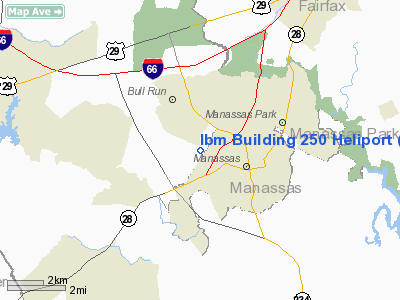
Ibm Building 250 Heliport |
Location & QuickFacts
| FAA Information Effective: | 2008-09-25 |
| Airport Identifier: | 52VA |
| Airport Status: | Operational |
| Longitude/Latitude: | 077-30-22.9620W/38-45-35.4150N
-77.506378/38.759838 (Estimated) |
| Elevation: | 230 ft / 70.10 m (Surveyed) |
| Land: | 0 acres |
| From nearest city: | 1 nautical miles SW of Manassas, VA |
| Location: | Prince William County, VA |
| Magnetic Variation: | 09W (1985) |
Owner & Manager
| Ownership: | Privately owned |
| Owner: | Int'l Busi. Machine Corp. |
| Address: | 9500 Goodwin Drive
Manassas, VA 22110 |
| Phone number: | 703-367-3980 |
| Manager: | C.w. Schuller |
| Address: | 9500 Goodwin Drive
Manassas, VA 22110 |
| Phone number: | 703-367-3980 |
Airport Operations and Facilities
| Airport Use: | Private |
| Segmented Circle: | Yes |
| Control Tower: | No |
| Landing fee charge: | No |
| Sectional chart: | Washington |
| Region: | AEA - Eastern |
| Boundary ARTCC: | ZDC - Washington |
| Tie-in FSS: | DCA - Leesburg |
| FSS Toll Free: | 1-800-WX-BRIEF |
Runway Information
Helipad H2
| Dimension: | 190 x 125 ft / 57.9 x 38.1 m |
| Surface: | ASPH, |
| |
Runway H2 |
Runway |
| Traffic Pattern: | Left | Left |
|
Radio Navigation Aids
| ID |
Type |
Name |
Ch |
Freq |
Var |
Dist |
| GDX | NDB | Goodwin Lake | | 227.00 | 08W | 19.2 nm |
| GTN | NDB | Georgetown | | 323.00 | 09W | 20.6 nm |
| CJR | NDB | Culpeper | | 252.00 | 09W | 21.5 nm |
| DC | NDB | Oxonn | | 332.00 | 11W | 22.5 nm |
| VKX | NDB | Potomac | | 241.00 | 10W | 25.8 nm |
| MSQ | NDB | Nailr | | 351.00 | 10W | 26.2 nm |
| GAI | NDB | Gaithersburg | | 385.00 | 09W | 29.3 nm |
| EZF | NDB | Shannon | | 237.00 | 10W | 29.8 nm |
| TZ | NDB | Cogan | | 364.00 | 10W | 32.8 nm |
| BUH | NDB | Anne Arundel | | 260.00 | 10W | 40.0 nm |
| APH | NDB | A P Hill | | 396.00 | 10W | 41.3 nm |
| LUA | NDB | Caverns | | 245.00 | 09W | 45.4 nm |
| FND | NDB | Ellicott | | 371.00 | 11W | 46.5 nm |
| IQK | NDB | Louisa | | 382.00 | 09W | 47.5 nm |
| FDK | VOR | Frederick | | 109.00 | 08W | 39.7 nm |
| DCA | VOR/DME | Washington | 047X | 111.00 | 09W | 22.8 nm |
| AML | VORTAC | Armel | 082X | 113.50 | 08W | 10.7 nm |
| CSN | VORTAC | Casanova | 110X | 116.30 | 06W | 18.3 nm |
| BRV | VORTAC | Brooke | 092X | 114.50 | 09W | 26.5 nm |
| ADW | VORTAC | Andrews | 078X | 113.10 | 10W | 30.1 nm |
| LDN | VORTAC | Linden | 090X | 114.30 | 06W | 33.2 nm |
| OTT | VORTAC | Nottingham | 084X | 113.70 | 10W | 35.9 nm |
| MRB | VORTAC | Martinsburg | 058X | 112.10 | 07W | 40.9 nm |
| BAL | VORTAC | Baltimore | 098X | 115.10 | 11W | 46.6 nm |
| DCA | VOT | Washington National | | 109.40 | | 22.7 nm |
| ADW | VOT | Andrews Afb | | 109.60 | | 29.4 nm |
Remarks
- HELIPORT USED FOR EMERGENCY PURPOSES ONLY.
- PROVIDED PROPONENT BECOMES FAMILIAR WITH AIR TRAFFIC PATTERNS & OPERATIONS AT MANASSAS ARPT; AGREEMENT WITH IAD ATCT REGARDING ROUTES AND ALTITUDES; PILOTS ARE APPROPRIATELY BRIEFED.
Images and information placed above are from
http://www.airport-data.com/airport/52VA/
We thank them for the data!
| General Info
|
| Country |
United States
|
| State |
VIRGINIA
|
| FAA ID |
52VA
|
| Latitude |
38-45-35.415N
|
| Longitude |
077-30-22.962W
|
| Elevation |
230 feet
|
| Near City |
MANASSAS
|
We don't guarantee the information is fresh and accurate. The data may
be wrong or outdated.
For more up-to-date information please refer to other sources.
|
|


