 |
|
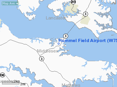
Location & QuickFacts
| FAA Information Effective: | 2008-09-25 |
| Airport Identifier: | W75 |
| Airport Status: | Operational |
| Longitude/Latitude: | 076-26-47.9950W/37-36-08.7550N
-76.446665/37.602432 (Estimated) |
| Elevation: | 30 ft / 9.14 m (Surveyed) |
| Land: | 80 acres |
| From nearest city: | 6 nautical miles E of Saluda, VA |
| Location: | Middlesex County, VA |
| Magnetic Variation: | 10W (1995) |
Owner & Manager
| Ownership: | Publicly owned |
| Owner: | County Board Of Supervisors |
| Address: | County Court House
Saluda, VA 23149 |
| Phone number: | 804-758-4330 |
| Manager: | Marcia Jones |
| Address: | Co Court Hse
Saluda, VA 23149 |
| Phone number: | 804-758-4330 |
Airport Operations and Facilities
| Airport Use: | Open to public |
| Wind indicator: | Yes |
| Segmented Circle: | No |
| Control Tower: | No |
| Lighting Schedule: | DUSK-DAWN
ACTVT MIRL RY 18/36 - CTAF. |
| Beacon Color: | Clear-Green (lighted land airport) |
| Sectional chart: | Washington |
| Region: | AEA - Eastern |
| Boundary ARTCC: | ZDC - Washington |
| Tie-in FSS: | DCA - Leesburg |
| FSS on Airport: | No |
| FSS Toll Free: | 1-800-WX-BRIEF |
| NOTAMs Facility: | DCA (NOTAM-d service avaliable) |
Airport Communications
| CTAF: | 123.000 |
| Unicom: | 123.000 |
Airport Services
| Fuel available: | 100LL |
| Airframe Repair: | MAJOR |
| Power Plant Repair: | MAJOR |
| Bottled Oxygen: | NONE |
| Bulk Oxygen: | NONE |
Runway Information
Runway 01/19
| Dimension: | 2270 x 45 ft / 691.9 x 13.7 m |
| Surface: | ASPH, Good Condition |
| Weight Limit: | Single wheel: 12500 lbs. |
| Edge Lights: | Medium |
| |
Runway 01 |
Runway 19 |
| Longitude: | 076-26-47.0400W | 076-26-48.9500W |
| Latitude: | 37-35-57.5600N | 37-36-19.9500N |
| Elevation: | 30.00 ft | 23.00 ft |
| Alignment: | 127 | 127 |
| Traffic Pattern: | Left | Left |
| Markings: | Non-precision instrument, Good Condition | Basic, Good Condition |
| Displaced threshold: | 135.00 ft | 0.00 ft |
| VASI: | system of panels on right side that may or may not be lighted | system of panels on left side that may or may not be lighted |
| Obstruction: | 64 ft tree, 417.0 ft from runway, 150 ft left of centerline, 3:1 slope to clear
APCH RATIO 5:1 TO DSPLCD THLD. | 15 ft road, 350.0 ft from runway, 10:1 slope to clear
7 FT CORN 20 FT FROM RY END BOTH SIDES. |
|
Radio Navigation Aids
| ID |
Type |
Name |
Ch |
Freq |
Var |
Dist |
| PJS | NDB | Henry | | 375.00 | 09W | 28.3 nm |
| FAF | NDB | Felker | | 226.00 | 08W | 29.1 nm |
| BDB | NDB | Accomack | | 336.00 | 11W | 30.9 nm |
| NHK | NDB | Patuxent | | 400.00 | 10W | 41.1 nm |
| AKQ | NDB | Wakefield | | 274.00 | 09W | 45.7 nm |
| PVG | NDB | Portsmouth | | 241.00 | 10W | 49.4 nm |
| LFI | TACAN | Langley | 070X | | 10W | 31.4 nm |
| NGU | TACAN | Chambers | 048X | | 10W | 40.6 nm |
| HCM | VORTAC | Harcum | 025X | 108.80 | 07W | 15.6 nm |
| CCV | VORTAC | Cape Charles | 059X | 112.20 | 10W | 26.3 nm |
| HPW | VORTAC | Hopewell | 057X | 112.00 | 06W | 35.9 nm |
| PXT | VORTAC | Patuxent | 123X | 117.60 | 10W | 41.3 nm |
| RIC | VORTAC | Richmond | 088X | 114.10 | 09W | 42.1 nm |
| ORF | VORTAC | Norfolk | 116X | 116.90 | 07W | 44.3 nm |
Remarks
- DRAINAGE SWALES FULL LENGTH OF RY ON BOTH SIDES; USE OF EXIT IN FRONT OF HUMMEL AVIATION ADVISED.
- DEPARTING RY 18/36 CLIMB TO 500 FT BEFORE ANY TURN OUT; ARRIVING ACFT USE WIDE PAT TO AVOID POPULATED AREAS EAST & WEST OF ARPT.
- BIRDS AND DEER ON & INVOF ARPT DURING WINTER.
- ACFT HOLD SHORT 75 FT OF EXISTING NSTD HOLD POSITION BARS.
- EXISTED PRIOR TO 1959.
Images and information placed above are from
http://www.airport-data.com/airport/W75/
We thank them for the data!
| General Info
|
| Country |
United States
|
| State |
VIRGINIA
|
| FAA ID |
W75
|
| Latitude |
37-36-08.755N
|
| Longitude |
076-26-47.995W
|
| Elevation |
30 feet
|
| Near City |
SALUDA
|
We don't guarantee the information is fresh and accurate. The data may
be wrong or outdated.
For more up-to-date information please refer to other sources.
|
|


