 |
|
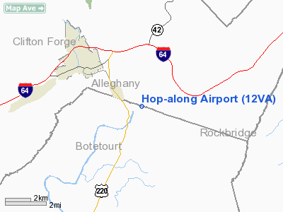
Location & QuickFacts
| FAA Information Effective: | 2008-09-25 |
| Airport Identifier: | 12VA |
| Airport Status: | Operational |
| Longitude/Latitude: | 079-46-04.0000W/37-47-17.0000N
-79.767778/37.788056 (Estimated) |
| Elevation: | 1060 ft / 323.09 m (Estimated) |
| Land: | 5 acres |
| From nearest city: | 3 nautical miles SE of Clifton Forge, VA |
| Location: | Alleghany County, VA |
| Magnetic Variation: | 08W (1995) |
Owner & Manager
| Ownership: | Privately owned |
| Owner: | Wm E Boyd |
| Address: | 5152 Mc Kinney Hollow Rd
Eagle Rock, VA 42085 |
| Phone number: | 540-863-9759 |
| Manager: | Wm E Boyd Jr |
| Address: | 4915 Mc Kinney Hollow Rd
Clifton Forge, VA 24422 |
| Phone number: | 540-862-0900 |
Airport Operations and Facilities
| Airport Use: | Private |
| Wind indicator: | Yes |
| Segmented Circle: | No |
| Control Tower: | No |
| Sectional chart: | Cincinnati |
| Region: | AEA - Eastern |
| Boundary ARTCC: | ZDC - Washington |
| Tie-in FSS: | DCA - Leesburg |
| FSS Toll Free: | 1-800-WX-BRIEF |
Runway Information
Runway 14/32
| Dimension: | 2150 x 50 ft / 655.3 x 15.2 m |
| Surface: | TURF,
TURF RY ROLLING & ROUGH. |
| |
Runway 14 |
Runway 32 |
| Traffic Pattern: | Left | Left |
| Displaced threshold: | 0.00 ft | 300.00 ft |
| Obstruction: | 34 ft plines, 400.0 ft from runway | 15 ft road, 20.0 ft from runway |
|
Radio Navigation Aids
| ID |
Type |
Name |
Ch |
Freq |
Var |
Dist |
| LW | NDB | Bushi | | 346.00 | 06W | 33.3 nm |
| VIT | NDB | Vinton | | 277.00 | 06W | 35.5 nm |
| CNQ | NDB | Callahan | | 379.00 | 05W | 36.7 nm |
| LY | NDB | Bojar | | 385.00 | 08W | 40.3 nm |
| TEC | NDB | Tech | | 368.00 | 06W | 46.2 nm |
| ODR | VOR | Woodrum | | 114.90 | 06W | 29.6 nm |
| LWB | VOR/DME | Greenbrier | 107Y | 116.05 | 08W | 30.0 nm |
| MOL | VOR/DME | Montebello | 100X | 115.30 | 05W | 32.1 nm |
| ROA | VORTAC | Roanoke | 031X | 109.40 | 04W | 30.4 nm |
| LYH | VORTAC | Lynchburg | 029X | 109.20 | 05W | 40.9 nm |
Remarks
- PRVDD VFR ONLY, CLEAR 20:1 APCH/DEP PATH EACH RY, LOA WITH OWNER OF RIVERWOOD ARPT TO COORDINATE TFC PATTERNS, & PLINES AT SE END RY 32 MKD.
Images and information placed above are from
http://www.airport-data.com/airport/12VA/
We thank them for the data!
| General Info
|
| Country |
United States
|
| State |
VIRGINIA
|
| FAA ID |
12VA
|
| Latitude |
37-47-23.000N
|
| Longitude |
079-46-15.000W
|
| Elevation |
1040 feet
|
| Near City |
CLIFTON FORGE
|
We don't guarantee the information is fresh and accurate. The data may
be wrong or outdated.
For more up-to-date information please refer to other sources.
|
|


