 |
|
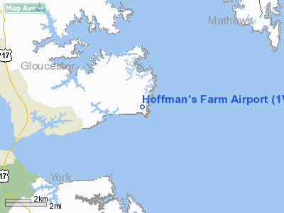
Location & QuickFacts
| FAA Information Effective: | 2008-09-25 |
| Airport Identifier: | 1VA5 |
| Airport Status: | Operational |
| Longitude/Latitude: | 076-23-33.8050W/37-16-13.5090N
-76.392724/37.270419 (Estimated) |
| Elevation: | 3 ft / 0.91 m (Estimated) |
| Land: | 8 acres |
| From nearest city: | 2 nautical miles SE of Severn, VA |
| Location: | Gloucester County, VA |
| Magnetic Variation: | 09W (1985) |
Owner & Manager
| Ownership: | Privately owned |
| Owner: | Fred Hoffman |
| Address: | 103 Travis Circle
Seaford, VA 23696 |
| Phone number: | 804-898-7332 |
| Manager: | Fred Hoffman |
| Address: | 103 Travis Circle
Seaford, VA 23696 |
| Phone number: | 804-898-7332 |
Airport Operations and Facilities
| Airport Use: | Private |
| Wind indicator: | No |
| Segmented Circle: | No |
| Control Tower: | No |
| Sectional chart: | Washington |
| Region: | AEA - Eastern |
| Boundary ARTCC: | ZDC - Washington |
| Tie-in FSS: | DCA - Leesburg |
| FSS on Airport: | No |
| FSS Toll Free: | 1-800-WX-BRIEF |
Airport Services
| Airframe Repair: | NONE |
| Power Plant Repair: | NONE |
Runway Information
Runway 02/20
| Dimension: | 1400 x 50 ft / 426.7 x 15.2 m |
| Surface: | TURF, |
| |
Runway 02 |
Runway 20 |
| Traffic Pattern: | Left | Left |
|
Runway 09W/27W
| Dimension: | 6000 x 50 ft / 1828.8 x 15.2 m |
| Surface: | WATER, |
| |
Runway 09W |
Runway 27W |
| Traffic Pattern: | Left | Left |
|
Radio Navigation Aids
| ID |
Type |
Name |
Ch |
Freq |
Var |
Dist |
| PJS | NDB | Henry | | 375.00 | 09W | 9.6 nm |
| FAF | NDB | Felker | | 226.00 | 08W | 13.4 nm |
| PVG | NDB | Portsmouth | | 241.00 | 10W | 29.6 nm |
| BDB | NDB | Accomack | | 336.00 | 11W | 33.6 nm |
| AKQ | NDB | Wakefield | | 274.00 | 09W | 33.9 nm |
| EY | NDB | Chesi | | 233.00 | 09W | 40.3 nm |
| RK | NDB | Waley | | 249.00 | 10W | 42.2 nm |
| LFI | TACAN | Langley | 070X | | 10W | 11.2 nm |
| NGU | TACAN | Chambers | 048X | | 10W | 20.6 nm |
| NTU | TACAN | Oceana | 113X | | 10W | 31.8 nm |
| HCM | VORTAC | Harcum | 025X | 108.80 | 07W | 18.6 nm |
| CCV | VORTAC | Cape Charles | 059X | 112.20 | 10W | 19.4 nm |
| ORF | VORTAC | Norfolk | 116X | 116.90 | 07W | 24.6 nm |
| HPW | VORTAC | Hopewell | 057X | 112.00 | 06W | 34.8 nm |
| FKN | VORTAC | Franklin | 043X | 110.60 | 09W | 44.7 nm |
| RIC | VORTAC | Richmond | 088X | 114.10 | 09W | 46.4 nm |
Images and information placed above are from
http://www.airport-data.com/airport/1VA5/
We thank them for the data!
| General Info
|
| Country |
United States
|
| State |
VIRGINIA
|
| FAA ID |
1VA5
|
| Latitude |
37-16-13.509N
|
| Longitude |
076-23-33.805W
|
| Elevation |
3 feet
|
| Near City |
SEVERN
|
We don't guarantee the information is fresh and accurate. The data may
be wrong or outdated.
For more up-to-date information please refer to other sources.
|
|


