 |
|
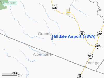
Location & QuickFacts
| FAA Information Effective: | 2008-09-25 |
| Airport Identifier: | 78VA |
| Airport Status: | Operational |
| Longitude/Latitude: | 078-28-31.0000W/38-14-47.0000N
-78.475278/38.246389 (Estimated) |
| Elevation: | 490 ft / 149.35 m (Estimated) |
| Land: | 50 acres |
| From nearest city: | 4 nautical miles SW of Stanardsville, VA |
| Location: | Greene County, VA |
| Magnetic Variation: | 08W (1990) |
Owner & Manager
| Ownership: | Privately owned |
| Owner: | Dorr B. Carpenter |
| Address: | Rt 1 Box 137c
Stanardsville, VA 22973 |
| Phone number: | 804-985-6188 |
| Manager: | Dorr B. Carpenter |
| Address: | Rt 1 Box 137c
Stanardsville, VA 22973 |
| Phone number: | 804-985-6188 |
Airport Operations and Facilities
| Airport Use: | Private |
| Segmented Circle: | No |
| Control Tower: | No |
| Sectional chart: | Washington |
| Region: | AEA - Eastern |
| Boundary ARTCC: | ZDC - Washington |
| Tie-in FSS: | DCA - Leesburg |
| FSS on Airport: | No |
| FSS Toll Free: | 1-800-WX-BRIEF |
Runway Information
Runway 17/35
| Dimension: | 2000 x 80 ft / 609.6 x 24.4 m |
| Surface: | TURF, |
| |
Runway 17 |
Runway 35 |
| Traffic Pattern: | Left | Left |
|
Radio Navigation Aids
| ID |
Type |
Name |
Ch |
Freq |
Var |
Dist |
| AZS | NDB | Azalea Park | | 336.00 | 08W | 14.3 nm |
| VBW | NDB | Bridgewater | | 241.00 | 07W | 24.0 nm |
| LUA | NDB | Caverns | | 245.00 | 09W | 27.2 nm |
| MSQ | NDB | Nailr | | 351.00 | 10W | 29.6 nm |
| IQK | NDB | Louisa | | 382.00 | 09W | 32.1 nm |
| CJR | NDB | Culpeper | | 252.00 | 09W | 33.7 nm |
| EZF | NDB | Shannon | | 237.00 | 10W | 48.4 nm |
| MOL | VOR/DME | Montebello | 100X | 115.30 | 05W | 36.4 nm |
| GVE | VORTAC | Gordonsville | 103X | 115.60 | 06W | 20.7 nm |
| CSN | VORTAC | Casanova | 110X | 116.30 | 06W | 37.2 nm |
| LDN | VORTAC | Linden | 090X | 114.30 | 06W | 38.7 nm |
Remarks
- LMTD TO LGT ACFT; IDENTIFIED TREES ARE REMOVED.
Images and information placed above are from
http://www.airport-data.com/airport/78VA/
We thank them for the data!
| General Info
|
| Country |
United States
|
| State |
VIRGINIA
|
| FAA ID |
78VA
|
| Latitude |
38-14-47.000N
|
| Longitude |
078-28-31.000W
|
| Elevation |
490 feet
|
| Near City |
STANARDSVILLE
|
We don't guarantee the information is fresh and accurate. The data may
be wrong or outdated.
For more up-to-date information please refer to other sources.
|
|


