 |
|
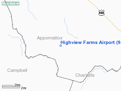
Location & QuickFacts
| FAA Information Effective: | 2008-09-25 |
| Airport Identifier: | 94VA |
| Airport Status: | Operational |
| Longitude/Latitude: | 078-50-58.0000W/37-15-47.0000N
-78.849444/37.263056 (Estimated) |
| Elevation: | 765 ft / 233.17 m (Estimated) |
| Land: | 3 acres |
| From nearest city: | 6 nautical miles S of Appomattox, VA |
| Location: | Appomattox County, VA |
| Magnetic Variation: | 08W (1990) |
Owner & Manager
| Ownership: | Privately owned |
| Owner: | Winfred D Nash |
| Address: | Rt 1 Box 331
Appomattox, VA 24522 |
| Phone number: | 804-352-5825 |
| Manager: | Winfred D Nash |
| Address: | Rt 1 Box 331
Appomattox, VA 24522 |
| Phone number: | 804-352-5825 |
Airport Operations and Facilities
| Airport Use: | Private |
| Wind indicator: | Yes |
| Segmented Circle: | No |
| Control Tower: | No |
| Sectional chart: | Washington |
| Region: | AEA - Eastern |
| Boundary ARTCC: | ZDC - Washington |
| Tie-in FSS: | DCA - Leesburg |
| FSS on Airport: | No |
| FSS Toll Free: | 1-800-WX-BRIEF |
Runway Information
Runway 14/32
| Dimension: | 2200 x 50 ft / 670.6 x 15.2 m |
| Surface: | TURF, |
| |
Runway 14 |
Runway 32 |
| Traffic Pattern: | Left | Left |
| Obstruction: | 25 ft plines, 100.0 ft from runway | |
|
Radio Navigation Aids
| ID |
Type |
Name |
Ch |
Freq |
Var |
Dist |
| LY | NDB | Bojar | | 385.00 | 08W | 18.8 nm |
| FVX | NDB | Farmville | | 367.00 | 07W | 20.4 nm |
| BKT | NDB | Blackstone | | 326.00 | 09W | 39.4 nm |
| AZS | NDB | Azalea Park | | 336.00 | 08W | 47.6 nm |
| VIT | NDB | Vinton | | 277.00 | 06W | 49.5 nm |
| DAN | VOR | Danville | | 113.10 | 06W | 47.8 nm |
| MOL | VOR/DME | Montebello | 100X | 115.30 | 05W | 40.2 nm |
| LYH | VORTAC | Lynchburg | 029X | 109.20 | 05W | 18.5 nm |
| SBV | VORTAC | South Boston | 041X | 110.40 | 05W | 36.2 nm |
Remarks
- ACFT RESTRICTED TO GROSS WEIGHT OF 7500 LBS OR LESS. 25 FT POWERLINES MARKED WITH SPHERICAL MARKERS.
Images and information placed above are from
http://www.airport-data.com/airport/94VA/
We thank them for the data!
| General Info
|
| Country |
United States
|
| State |
VIRGINIA
|
| FAA ID |
94VA
|
| Latitude |
37-15-47.000N
|
| Longitude |
078-50-58.000W
|
| Elevation |
765 feet
|
| Near City |
APPOMATTOX
|
We don't guarantee the information is fresh and accurate. The data may
be wrong or outdated.
For more up-to-date information please refer to other sources.
|
|


