 |
|
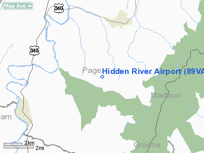
Location & QuickFacts
| FAA Information Effective: | 2008-09-25 |
| Airport Identifier: | 89VA |
| Airport Status: | Operational |
| Longitude/Latitude: | 078-31-27.0350W/38-31-20.4470N
-78.524176/38.522346 (Estimated) |
| Elevation: | 780 ft / 237.74 m (Estimated) |
| Land: | 0 acres |
| From nearest city: | 1 nautical miles E of Edinburg, VA |
| Location: | Shenandoah County, VA |
| Magnetic Variation: | 08W (1990) |
Owner & Manager
| Ownership: | Privately owned |
| Owner: | Stevan H White |
| Address: | Rt 4 Box 290
Edinburg, VA 22824 |
| Phone number: | 703-984-8638 |
| Manager: | Stevan H White |
| Address: | Rt 4box 290
Edinburg, VA 22824 |
| Phone number: | 703-984-8638 |
Airport Operations and Facilities
| Airport Use: | Private |
| Segmented Circle: | No |
| Control Tower: | No |
| Sectional chart: | Washington |
| Region: | AEA - Eastern |
| Boundary ARTCC: | ZDC - Washington |
| Tie-in FSS: | DCA - Leesburg |
| FSS on Airport: | No |
| FSS Toll Free: | 1-800-WX-BRIEF |
Runway Information
Runway 11/29
| Dimension: | 1500 x 40 ft / 457.2 x 12.2 m |
| Surface: | TURF, |
| |
Runway 11 |
Runway 29 |
| Traffic Pattern: | Right | Left |
| Obstruction: | 50 ft trees, 150.0 ft from runway | |
|
Radio Navigation Aids
| ID |
Type |
Name |
Ch |
Freq |
Var |
Dist |
| LUA | NDB | Caverns | | 245.00 | 09W | 10.9 nm |
| VBW | NDB | Bridgewater | | 241.00 | 07W | 22.6 nm |
| MSQ | NDB | Nailr | | 351.00 | 10W | 29.4 nm |
| AZS | NDB | Azalea Park | | 336.00 | 08W | 30.8 nm |
| CJR | NDB | Culpeper | | 252.00 | 09W | 31.3 nm |
| TZ | NDB | Cogan | | 364.00 | 10W | 40.1 nm |
| GDX | NDB | Goodwin Lake | | 227.00 | 08W | 41.6 nm |
| IQK | NDB | Louisa | | 382.00 | 09W | 43.5 nm |
| MOL | VOR/DME | Montebello | 100X | 115.30 | 05W | 46.4 nm |
| ESL | VOR/DME | Kessel | 045X | 110.80 | 06W | 47.5 nm |
| LDN | VORTAC | Linden | 090X | 114.30 | 06W | 24.9 nm |
| CSN | VORTAC | Casanova | 110X | 116.30 | 06W | 31.8 nm |
| GVE | VORTAC | Gordonsville | 103X | 115.60 | 06W | 35.2 nm |
Remarks
- SEE AIRSPACE DETERMINATION DATED MAY 21, 1992 (AIRSPACE CASE 91AEA-464-NRA).
Images and information placed above are from
http://www.airport-data.com/airport/89VA/
We thank them for the data!
| General Info
|
| Country |
United States
|
| State |
VIRGINIA
|
| FAA ID |
89VA
|
| Latitude |
38-31-20.447N
|
| Longitude |
078-31-27.035W
|
| Elevation |
780 feet
|
| Near City |
EDINBURG
|
We don't guarantee the information is fresh and accurate. The data may
be wrong or outdated.
For more up-to-date information please refer to other sources.
|
|


