 |
|
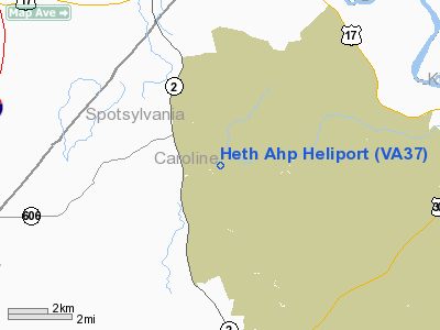
Location & QuickFacts
| FAA Information Effective: | 2008-09-25 |
| Airport Identifier: | VA37 |
| Airport Status: | Operational |
| Longitude/Latitude: | 077-21-58.9330W/38-09-00.4740N
-77.366370/38.150132 (Estimated) |
| Elevation: | 220 ft / 67.06 m (Estimated) |
| Land: | 0 acres |
| From nearest city: | 5 nautical miles N of Fort A. P. Hill, VA |
| Location: | Caroline County, VA |
| Magnetic Variation: | 09W (1985) |
Owner & Manager
| Ownership: | Army owned |
| Owner: | Us Army Atca-aso |
| Address: | Cameron Station
Alexandria, VA 22314 |
| Address: |
|
Airport Operations and Facilities
| Airport Use: | Private |
| Segmented Circle: | No |
| Control Tower: | No |
| Sectional chart: | Washington |
| Region: | AEA - Eastern |
| Boundary ARTCC: | ZDC - Washington |
| Tie-in FSS: | DCA - Leesburg |
| FSS on Airport: | No |
| FSS Toll Free: | 1-800-WX-BRIEF |
Runway Information
Helipad H1
| Dimension: | 1800 x 75 ft / 548.6 x 22.9 m |
| Surface: | GRAVEL, |
| |
Runway H1 |
Runway |
| Traffic Pattern: | Left | Left |
|
Radio Navigation Aids
| ID |
Type |
Name |
Ch |
Freq |
Var |
Dist |
| APH | NDB | A P Hill | | 396.00 | 10W | 4.2 nm |
| EZF | NDB | Shannon | | 237.00 | 10W | 8.0 nm |
| LJK | NDB | Ashey | | 280.00 | 09W | 23.3 nm |
| IQK | NDB | Louisa | | 382.00 | 09W | 24.6 nm |
| MSQ | NDB | Nailr | | 351.00 | 10W | 31.3 nm |
| CJR | NDB | Culpeper | | 252.00 | 09W | 32.6 nm |
| DC | NDB | Oxonn | | 332.00 | 11W | 40.3 nm |
| VKX | NDB | Potomac | | 241.00 | 10W | 40.8 nm |
| NHK | NDB | Patuxent | | 400.00 | 10W | 46.2 nm |
| GTN | NDB | Georgetown | | 323.00 | 09W | 48.2 nm |
| CF | NDB | Pubbs | | 392.00 | 09W | 49.3 nm |
| DCA | VOR/DME | Washington | 047X | 111.00 | 09W | 45.4 nm |
| BRV | VORTAC | Brooke | 092X | 114.50 | 09W | 11.2 nm |
| CSN | VORTAC | Casanova | 110X | 116.30 | 06W | 37.7 nm |
| GVE | VORTAC | Gordonsville | 103X | 115.60 | 06W | 38.1 nm |
| RIC | VORTAC | Richmond | 088X | 114.10 | 09W | 39.0 nm |
| FAK | VORTAC | Flat Rock | 080X | 113.30 | 06W | 43.3 nm |
| OTT | VORTAC | Nottingham | 084X | 113.70 | 10W | 44.4 nm |
| ADW | VORTAC | Andrews | 078X | 113.10 | 10W | 46.0 nm |
| PXT | VORTAC | Patuxent | 123X | 117.60 | 10W | 46.4 nm |
| AML | VORTAC | Armel | 082X | 113.50 | 08W | 47.4 nm |
| DCA | VOT | Washington National | | 109.40 | | 44.6 nm |
| ADW | VOT | Andrews Afb | | 109.60 | | 44.7 nm |
Remarks
- CTC OPNS DIV A. P. HILL V934-8203 FOR WAIVERS TO ABOVE POLICY.
- (E137-1) CONTACT OPERNS DIVISION FORT A. P. HILL BEFORE USING THIS HELIPORT.
Images and information placed above are from
http://www.airport-data.com/airport/VA37/
We thank them for the data!
| General Info
|
| Country |
United States
|
| State |
VIRGINIA
|
| FAA ID |
VA37
|
| Latitude |
38-09-00.474N
|
| Longitude |
077-21-58.933W
|
| Elevation |
220 feet
|
| Near City |
FORT A. P. HILL
|
We don't guarantee the information is fresh and accurate. The data may
be wrong or outdated.
For more up-to-date information please refer to other sources.
|
|


