 |
|
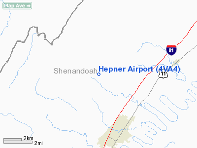
Location & QuickFacts
| FAA Information Effective: | 2008-09-25 |
| Airport Identifier: | 4VA4 |
| Airport Status: | Operational |
| Longitude/Latitude: | 078-32-24.0390W/38-56-05.3960N
-78.540011/38.934832 (Estimated) |
| Elevation: | 1150 ft / 350.52 m (Estimated) |
| Land: | 10 acres |
| From nearest city: | 5 nautical miles NE of Woodstock, VA |
| Location: | Shenandoah County, VA |
| Magnetic Variation: | 09W (1990) |
Owner & Manager
| Ownership: | Privately owned |
| Owner: | James A. Hepner |
| Address: | Rt 1 Box 389
Maurertown, VA 22644 |
| Phone number: | 703-459-3132 |
| Address: |
|
Airport Operations and Facilities
| Airport Use: | Private |
| Wind indicator: | Yes |
| Segmented Circle: | No |
| Control Tower: | No |
| Sectional chart: | Washington |
| Region: | AEA - Eastern |
| Boundary ARTCC: | ZDC - Washington |
| Tie-in FSS: | DCA - Leesburg |
| FSS Toll Free: | 1-800-WX-BRIEF |
Runway Information
Runway 07/25
| Dimension: | 2000 x 75 ft / 609.6 x 22.9 m |
| Surface: | TURF, |
| |
Runway 07 |
Runway 25 |
| Traffic Pattern: | Left | Left |
| Obstruction: | | 75 ft trees, 150.0 ft from runway |
|
Radio Navigation Aids
| ID |
Type |
Name |
Ch |
Freq |
Var |
Dist |
| LUA | NDB | Caverns | | 245.00 | 09W | 14.5 nm |
| TZ | NDB | Cogan | | 364.00 | 10W | 23.8 nm |
| GDX | NDB | Goodwin Lake | | 227.00 | 08W | 33.2 nm |
| VBW | NDB | Bridgewater | | 241.00 | 07W | 39.5 nm |
| CJR | NDB | Culpeper | | 252.00 | 09W | 40.1 nm |
| MSQ | NDB | Nailr | | 351.00 | 10W | 41.5 nm |
| CBE | NDB | Cumberland | | 317.00 | 07W | 43.9 nm |
| ESL | VOR/DME | Kessel | 045X | 110.80 | 06W | 27.3 nm |
| GRV | VOR/DME | Grantsville | 070X | 112.30 | 06W | 48.3 nm |
| LDN | VORTAC | Linden | 090X | 114.30 | 06W | 16.4 nm |
| CSN | VORTAC | Casanova | 110X | 116.30 | 06W | 36.2 nm |
| MRB | VORTAC | Martinsburg | 058X | 112.10 | 07W | 42.1 nm |
Remarks
- PRVDD VFR DLGT OPS; THR OF RY 25 IS DSPLCD & MKD 80 FT TO PRVD A 20:1 CLNC OVER 4 FT FENCE AT END OF RY; & TREES AT EACH END OF THE RY ARE REMOVED OR LOWERED BELOW THE 20:1 APCH SFC.
Images and information placed above are from
http://www.airport-data.com/airport/4VA4/
We thank them for the data!
| General Info
|
| Country |
United States
|
| State |
VIRGINIA
|
| FAA ID |
4VA4
|
| Latitude |
38-56-05.396N
|
| Longitude |
078-32-24.039W
|
| Elevation |
1150 feet
|
| Near City |
WOODSTOCK
|
We don't guarantee the information is fresh and accurate. The data may
be wrong or outdated.
For more up-to-date information please refer to other sources.
|
|


