 |
|
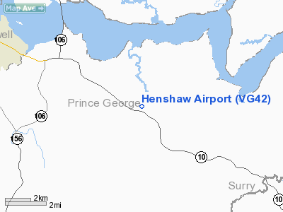
Location & QuickFacts
| FAA Information Effective: | 2008-09-25 |
| Airport Identifier: | VG42 |
| Airport Status: | Operational |
| Longitude/Latitude: | 077-09-09.6000W/37-15-08.5000N
-77.152667/37.252361 (Estimated) |
| Elevation: | 85 ft / 25.91 m () |
| Land: | 5 acres |
| From nearest city: | 5 nautical miles E of Hopewell, VA |
| Location: | Prince George County, VA |
| Magnetic Variation: | 10W (2000) |
Owner & Manager
| Ownership: | Privately owned |
| Owner: | Richard Henshaw Sr |
| Address: | 13559 Moody Rd
Hopewell, VA 23860 |
| Phone number: | 804-458-1921 |
| Manager: | Richard Henshaw Sr |
| Address: | 13559 Moody Rd
Hopewell, VA 23860 |
| Phone number: | 804-458-1921 |
Airport Operations and Facilities
| Airport Use: | Private |
| Wind indicator: | Yes |
| Segmented Circle: | No |
| Control Tower: | No |
| Sectional chart: | Washington |
| Region: | AEA - Eastern |
| Boundary ARTCC: | ZDC - Washington |
| Tie-in FSS: | DCA - Leesburg |
| FSS Toll Free: | 1-800-WX-BRIEF |
Runway Information
Runway 02/20
| Dimension: | 2700 x 75 ft / 823.0 x 22.9 m |
| Surface: | TURF, |
| |
Runway 02 |
Runway 20 |
| Traffic Pattern: | Left | Left |
|
Radio Navigation Aids
| ID |
Type |
Name |
Ch |
Freq |
Var |
Dist |
| CF | NDB | Pubbs | | 392.00 | 09W | 15.2 nm |
| AKQ | NDB | Wakefield | | 274.00 | 09W | 17.7 nm |
| PTB | NDB | Petersburg | | 284.00 | 08W | 21.5 nm |
| FAF | NDB | Felker | | 226.00 | 08W | 26.5 nm |
| PJS | NDB | Henry | | 375.00 | 09W | 32.4 nm |
| LJK | NDB | Ashey | | 280.00 | 09W | 35.0 nm |
| ELQ | NDB | Emporia | | 261.00 | 10W | 40.3 nm |
| BKT | NDB | Blackstone | | 326.00 | 09W | 43.4 nm |
| PVG | NDB | Portsmouth | | 241.00 | 10W | 44.2 nm |
| RK | NDB | Waley | | 249.00 | 10W | 46.1 nm |
| LFI | TACAN | Langley | 070X | | 10W | 39.3 nm |
| NGU | TACAN | Chambers | 048X | | 10W | 46.0 nm |
| HPW | VORTAC | Hopewell | 057X | 112.00 | 06W | 4.9 nm |
| RIC | VORTAC | Richmond | 088X | 114.10 | 09W | 17.0 nm |
| HCM | VORTAC | Harcum | 025X | 108.80 | 07W | 24.2 nm |
| FKN | VORTAC | Franklin | 043X | 110.60 | 09W | 33.0 nm |
| FAK | VORTAC | Flat Rock | 080X | 113.30 | 06W | 36.3 nm |
| LVL | VORTAC | Lawrenceville | 076X | 112.90 | 08W | 44.5 nm |
Remarks
- PRVDD VFR; NO IFR OPNS; CLEAR 20:1 APCH/DEP PATH; NSTD TFC PATTERN RY 20 TO AVOID CHURCH FOR NOISE PURPOSES.
Images and information placed above are from
http://www.airport-data.com/airport/VG42/
We thank them for the data!
| General Info
|
| Country |
United States
|
| State |
VIRGINIA
|
| FAA ID |
VG42
|
| Latitude |
37-15-08.500N
|
| Longitude |
077-09-09.600W
|
| Elevation |
85 feet
|
| Near City |
HOPEWELL
|
We don't guarantee the information is fresh and accurate. The data may
be wrong or outdated.
For more up-to-date information please refer to other sources.
|
|


