 |
|
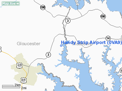
Location & QuickFacts
| FAA Information Effective: | 2008-09-25 |
| Airport Identifier: | 0VA9 |
| Airport Status: | Operational |
| Longitude/Latitude: | 076-27-13.8120W/37-26-50.4980N
-76.453837/37.447361 (Estimated) |
| Elevation: | 8 ft / 2.44 m (Estimated) |
| Land: | 5 acres |
| From nearest city: | 4 nautical miles NE of Gloucester Court House, VA |
| Location: | Gloucester County, VA |
| Magnetic Variation: | 09W (1985) |
Owner & Manager
| Ownership: | Privately owned |
| Owner: | Gilbert Handy |
| Address: | Rt. 4 Box 1765
Gloucester, VA 23061 |
| Phone number: | 804-693-2946 |
| Manager: | Gilbert Handy |
| Address: | Rt. 4 Box 1765
Gloucester, VA 23061 |
| Phone number: | 804-693-2946 |
Airport Operations and Facilities
| Airport Use: | Private |
| Wind indicator: | Yes |
| Segmented Circle: | No |
| Control Tower: | No |
| Sectional chart: | Washington |
| Region: | AEA - Eastern |
| Boundary ARTCC: | ZDC - Washington |
| Tie-in FSS: | DCA - Leesburg |
| FSS Toll Free: | 1-800-WX-BRIEF |
Runway Information
Runway 02/20
| Dimension: | 1000 x 30 ft / 304.8 x 9.1 m |
| Surface: | TURF, |
| |
Runway 02 |
Runway 20 |
| Traffic Pattern: | Left | Right |
| Displaced threshold: | 300.00 ft | 0.00 ft |
| Obstruction: | 20 ft pline, 100.0 ft from runway | |
|
Radio Navigation Aids
| ID |
Type |
Name |
Ch |
Freq |
Var |
Dist |
| PJS | NDB | Henry | | 375.00 | 09W | 19.0 nm |
| FAF | NDB | Felker | | 226.00 | 08W | 20.2 nm |
| BDB | NDB | Accomack | | 336.00 | 11W | 32.1 nm |
| AKQ | NDB | Wakefield | | 274.00 | 09W | 38.3 nm |
| PVG | NDB | Portsmouth | | 241.00 | 10W | 40.1 nm |
| CF | NDB | Pubbs | | 392.00 | 09W | 48.2 nm |
| LFI | TACAN | Langley | 070X | | 10W | 22.2 nm |
| NGU | TACAN | Chambers | 048X | | 10W | 31.6 nm |
| NTU | TACAN | Oceana | 113X | | 10W | 42.5 nm |
| HCM | VORTAC | Harcum | 025X | 108.80 | 07W | 12.3 nm |
| CCV | VORTAC | Cape Charles | 059X | 112.20 | 10W | 22.6 nm |
| HPW | VORTAC | Hopewell | 057X | 112.00 | 06W | 32.4 nm |
| ORF | VORTAC | Norfolk | 116X | 116.90 | 07W | 35.5 nm |
| RIC | VORTAC | Richmond | 088X | 114.10 | 09W | 41.5 nm |
Remarks
- DAYTIME VFR USE ONLY; RY 02 THR DSPLCD TO PRVD 20:1 APCH SLOPE; ONLY N3 PUP-NOSTALGIA ACFT USED.
Images and information placed above are from
http://www.airport-data.com/airport/0VA9/
We thank them for the data!
| General Info
|
| Country |
United States
|
| State |
VIRGINIA
|
| FAA ID |
0VA9
|
| Latitude |
37-26-50.498N
|
| Longitude |
076-27-13.812W
|
| Elevation |
8 feet
|
| Near City |
GLOUCESTER COURT HOUSE
|
We don't guarantee the information is fresh and accurate. The data may
be wrong or outdated.
For more up-to-date information please refer to other sources.
|
|


