 |
|
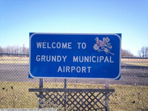
| Grundy Municipal Airport |
| IATA: none – ICAO: KGDY – FAA LID: GDY |
| Summary |
| Airport type |
Public |
| Owner |
Town of Grundy |
| Operator |
Grundy Municipal Airport Commission |
| Serves |
Grundy, Virginia |
| Elevation AMSL |
2,304 ft / 702 m |
| Coordinates |
37°13′57″N 082°07′30″W / 37.2325°N 82.125°W / 37.2325; -82.125 |
| Runways |
| Direction |
Length |
Surface |
| ft |
m |
| 4/22 |
2,256 |
688 |
Asphalt |
| Statistics (2008) |
| Aircraft operations |
4,177 |
| Source: Federal Aviation Administration |
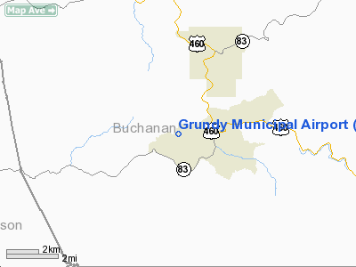
Grundy Municipal Airport (ICAO: KGDY, FAA LID: GDY) is a public-use airport located three nautical miles (6 km) southwest of the central business district of Grundy, a town in Buchanan County, Virginia, United States. It is publicly owned by the Town of Grundy and is operated by the Grundy Municipal Airport Commission. Grundy Municipal is the only airport operating in Buchanan County. Small personal and charter planes use the facility. It is a 3 miles (5 km) drive from Grundy, the county seat of Buchanan County.
Although most U.S. airports use the same three-letter location identifier for the FAA and IATA, this airport is assigned GDY by the FAA but has no designation from the IATA. Facilities and aircraft
Grundy Municipal Airport covers an area of 89 acres (36 ha) at an elevation of 2,304 feet (702 m) above mean sea level. It has one asphalt paved runway designated 4/22 which measures 2,256 by 60 feet (688 x 18 m). For the 12-month period ending May 31, 2008, the airport had 4,177 general aviation aircraft operations, an average of 11 per day.
Future of the airport
Grundy Municipal Airport was completed in 1969 when the property it lies on was donated to the town by the United Coal Company, after surface mining created the new flat land. The lack of flat terrain in the mountainous region made it difficult to find a location suitable to sustain a proper airport facility. After 35 years of operation, many local leaders want to replace the current airport for a larger regional airport. Leaders on a local, state, and federal level have been working on creating a new regional airport serving Buchanan and Dickenson Counties. Currently, work is in the alpha stages to develop a new regional airport with the relocation of residents.
The above content comes from Wikipedia and is published under free licenses – click here to read more.
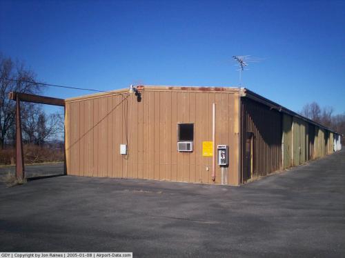 |
(Click on the photo to enlarge) |
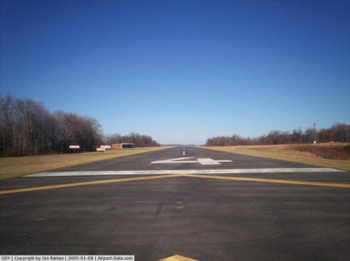 |
(Click on the photo to enlarge) |
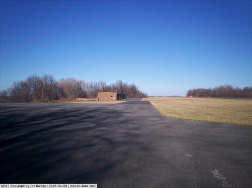 |
(Click on the photo to enlarge) |
 |
(Click on the photo to enlarge) |
Location & QuickFacts
| FAA Information Effective: | 2008-09-25 |
| Airport Identifier: | GDY |
| Airport Status: | Operational |
| Longitude/Latitude: | 082-07-29.9880W/37-13-56.6150N
-82.124997/37.232393 (Estimated) |
| Elevation: | 2304 ft / 702.26 m (Surveyed) |
| Land: | 89 acres |
| From nearest city: | 3 nautical miles SW of Grundy, VA |
| Location: | Buchanan County, VA |
| Magnetic Variation: | 06W (2000) |
Owner & Manager
| Ownership: | Publicly owned |
| Owner: | Town Of Grundy |
| Address: | 1103 Plaza Drive, Suite D
Grundy, VA 24614 |
| Phone number: | 276-935-2551 |
| Manager: | James Keen |
| Address: | 1103 Plaza Drive, Suite D
Grundy, VA 24614 |
| Phone number: | 276-935-2551 |
Airport Operations and Facilities
| Airport Use: | Open to public |
| Wind indicator: | Yes |
| Segmented Circle: | No |
| Control Tower: | No |
| Lighting Schedule: | DUSK-DAWN
ACTVT MIRL RY 04/22 - CTAF; HIGH INTSTY ONLY. |
| Beacon Color: | Clear-Green (lighted land airport) |
| Landing fee charge: | No |
| Sectional chart: | Cincinnati |
| Region: | AEA - Eastern |
| Boundary ARTCC: | ZID - Indianapolis |
| Tie-in FSS: | DCA - Leesburg |
| FSS on Airport: | No |
| FSS Toll Free: | 1-800-WX-BRIEF |
| NOTAMs Facility: | DCA (NOTAM-d service avaliable) |
| Federal Agreements: | NGY |
Airport Communications
| CTAF: | 123.000 |
| Unicom: | 123.000 |
Airport Services
| Airframe Repair: | NONE |
| Power Plant Repair: | NONE |
| Bottled Oxygen: | NONE |
| Bulk Oxygen: | NONE |
Runway Information
Runway 04/22
| Dimension: | 2256 x 60 ft / 687.6 x 18.3 m |
| Surface: | ASPH, Good Condition |
| Weight Limit: | Single wheel: 7000 lbs. |
| Edge Lights: | Medium |
| |
Runway 04 |
Runway 22 |
| Longitude: | 082-07-38.4730W | 082-07-21.5030W |
| Latitude: | 37-13-47.7650N | 37-14-05.4650N |
| Elevation: | 2304.00 ft | 2304.00 ft |
| Alignment: | 37 | 127 |
| Traffic Pattern: | Left | Left |
| Markings: | Basic, Good Condition | Basic, Good Condition |
| VASI: | system of panels on left side that may or may not be lighted | system of panels on left side that may or may not be lighted |
| Obstruction: | 21 ft tree, 211.0 ft from runway, 164 ft left of centerline | 51 ft tree, 246.0 ft from runway, 150 ft left of centerline |
|
Radio Navigation Aids
| ID |
Type |
Name |
Ch |
Freq |
Var |
Dist |
| VJ | NDB | Whine | | 236.00 | 05W | 31.1 nm |
| GTC | NDB | Guyandot | | 293.00 | 03W | 34.6 nm |
| MK | NDB | Suzze | | 335.00 | 06W | 46.3 nm |
| GZG | VOR/DME | Glade Spring | 039X | 110.20 | 02W | 24.6 nm |
| BLF | VORTAC | Bluefield | 037X | 110.00 | 03W | 44.7 nm |
| HMV | VORTAC | Holston Mountain | 093X | 114.60 | 04W | 47.8 nm |
Remarks
- PAY PHONE AT AIRPORT 276-935-8022.
- WILDLIFE INVOF ARPT.
Images and information placed above are from
http://www.airport-data.com/airport/GDY/
We thank them for the data!
| General Info
|
| Country |
United States
|
| State |
VIRGINIA
|
| FAA ID |
GDY
|
| Latitude |
37-13-56.644N
|
| Longitude |
082-07-29.967W
|
| Elevation |
2304 feet
|
| Near City |
GRUNDY
|
We don't guarantee the information is fresh and accurate. The data may
be wrong or outdated.
For more up-to-date information please refer to other sources.
|
|


