 |
|
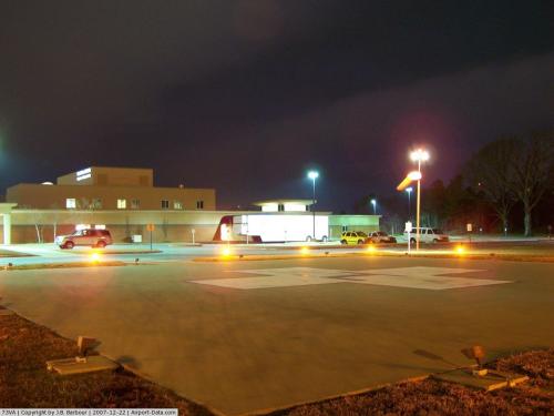
Greensville Memorial Hospital Heliport |
 |
(Click on the photo to enlarge) |
Location & QuickFacts
| FAA Information Effective: | 2008-09-25 |
| Airport Identifier: | 73VA |
| Airport Status: | Operational |
| Longitude/Latitude: | 077-32-23.9310W/36-42-07.5370N
-77.539981/36.702094 (Estimated) |
| Elevation: | 130 ft / 39.62 m (Estimated) |
| Land: | 0 acres |
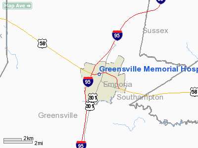
| From nearest city: | 0 nautical miles N of Emporia, VA |
| Location: | Greensville County, VA |
| Magnetic Variation: | 08W (1985) |
Owner & Manager
| Ownership: | Privately owned |
| Owner: | Emporia Hospital Corp |
| Address: | 4000 Meridian Blvd
Franklin, TN 37067 |
| Phone number: | 615-465-7000 |
| Manager: | Doug Arbour, Ceo
OTHER CONTACT: TOM CLINEDINST, ENGINEERING DIRECTOR 434-348-4925 |
| Address: | 727 N. Main St.
Emporia, VA 23847 |
| Phone number: | 804-434-4400 |
Airport Operations and Facilities
| Airport Use: | Private
MEDICAL USE |
| Segmented Circle: | No |
| Control Tower: | No |
| Landing fee charge: | No |
| Sectional chart: | Charlotte |
| Region: | AEA - Eastern |
| Boundary ARTCC: | ZDC - Washington |
| Tie-in FSS: | DCA - Leesburg |
| FSS Toll Free: | 1-800-WX-BRIEF |
Runway Information
Helipad H1
| Dimension: | 70 x 70 ft / 21.3 x 21.3 m |
| Surface: | CONC, |
| |
Runway H1 |
Runway |
| Traffic Pattern: | Left | Left |
|
Radio Navigation Aids
| ID |
Type |
Name |
Ch |
Freq |
Var |
Dist |
| ELQ | NDB | Emporia | | 261.00 | 10W | 7.5 nm |
| RZZ | NDB | Rapids | | 407.00 | 08W | 17.7 nm |
| MBV | NDB | Mecklenburg/dcmsnd | | 356.00 | 08W | 24.9 nm |
| AEA | NDB | Jones | | 373.00 | 09W | 25.3 nm |
| PTB | NDB | Petersburg | | 284.00 | 08W | 25.8 nm |
| ASJ | NDB | Ahoskie | | 415.00 | 10W | 29.9 nm |
| AKQ | NDB | Wakefield | | 274.00 | 09W | 30.9 nm |
| BKT | NDB | Blackstone | | 326.00 | 09W | 35.2 nm |
| CF | NDB | Pubbs | | 392.00 | 09W | 38.2 nm |
| RK | NDB | Waley | | 249.00 | 10W | 43.4 nm |
| ETC | NDB | Tarboro | | 257.00 | 08W | 46.1 nm |
| LVL | VORTAC | Lawrenceville | 076X | 112.90 | 08W | 18.8 nm |
| FKN | VORTAC | Franklin | 043X | 110.60 | 09W | 25.4 nm |
| CVI | VORTAC | Cofield | 093X | 114.60 | 09W | 37.9 nm |
| HPW | VORTAC | Hopewell | 057X | 112.00 | 06W | 42.8 nm |
| TYI | VORTAC | Tar River | 125X | 117.80 | 05W | 44.3 nm |
| RIC | VORTAC | Richmond | 088X | 114.10 | 09W | 49.2 nm |
Remarks
- GUY WIRES TO THE EAST ARE MKD AND LIGHTED; INGRESS/EGRESS ROUTES ARE LIGHTED.
Images and information placed above are from
http://www.airport-data.com/airport/73VA/
We thank them for the data!
| General Info
|
| Country |
United States
|
| State |
VIRGINIA
|
| FAA ID |
73VA
|
| Latitude |
36-42-07.537N
|
| Longitude |
077-32-23.931W
|
| Elevation |
130 feet
|
| Near City |
EMPORIA
|
We don't guarantee the information is fresh and accurate. The data may
be wrong or outdated.
For more up-to-date information please refer to other sources.
|
|


