 |
|
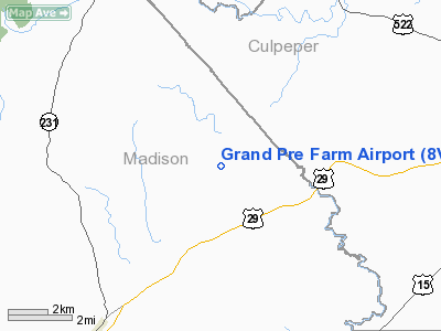
Location & QuickFacts
| FAA Information Effective: | 2008-09-25 |
| Airport Identifier: | 8VA1 |
| Airport Status: | Operational |
| Longitude/Latitude: | 078-11-11.0040W/38-27-15.4550N
-78.186390/38.454293 (Estimated) |
| Elevation: | 500 ft / 152.40 m (Estimated) |
| Land: | 200 acres |
| From nearest city: | 2 nautical miles N of Brightwood, VA |
| Location: | Madison County, VA |
| Magnetic Variation: | 08W (1985) |
Owner & Manager
| Ownership: | Privately owned |
| Owner: | Col. Donn R. Grand Pre |
| Address: | Rt 1, Box 232
Reva, VA 22735 |
| Phone number: | 703-547-2825 |
| Manager: | Col. Donn R. Grand Pre |
| Address: | Rt 1, Box 232
Reva, VA 22735 |
| Phone number: | 703-547-2825 |
Airport Operations and Facilities
| Airport Use: | Private |
| Wind indicator: | Yes |
| Segmented Circle: | No |
| Control Tower: | No |
| Landing fee charge: | No |
| Sectional chart: | Washington |
| Region: | AEA - Eastern |
| Boundary ARTCC: | ZDC - Washington |
| Tie-in FSS: | DCA - Leesburg |
| FSS on Airport: | No |
| FSS Toll Free: | 1-800-WX-BRIEF |
Runway Information
Runway 06/24
| Dimension: | 1800 x 30 ft / 548.6 x 9.1 m |
| Surface: | TURF, Good Condition |
| |
Runway 06 |
Runway 24 |
| Traffic Pattern: | Left | Left |
| Obstruction: | | 20 ft pline, 750.0 ft from runway |
|
Radio Navigation Aids
| ID |
Type |
Name |
Ch |
Freq |
Var |
Dist |
| MSQ | NDB | Nailr | | 351.00 | 10W | 13.2 nm |
| CJR | NDB | Culpeper | | 252.00 | 09W | 16.1 nm |
| LUA | NDB | Caverns | | 245.00 | 09W | 19.9 nm |
| IQK | NDB | Louisa | | 382.00 | 09W | 30.3 nm |
| AZS | NDB | Azalea Park | | 336.00 | 08W | 31.0 nm |
| GDX | NDB | Goodwin Lake | | 227.00 | 08W | 34.3 nm |
| EZF | NDB | Shannon | | 237.00 | 10W | 36.5 nm |
| VBW | NDB | Bridgewater | | 241.00 | 07W | 36.9 nm |
| TZ | NDB | Cogan | | 364.00 | 10W | 38.4 nm |
| APH | NDB | A P Hill | | 396.00 | 10W | 46.2 nm |
| CSN | VORTAC | Casanova | 110X | 116.30 | 06W | 18.8 nm |
| LDN | VORTAC | Linden | 090X | 114.30 | 06W | 24.1 nm |
| GVE | VORTAC | Gordonsville | 103X | 115.60 | 06W | 26.5 nm |
| BRV | VORTAC | Brooke | 092X | 114.50 | 09W | 39.9 nm |
| AML | VORTAC | Armel | 082X | 113.50 | 08W | 44.4 nm |
Images and information placed above are from
http://www.airport-data.com/airport/8VA1/
We thank them for the data!
| General Info
|
| Country |
United States
|
| State |
VIRGINIA
|
| FAA ID |
8VA1
|
| Latitude |
38-27-15.455N
|
| Longitude |
078-11-11.004W
|
| Elevation |
500 feet
|
| Near City |
BRIGHTWOOD
|
We don't guarantee the information is fresh and accurate. The data may
be wrong or outdated.
For more up-to-date information please refer to other sources.
|
|


