 |
|
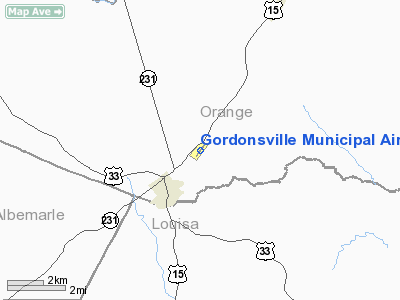
Gordonsville Muni Airport |
Location & QuickFacts
| FAA Information Effective: | 2008-09-25 |
| Airport Identifier: | GVE |
| Airport Status: | Operational |
| Longitude/Latitude: | 078-09-56.8080W/38-09-21.5860N
-78.165780/38.155996 (Estimated) |
| Elevation: | 454 ft / 138.38 m (Estimated) |
| Land: | 34 acres |
| From nearest city: | 3 nautical miles NE of Gordonsville, VA |
| Location: | Orange County, VA |
| Magnetic Variation: | 06W (1965) |
Owner & Manager
| Ownership: | Publicly owned |
| Owner: | Town Of Gordonsville |
| Address: | P.o. Box 276
Gordonsville, VA 22942 |
| Phone number: | 540-832-2233 |
| Manager: | Brent Hall |
| Address: | Po Box 518
Gordonsville, VA 22942 |
| Phone number: | 434-996-5911 |
Airport Operations and Facilities
| Airport Use: | Open to public |
| Wind indicator: | Yes |
| Segmented Circle: | No |
| Control Tower: | No |
| Lighting Schedule: | DUSK-DAWN
ACTIVATE MIRL RY 05/23 - CTAF. |
| Beacon Color: | Clear-Green (lighted land airport) |
| Landing fee charge: | No |
| Sectional chart: | Washington |
| Region: | AEA - Eastern |
| Boundary ARTCC: | ZDC - Washington |
| Tie-in FSS: | DCA - Leesburg |
| FSS on Airport: | No |
| FSS Toll Free: | 1-800-WX-BRIEF |
| NOTAMs Facility: | DCA (NOTAM-d service avaliable) |
Airport Communications
| CTAF: | 123.000 |
| Unicom: | 123.000 |
Airport Services
| Fuel available: | 100LL |
| Airframe Repair: | MINOR |
| Power Plant Repair: | MINOR |
| Bottled Oxygen: | NONE |
| Bulk Oxygen: | NONE |
Runway Information
Runway 05/23
| Dimension: | 2300 x 40 ft / 701.0 x 12.2 m |
| Surface: | ASPH, Poor Condition
OLD CRACKSEAL SIX INCHES WIDE IN PLACES, VERY SOFT |
| Weight Limit: | Single wheel: 12500 lbs. |
| Edge Lights: | Medium |
| |
Runway 05 |
Runway 23 |
| Longitude: | 078-10-05.6460W | 078-09-47.9360W |
| Latitude: | 38-09-12.5910N | 38-09-30.5170N |
| Elevation: | 453.00 ft | 442.00 ft |
| Alignment: | 38 | 127 |
| Traffic Pattern: | Left | Left |
| Markings: | Non-precision instrument, Fair Condition | Non-precision instrument, Fair Condition |
| Displaced threshold: | 0.00 ft | 440.00 ft |
| VASI: | system of panels on right side that may or may not be lighted | system of panels on right side that may or may not be lighted |
| Obstruction: | 25 ft tree, 387.0 ft from runway, 85 ft right of centerline, 7:1 slope to clear
TREE 184 FT FM RY END & 74 FT LEFT ON APCH IS 13 FT ABOVE THE RY END ELEV. | 37 ft tree, 296.0 ft from runway, 25 ft right of centerline, 2:1 slope to clear
RY 23 APCH RATIO 0:1 TO DSPD THLD; +26 FT TREE 23 FT FM DSPLCD THLD; 115 FT L BASED ON DSPD THLD. |
|
Radio Navigation Aids
| ID |
Type |
Name |
Ch |
Freq |
Var |
Dist |
| IQK | NDB | Louisa | | 382.00 | 09W | 16.6 nm |
| AZS | NDB | Azalea Park | | 336.00 | 08W | 18.8 nm |
| MSQ | NDB | Nailr | | 351.00 | 10W | 21.7 nm |
| CJR | NDB | Culpeper | | 252.00 | 09W | 26.8 nm |
| EZF | NDB | Shannon | | 237.00 | 10W | 34.4 nm |
| LUA | NDB | Caverns | | 245.00 | 09W | 35.7 nm |
| VBW | NDB | Bridgewater | | 241.00 | 07W | 39.6 nm |
| LJK | NDB | Ashey | | 280.00 | 09W | 39.8 nm |
| APH | NDB | A P Hill | | 396.00 | 10W | 40.0 nm |
| FVX | NDB | Farmville | | 367.00 | 07W | 50.0 nm |
| MOL | VOR/DME | Montebello | 100X | 115.30 | 05W | 47.1 nm |
| GVE | VORTAC | Gordonsville | 103X | 115.60 | 06W | 8.6 nm |
| CSN | VORTAC | Casanova | 110X | 116.30 | 06W | 32.4 nm |
| BRV | VORTAC | Brooke | 092X | 114.50 | 09W | 39.9 nm |
| FAK | VORTAC | Flat Rock | 080X | 113.30 | 06W | 41.0 nm |
| LDN | VORTAC | Linden | 090X | 114.30 | 06W | 42.0 nm |
Remarks
Images and information placed above are from
http://www.airport-data.com/airport/GVE/
We thank them for the data!
| General Info
|
| Country |
United States
|
| State |
VIRGINIA
|
| FAA ID |
GVE
|
| Latitude |
38-09-21.586N
|
| Longitude |
078-09-56.808W
|
| Elevation |
454 feet
|
| Near City |
GORDONSVILLE
|
We don't guarantee the information is fresh and accurate. The data may
be wrong or outdated.
For more up-to-date information please refer to other sources.
|
|


