 |
|
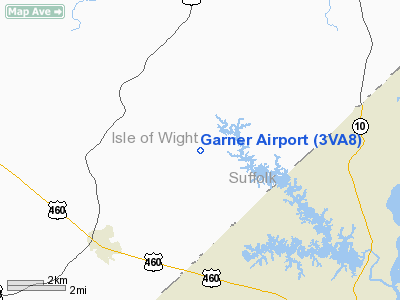
Location & QuickFacts
| FAA Information Effective: | 2008-09-25 |
| Airport Identifier: | 3VA8 |
| Airport Status: | Operational |
| Longitude/Latitude: | 076-40-55.8410W/36-51-22.5370N
-76.682178/36.856260 (Estimated) |
| Elevation: | 80 ft / 24.38 m (Surveyed) |
| Land: | 21 acres |
| From nearest city: | 5 nautical miles NE of Windsor, VA |
| Location: | Isle Of Wight County, VA |
| Magnetic Variation: | 09W (1985) |
Owner & Manager
| Ownership: | Privately owned |
| Owner: | Tidewater Soaring Foundation |
| Address: | 1400 Maqruder Rd
Smithfield, VA 23430 |
| Phone number: | 757-357-2360 |
| Manager: | William E. Laine, Jr |
| Address: | 1400 Maqruder Rd
Smithfield, VA 23430 |
| Phone number: | 757-357-2360
WEEKENDS ONLY. |
Airport Operations and Facilities
| Airport Use: | Private |
| Wind indicator: | Yes |
| Segmented Circle: | No |
| Control Tower: | No |
| Landing fee charge: | No |
| Sectional chart: | Washington |
| Region: | AEA - Eastern |
| Boundary ARTCC: | ZDC - Washington |
| Tie-in FSS: | DCA - Leesburg |
| FSS on Airport: | No |
| FSS Toll Free: | 1-800-WX-BRIEF |
Airport Services
| Airframe Repair: | NONE |
| Power Plant Repair: | NONE |
Runway Information
Runway N/S
| Dimension: | 2600 x 50 ft / 792.5 x 15.2 m |
| Surface: | TURF, |
| |
Runway N |
Runway S |
| Traffic Pattern: | Left | Left |
|
Radio Navigation Aids
| ID |
Type |
Name |
Ch |
Freq |
Var |
Dist |
| PVG | NDB | Portsmouth | | 241.00 | 10W | 12.3 nm |
| RK | NDB | Waley | | 249.00 | 10W | 15.5 nm |
| AKQ | NDB | Wakefield | | 274.00 | 09W | 17.1 nm |
| FAF | NDB | Felker | | 226.00 | 08W | 17.3 nm |
| PJS | NDB | Henry | | 375.00 | 09W | 18.9 nm |
| EY | NDB | Chesi | | 233.00 | 09W | 21.1 nm |
| ELQ | NDB | Emporia | | 261.00 | 10W | 38.6 nm |
| LLW | NDB | Woodville | | 254.00 | 10W | 40.2 nm |
| ASJ | NDB | Ahoskie | | 415.00 | 10W | 41.1 nm |
| PTB | NDB | Petersburg | | 284.00 | 08W | 45.9 nm |
| CF | NDB | Pubbs | | 392.00 | 09W | 46.8 nm |
| NGU | TACAN | Chambers | 048X | | 10W | 20.1 nm |
| LFI | TACAN | Langley | 070X | | 10W | 20.7 nm |
| NTU | TACAN | Oceana | 113X | | 10W | 31.1 nm |
| ECG | VOR/DME | Elizabeth City | 072X | 112.50 | 07W | 43.5 nm |
| FKN | VORTAC | Franklin | 043X | 110.60 | 09W | 18.0 nm |
| ORF | VORTAC | Norfolk | 116X | 116.90 | 07W | 23.3 nm |
| CVI | VORTAC | Cofield | 093X | 114.60 | 09W | 30.5 nm |
| HPW | VORTAC | Hopewell | 057X | 112.00 | 06W | 35.2 nm |
| HCM | VORTAC | Harcum | 025X | 108.80 | 07W | 35.6 nm |
| CCV | VORTAC | Cape Charles | 059X | 112.20 | 10W | 44.1 nm |
| RIC | VORTAC | Richmond | 088X | 114.10 | 09W | 49.4 nm |
Remarks
- GLIDER OPERATIONS ON WEEKENDS.
- TO OBTAIN LANDING PERMISSION CALL W.E. LAINE, JR., 804-357-3191 (DAYS) 804-357-2360 (NIGHTS & WEEKENDS).
- BUILT PRIOR TO 1959.
Images and information placed above are from
http://www.airport-data.com/airport/3VA8/
We thank them for the data!
| General Info
|
| Country |
United States
|
| State |
VIRGINIA
|
| FAA ID |
3VA8
|
| Latitude |
36-51-22.537N
|
| Longitude |
076-40-55.841W
|
| Elevation |
80 feet
|
| Near City |
WINDSOR
|
We don't guarantee the information is fresh and accurate. The data may
be wrong or outdated.
For more up-to-date information please refer to other sources.
|
|


