 |
|
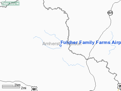
Fulcher Family Farms Airport |
Location & QuickFacts
| FAA Information Effective: | 2008-09-25 |
| Airport Identifier: | VG06 |
| Airport Status: | Operational |
| Longitude/Latitude: | 079-04-59.0900W/37-43-30.4900N
-79.083081/37.725136 (Estimated) |
| Elevation: | 980 ft / 298.70 m (Estimated) |
| Land: | 10 acres |
| From nearest city: | 9 nautical miles N of Amherst, VA |
| Location: | Amherst County, VA |
| Magnetic Variation: | 08W (1995) |
Owner & Manager
| Ownership: | Privately owned |
| Owner: | Thomas M Fulcher |
| Address: | 3300 Golsdsboro Ct
Falls Church, VA 22042 |
| Phone number: | 703-698-3563 |
| Manager: | Thomas M Fulcher |
| Address: | 3300 Goldsboro Ct
Falls Church, VA 22042 |
| Phone number: | 703-698-3563 |
Airport Operations and Facilities
| Airport Use: | Private |
| Wind indicator: | Yes |
| Segmented Circle: | No |
| Control Tower: | No |
| Sectional chart: | Cincinnati |
| Region: | AEA - Eastern |
| Boundary ARTCC: | ZDC - Washington |
| Tie-in FSS: | DCA - Leesburg |
| FSS Toll Free: | 1-800-WX-BRIEF |
Runway Information
Runway 11/29
| Dimension: | 3000 x 100 ft / 914.4 x 30.5 m |
| Surface: | TURF, Good Condition |
| |
Runway 11 |
Runway 29 |
| Traffic Pattern: | Left | Left |
|
Radio Navigation Aids
| ID |
Type |
Name |
Ch |
Freq |
Var |
Dist |
| LY | NDB | Bojar | | 385.00 | 08W | 28.8 nm |
| AZS | NDB | Azalea Park | | 336.00 | 08W | 31.8 nm |
| FVX | NDB | Farmville | | 367.00 | 07W | 38.0 nm |
| VBW | NDB | Bridgewater | | 241.00 | 07W | 38.9 nm |
| VIT | NDB | Vinton | | 277.00 | 06W | 49.3 nm |
| ODR | VOR | Woodrum | | 114.90 | 06W | 49.0 nm |
| MOL | VOR/DME | Montebello | 100X | 115.30 | 05W | 10.6 nm |
| LYH | VORTAC | Lynchburg | 029X | 109.20 | 05W | 29.2 nm |
| GVE | VORTAC | Gordonsville | 103X | 115.60 | 06W | 47.4 nm |
Remarks
- PRVDD VFR ONLY; OWNER OPERATES TO MINIMIZE NOISE; 20:1 APCH.
Images and information placed above are from
http://www.airport-data.com/airport/VG06/
We thank them for the data!
| General Info
|
| Country |
United States
|
| State |
VIRGINIA
|
| FAA ID |
VG06
|
| Latitude |
37-43-30.490N
|
| Longitude |
079-04-59.090W
|
| Elevation |
980 feet
|
| Near City |
AMHERST
|
We don't guarantee the information is fresh and accurate. The data may
be wrong or outdated.
For more up-to-date information please refer to other sources.
|
|


