|
|
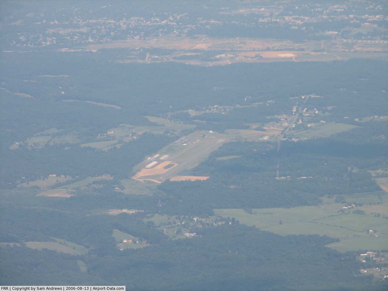
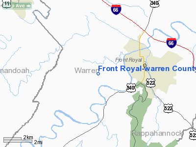
Front Royal-warren County Airport |
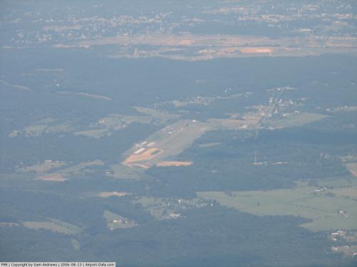 |
(Click on the photo to enlarge) |
Location & QuickFacts
| FAA Information Effective: | 2008-09-25 |
| Airport Identifier: | FRR |
| Airport Status: | Operational |
| Longitude/Latitude: | 078-15-12.6530W/38-55-03.1170N
-78.253515/38.917533 (Estimated) |
| Elevation: | 709 ft / 216.10 m (Surveyed) |
| Land: | 90 acres |
| From nearest city: | 3 nautical miles W of Front Royal, VA |
| Location: | Warren County, VA |
| Magnetic Variation: | 10W (2005) |
Owner & Manager
| Ownership: | Publicly owned |
| Owner: | Warren Co Apt Comm |
| Address: | 229 Stokes Airport Rd
Front Royal, VA 22630 |
| Phone number: | 540-635-3570 |
| Manager: | Reginald Cassagnol |
| Address: | 229 Stokes Airport Rd
Front Royal, VA 22630 |
| Phone number: | 540-635-3570 |
Airport Operations and Facilities
| Airport Use: | Open to public |
| Wind indicator: | Yes |
| Segmented Circle: | No |
| Control Tower: | No |
| Lighting Schedule: | DUSK-DAWN
ACTVT MIRL RY 09/27 - CTAF. |
| Beacon Color: | Clear-Green (lighted land airport) |
| Landing fee charge: | No |
| Sectional chart: | Washington |
| Region: | AEA - Eastern |
| Traffic Pattern Alt: | 1000 ft |
| Boundary ARTCC: | ZDC - Washington |
| Tie-in FSS: | DCA - Leesburg |
| FSS on Airport: | No |
| FSS Toll Free: | 1-800-WX-BRIEF |
| NOTAMs Facility: | DCA (NOTAM-d service avaliable) |
| Federal Agreements: | NGY |
Airport Communications
| CTAF: | 123.000 |
| Unicom: | 123.000 |
Airport Services
| Fuel available: | 100LL |
| Airframe Repair: | MINOR |
| Power Plant Repair: | MINOR |
| Bottled Oxygen: | NONE |
| Bulk Oxygen: | NONE |
Runway Information
Runway 09/27
| Dimension: | 3007 x 75 ft / 916.5 x 22.9 m |
| Surface: | ASPH, Good Condition |
| Weight Limit: | Single wheel: 12500 lbs. |
| Edge Lights: | Medium |
| |
Runway 09 |
Runway 27 |
| Longitude: | 078-15-31.1800W | 078-14-53.1790W |
| Latitude: | 38-55-02.3850N | 38-55-03.8860N |
| Elevation: | 693.00 ft | 704.00 ft |
| Traffic Pattern: | Left | Left |
| Markings: | Basic, Good Condition | Non-precision instrument, Good Condition |
| Crossing Height: | 16.00 ft | 16.00 ft |
| VASI: | system of panels on left side that may or may not be lighted | system of panels on right side that may or may not be lighted |
| Visual Glide Angle: | 3.00° | 3.00° |
| Runway End Identifier: | No | No |
| Obstruction: | 42 ft trees, 480.0 ft from runway, 140 ft right of centerline, 7:1 slope to clear | 160 ft tree, 3700.0 ft from runway, 210 ft right of centerline, 22:1 slope to clear |
|
Radio Navigation Aids
| ID |
Type |
Name |
Ch |
Freq |
Var |
Dist |
| TZ | NDB | Cogan | | 364.00 | 10W | 13.3 nm |
| LUA | NDB | Caverns | | 245.00 | 09W | 16.6 nm |
| GDX | NDB | Goodwin Lake | | 227.00 | 08W | 19.9 nm |
| CJR | NDB | Culpeper | | 252.00 | 09W | 29.7 nm |
| MSQ | NDB | Nailr | | 351.00 | 10W | 32.3 nm |
| VBW | NDB | Bridgewater | | 241.00 | 07W | 47.0 nm |
| CBE | NDB | Cumberland | | 317.00 | 07W | 49.6 nm |
| ESL | VOR/DME | Kessel | 045X | 110.80 | 06W | 39.0 nm |
| LDN | VORTAC | Linden | 090X | 114.30 | 06W | 4.4 nm |
| CSN | VORTAC | Casanova | 110X | 116.30 | 06W | 24.6 nm |
| MRB | VORTAC | Martinsburg | 058X | 112.10 | 07W | 33.9 nm |
| AML | VORTAC | Armel | 082X | 113.50 | 08W | 36.8 nm |
Remarks
- GLIDER OPNS ON & INVOF ARPT.
- NOISE ABATEMENT PROCRDURES IN EFFECT,CTC ARPT MANAGER FOR DETAILS AT 540-635-3570.
- DEER ON & INVOF ARPT.
- IN OPERATION PRIOR TO 1959
Images and information placed above are from
http://www.airport-data.com/airport/FRR/
We thank them for the data!
| General Info
|
| Country |
United States
|
| State |
VIRGINIA
|
| FAA ID |
FRR
|
| Latitude |
38-55-03.117N
|
| Longitude |
078-15-12.653W
|
| Elevation |
709 feet
|
| Near City |
FRONT ROYAL
|
We don't guarantee the information is fresh and accurate. The data may
be wrong or outdated.
For more up-to-date information please refer to other sources.
|
|