 |
|
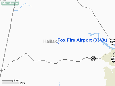
Location & QuickFacts
| FAA Information Effective: | 2008-09-25 |
| Airport Identifier: | 33VA |
| Airport Status: | Operational |
| Longitude/Latitude: | 079-02-59.0510W/36-47-03.4940N
-79.049736/36.784304 (Estimated) |
| Elevation: | 535 ft / 163.07 m (Estimated) |
| Land: | 4 acres |
| From nearest city: | 6 nautical miles NW of Halifax, VA |
| Location: | Halifax County, VA |
| Magnetic Variation: | 07W (1985) |
Owner & Manager
| Ownership: | Privately owned |
| Owner: | Harold W. Ferrell |
| Address: | 1101 Foxfire Dr.
Vernon Hill, VA 24597 |
| Phone number: | 804-476-1124 |
| Address: |
|
Airport Operations and Facilities
| Airport Use: | Private |
| Wind indicator: | Yes |
| Segmented Circle: | No |
| Control Tower: | No |
| Landing fee charge: | No |
| Sectional chart: | Cincinnati |
| Region: | AEA - Eastern |
| Boundary ARTCC: | ZDC - Washington |
| Tie-in FSS: | DCA - Leesburg |
| FSS on Airport: | No |
| FSS Toll Free: | 1-800-WX-BRIEF |
Runway Information
Runway 13/31
| Dimension: | 1600 x 60 ft / 487.7 x 18.3 m |
| Surface: | TURF, |
| |
Runway 13 |
Runway 31 |
| Traffic Pattern: | Left | Left |
|
Radio Navigation Aids
| ID |
Type |
Name |
Ch |
Freq |
Var |
Dist |
| OQA | FAN MARKER | Rockingham County | | | | 43.3 nm |
| LY | NDB | Bojar | | 385.00 | 08W | 30.2 nm |
| HUR | NDB | Person | | 220.00 | 08W | 33.1 nm |
| HXO | NDB | Huntsboro | | 271.00 | 07W | 35.8 nm |
| SIF | NDB | Slammer | | 423.00 | 07W | 42.1 nm |
| UV | NDB | Bales | | 396.00 | 07W | 43.4 nm |
| FVX | NDB | Farmville | | 367.00 | 07W | 45.0 nm |
| VIT | NDB | Vinton | | 277.00 | 06W | 47.2 nm |
| MBV | NDB | Mecklenburg/dcmsnd | | 356.00 | 08W | 48.2 nm |
| AEA | NDB | Jones | | 373.00 | 09W | 49.1 nm |
| DAN | VOR | Danville | | 113.10 | 06W | 18.9 nm |
| SBV | VORTAC | South Boston | 041X | 110.40 | 05W | 6.8 nm |
| LYH | VORTAC | Lynchburg | 029X | 109.20 | 05W | 29.7 nm |
Images and information placed above are from
http://www.airport-data.com/airport/33VA/
We thank them for the data!
| General Info
|
| Country |
United States
|
| State |
VIRGINIA
|
| FAA ID |
33VA
|
| Latitude |
36-47-03.494N
|
| Longitude |
079-02-59.051W
|
| Elevation |
535 feet
|
| Near City |
HALIFAX
|
We don't guarantee the information is fresh and accurate. The data may
be wrong or outdated.
For more up-to-date information please refer to other sources.
|
|


