 |
|
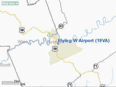
Location & QuickFacts
| FAA Information Effective: | 2008-09-25 |
| Airport Identifier: | 19VA |
| Airport Status: | Operational |
| Longitude/Latitude: | 082-17-52.0000W/36-53-23.0000N
-82.297778/36.889722 (Estimated) |
| Elevation: | 1760 ft / 536.45 m (Estimated) |
| Land: | 0 acres |
| From nearest city: | 1 nautical miles SE of St. Paul, VA |
| Location: | Russell County, VA |
| Magnetic Variation: | 05W (1990) |
Owner & Manager
| Ownership: | Privately owned |
| Owner: | James F. White Jr. |
| Address: | Rt 3 Box 89b
Castlewood, VA 24224 |
| Phone number: | 703-762-5563 |
| Manager: | James F. White Jr. |
| Address: | Rt 3 Box 89b
Castlewood, VA 24224 |
| Phone number: | 703-762-5563 |
Airport Operations and Facilities
| Airport Use: | Private |
| Segmented Circle: | No |
| Control Tower: | No |
| Sectional chart: | Cincinnati |
| Region: | AEA - Eastern |
| Boundary ARTCC: | ZTL - Atlanta |
| Tie-in FSS: | DCA - Leesburg |
| FSS Toll Free: | 1-800-WX-BRIEF |
Runway Information
Runway N/S
| Dimension: | 1600 x 50 ft / 487.7 x 15.2 m |
| Surface: | TURF, |
| |
Runway N |
Runway S |
| Traffic Pattern: | Left | Left |
|
Radio Navigation Aids
| ID |
Type |
Name |
Ch |
Freq |
Var |
Dist |
| VJ | NDB | Whine | | 236.00 | 05W | 19.2 nm |
| BO | NDB | Booie | | 221.00 | 04W | 31.0 nm |
| EZT | NDB | Elizabethton | | 275.00 | 02W | 34.5 nm |
| JJO | NDB | Mountain City | | 396.00 | 04W | 36.5 nm |
| RVN | NDB | Rogersville | | 329.00 | 04W | 38.5 nm |
| LQV | NDB | Long Hollow | | 252.00 | 03W | 38.9 nm |
| BAR | NDB | Hemlock | | 320.00 | 02W | 48.6 nm |
| GZG | VOR/DME | Glade Spring | 039X | 110.20 | 02W | 11.2 nm |
| HMV | VORTAC | Holston Mountain | 093X | 114.60 | 04W | 28.4 nm |
Remarks
- PRVDD DALGT VFR OPS ONLY; RY THRS DSPLCD TO PROVIDE A 20:1 APCH CLNC.
Images and information placed above are from
http://www.airport-data.com/airport/19VA/
We thank them for the data!
| General Info
|
| Country |
United States
|
| State |
VIRGINIA
|
| FAA ID |
19VA
|
| Latitude |
36-53-23.000N
|
| Longitude |
082-17-52.000W
|
| Elevation |
1720 feet
|
| Near City |
ST. PAUL
|
We don't guarantee the information is fresh and accurate. The data may
be wrong or outdated.
For more up-to-date information please refer to other sources.
|
|


