 |
|
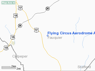
Flying Circus Aerodrome Airport |
Location & QuickFacts
| FAA Information Effective: | 2008-09-25 |
| Airport Identifier: | 3VA3 |
| Airport Status: | Operational |
| Longitude/Latitude: | 077-42-56.9680W/38-33-01.4450N
-77.715824/38.550401 (Estimated) |
| Elevation: | 315 ft / 96.01 m (Estimated) |
| Land: | 0 acres |
| From nearest city: | 10 nautical miles SE of Warrenton, VA |
| Location: | Fauquier County, VA |
| Magnetic Variation: | 09W (1985) |
Owner & Manager
| Ownership: | Privately owned |
| Owner: | Flying Circus Airshows Inc |
| Address: |
Bealton, VA 22712 |
| Phone number: | 703-439-8661 |
| Manager: | Charles A. Kulp |
| Address: | Rt 17
Bealeton, VA 22712 |
| Phone number: | 703-439-8661 |
Airport Operations and Facilities
| Airport Use: | Private |
| Wind indicator: | Yes |
| Segmented Circle: | Yes |
| Control Tower: | No |
| Landing fee charge: | No |
| Sectional chart: | Washington |
| Region: | AEA - Eastern |
| Boundary ARTCC: | ZDC - Washington |
| Tie-in FSS: | DCA - Leesburg |
| FSS on Airport: | No |
| FSS Toll Free: | 1-800-WX-BRIEF |
Airport Services
| Airframe Repair: | NONE |
| Power Plant Repair: | NONE |
Runway Information
Runway 02/20
| Dimension: | 2000 x 150 ft / 609.6 x 45.7 m |
| Surface: | TURF, |
| |
Runway 02 |
Runway 20 |
| Traffic Pattern: | Left | Right |
|
Runway 16/34
| Dimension: | 2500 x 150 ft / 762.0 x 45.7 m |
| Surface: | TURF, |
| |
Runway 16 |
Runway 34 |
| Traffic Pattern: | Right | Left |
|
Radio Navigation Aids
| ID |
Type |
Name |
Ch |
Freq |
Var |
Dist |
| CJR | NDB | Culpeper | | 252.00 | 09W | 6.8 nm |
| MSQ | NDB | Nailr | | 351.00 | 10W | 10.6 nm |
| EZF | NDB | Shannon | | 237.00 | 10W | 21.1 nm |
| GDX | NDB | Goodwin Lake | | 227.00 | 08W | 24.9 nm |
| IQK | NDB | Louisa | | 382.00 | 09W | 32.6 nm |
| APH | NDB | A P Hill | | 396.00 | 10W | 33.4 nm |
| DC | NDB | Oxonn | | 332.00 | 11W | 34.8 nm |
| GTN | NDB | Georgetown | | 323.00 | 09W | 35.9 nm |
| TZ | NDB | Cogan | | 364.00 | 10W | 36.2 nm |
| LUA | NDB | Caverns | | 245.00 | 09W | 36.6 nm |
| VKX | NDB | Potomac | | 241.00 | 10W | 37.6 nm |
| GAI | NDB | Gaithersburg | | 385.00 | 09W | 45.3 nm |
| LJK | NDB | Ashey | | 280.00 | 09W | 48.0 nm |
| AZS | NDB | Azalea Park | | 336.00 | 08W | 49.9 nm |
| DCA | VOR/DME | Washington | 047X | 111.00 | 09W | 36.9 nm |
| CSN | VORTAC | Casanova | 110X | 116.30 | 06W | 8.9 nm |
| BRV | VORTAC | Brooke | 092X | 114.50 | 09W | 21.4 nm |
| AML | VORTAC | Armel | 082X | 113.50 | 08W | 25.9 nm |
| LDN | VORTAC | Linden | 090X | 114.30 | 06W | 29.4 nm |
| GVE | VORTAC | Gordonsville | 103X | 115.60 | 06W | 38.3 nm |
| ADW | VORTAC | Andrews | 078X | 113.10 | 10W | 42.7 nm |
| OTT | VORTAC | Nottingham | 084X | 113.70 | 10W | 46.5 nm |
| DCA | VOT | Washington National | | 109.40 | | 36.6 nm |
| ADW | VOT | Andrews Afb | | 109.60 | | 41.7 nm |
Remarks
- THIS FIELD FOR FLYING CIRCUS AERO INC; PRIVATE-AIRSHOW.
- UNMRKD/UNLGTD TREES & PLINES.
Images and information placed above are from
http://www.airport-data.com/airport/3VA3/
We thank them for the data!
| General Info
|
| Country |
United States
|
| State |
VIRGINIA
|
| FAA ID |
3VA3
|
| Latitude |
38-33-01.445N
|
| Longitude |
077-42-56.968W
|
| Elevation |
315 feet
|
| Near City |
WARRENTON
|
We don't guarantee the information is fresh and accurate. The data may
be wrong or outdated.
For more up-to-date information please refer to other sources.
|
|


