 |
|
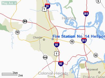
Fire Station No. 14 Heliport |
Location & QuickFacts
| FAA Information Effective: | 2008-09-25 |
| Airport Identifier: | 9VA7 |
| Airport Status: | Operational |
| Longitude/Latitude: | 077-24-55.9370W/37-21-17.5350N
-77.415538/37.354871 (Estimated) |
| Elevation: | 169 ft / 51.51 m (Estimated) |
| Land: | 1 acres |
| From nearest city: | 1 nautical miles W of Chester, VA |
| Location: | Chesterfield County, VA |
| Magnetic Variation: | 09W (1985) |
Owner & Manager
| Ownership: | Publicly owned |
| Owner: | County Of Chesterfield |
| Address: | Po Box 40
Chesterfield, VA 23832 |
| Phone number: | 804-748-1360 |
| Manager: | Chief Robert L. Eanes |
| Address: | Po Box 40
Chesterfield, VA 23832 |
| Phone number: | 804-748-1360 |
Airport Operations and Facilities
| Airport Use: | Private
MEDICAL. |
| Wind indicator: | Yes |
| Segmented Circle: | No |
| Control Tower: | No |
| Lighting Schedule: | PHONE REQ
FOR PERIMETER LGTS CALL - 804-748-1360. |
| Landing fee charge: | No |
| Sectional chart: | Washington |
| Region: | AEA - Eastern |
| Boundary ARTCC: | ZDC - Washington |
| Tie-in FSS: | DCA - Leesburg |
| FSS on Airport: | No |
| FSS Toll Free: | 1-800-WX-BRIEF |
Runway Information
Helipad H1
| Dimension: | 50 x 50 ft / 15.2 x 15.2 m |
| Surface: | CONC, |
| |
Runway H1 |
Runway |
| Traffic Pattern: | Left | Left |
|
Radio Navigation Aids
| ID |
Type |
Name |
Ch |
Freq |
Var |
Dist |
| CF | NDB | Pubbs | | 392.00 | 09W | 2.2 nm |
| PTB | NDB | Petersburg | | 284.00 | 08W | 15.5 nm |
| LJK | NDB | Ashey | | 280.00 | 09W | 25.3 nm |
| AKQ | NDB | Wakefield | | 274.00 | 09W | 29.9 nm |
| BKT | NDB | Blackstone | | 326.00 | 09W | 33.1 nm |
| FAF | NDB | Felker | | 226.00 | 08W | 40.3 nm |
| APH | NDB | A P Hill | | 396.00 | 10W | 44.3 nm |
| ELQ | NDB | Emporia | | 261.00 | 10W | 44.3 nm |
| IQK | NDB | Louisa | | 382.00 | 09W | 45.2 nm |
| PJS | NDB | Henry | | 375.00 | 09W | 46.1 nm |
| FVX | NDB | Farmville | | 367.00 | 07W | 48.9 nm |
| RIC | VORTAC | Richmond | 088X | 114.10 | 09W | 10.0 nm |
| HPW | VORTAC | Hopewell | 057X | 112.00 | 06W | 14.4 nm |
| FAK | VORTAC | Flat Rock | 080X | 113.30 | 06W | 22.3 nm |
| HCM | VORTAC | Harcum | 025X | 108.80 | 07W | 34.1 nm |
| LVL | VORTAC | Lawrenceville | 076X | 112.90 | 08W | 39.8 nm |
| FKN | VORTAC | Franklin | 043X | 110.60 | 09W | 43.1 nm |
Images and information placed above are from
http://www.airport-data.com/airport/9VA7/
We thank them for the data!
| General Info
|
| Country |
United States
|
| State |
VIRGINIA
|
| FAA ID |
9VA7
|
| Latitude |
37-21-17.535N
|
| Longitude |
077-24-55.937W
|
| Elevation |
169 feet
|
| Near City |
CHESTER
|
We don't guarantee the information is fresh and accurate. The data may
be wrong or outdated.
For more up-to-date information please refer to other sources.
|
|


