 |
|
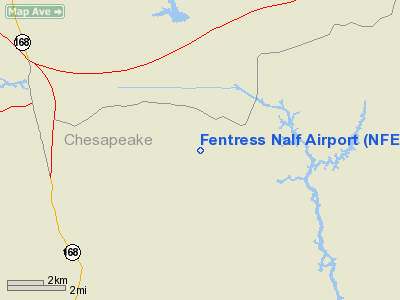
Location & QuickFacts
| FAA Information Effective: | 2008-09-25 |
| Airport Identifier: | NFE |
| Airport Status: | Operational |
| Longitude/Latitude: | 076-08-04.4305W/36-41-31.3310N
-76.134564/36.692036 (Estimated) |
| Elevation: | 16 ft / 4.88 m (Estimated) |
| Land: | 0 acres |
| From nearest city: | 0 nautical miles of Fentress, VA |
| Location: | Chesapeake County, VA |
| Magnetic Variation: | 09W (1985) |
Owner & Manager
| Ownership: | Navy owned |
| Owner: | Us Navy |
| Address: | Oceanographic Ofc - Code 3142
Washington, DC 20373 |
| Address: |
|
Airport Operations and Facilities
| Airport Use: | Private |
| Segmented Circle: | No |
| Control Tower: | No |
| Sectional chart: | Washington |
| Region: | AEA - Eastern |
| Boundary ARTCC: | ZDC - Washington |
| Tie-in FSS: | DCA - Leesburg |
| FSS on Airport: | No |
| FSS Toll Free: | 1-800-WX-BRIEF |
Runway Information
Runway 05/23
| Dimension: | 8004 x 175 ft / 2439.6 x 53.3 m |
| Surface: | ASPH, |
| Weight Limit: | Single wheel: 86000 lbs.
Dual wheel: 112000 lbs.
Dual tandem wheel: 168000 lbs. |
| Edge Lights: | Low |
| |
Runway 05 |
Runway 23 |
| Longitude: | 076-08-35.7550W | 076-07-33.1060W |
| Latitude: | 36-41-00.8420N | 36-42-01.8200N |
| Elevation: | 14.00 ft | 14.00 ft |
| Alignment: | 40 | 127 |
| Traffic Pattern: | Left | Left |
|
Radio Navigation Aids
| ID |
Type |
Name |
Ch |
Freq |
Var |
Dist |
| EY | NDB | Chesi | | 233.00 | 09W | 13.2 nm |
| PVG | NDB | Portsmouth | | 241.00 | 10W | 15.9 nm |
| RK | NDB | Waley | | 249.00 | 10W | 25.4 nm |
| LLW | NDB | Woodville | | 254.00 | 10W | 27.0 nm |
| PJS | NDB | Henry | | 375.00 | 09W | 31.6 nm |
| FAF | NDB | Felker | | 226.00 | 08W | 35.5 nm |
| EDE | NDB | Edenton | | 265.00 | 10W | 45.2 nm |
| AKQ | NDB | Wakefield | | 274.00 | 09W | 45.2 nm |
| NTU | TACAN | Oceana | 113X | | 10W | 9.2 nm |
| NGU | TACAN | Chambers | 048X | | 10W | 16.4 nm |
| LFI | TACAN | Langley | 070X | | 10W | 26.0 nm |
| ECG | VOR/DME | Elizabeth City | 072X | 112.50 | 07W | 26.2 nm |
| ORF | VORTAC | Norfolk | 116X | 116.90 | 07W | 12.4 nm |
| CCV | VORTAC | Cape Charles | 059X | 112.20 | 10W | 39.9 nm |
| CVI | VORTAC | Cofield | 093X | 114.60 | 09W | 40.4 nm |
| FKN | VORTAC | Franklin | 043X | 110.60 | 09W | 42.3 nm |
Remarks
- (E137-1) CTN: PRCHT JUMPS AT FENTRESS ALF 1300-1430Z TUES-THUR.
- (E60-05) E-28(B) LOCATED 1500 FT FROM RWY END AND RWY 23 E-28(B) LOCATED 1500 FT FROM RWY END.
Images and information placed above are from
http://www.airport-data.com/airport/NFE/
We thank them for the data!
| General Info
|
| Country |
United States
|
| State |
VIRGINIA
|
| FAA ID |
NFE
|
| Latitude |
36-41-42.540N
|
| Longitude |
076-08-07.763W
|
| Elevation |
16 feet
|
| Near City |
FENTRESS
|
We don't guarantee the information is fresh and accurate. The data may
be wrong or outdated.
For more up-to-date information please refer to other sources.
|
|


