 |
|
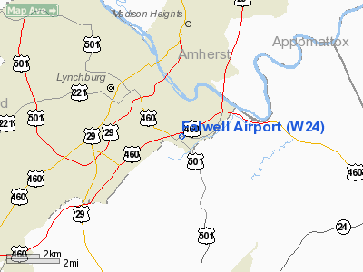
| Falwell Airport |
| IATA: none – ICAO: none – FAA LID: W24 |
| Summary |
| Operator |
L.W. Falwell |
| Location |
Lynchburg, Virginia |
| Elevation AMSL |
939 ft / 286.2 m |
| Coordinates |
37°22′40.51″N 79°7′20.08″W / 37.3779194°N 79.1222444°W / 37.3779194; -79.1222444Coordinates: 37°22′40.51″N 79°7′20.08″W / 37.3779194°N 79.1222444°W / 37.3779194; -79.1222444 |
| Runways |
| Direction |
Length |
Surface |
| ft |
m |
| 10/28 |
2,932 |
894 |
Asphalt |
The Falwell Airport (FAA W24) is a private airport located 3 miles (4.8 km) southeast of downtown Lynchburg, Virginia, USA. Serving as the base for Falwell Aviation, the facility serves primarily general aviation.
The above content comes from Wikipedia and is published under free licenses – click here to read more.
Location & QuickFacts
| FAA Information Effective: | 2008-09-25 |
| Airport Identifier: | W24 |
| Airport Status: | Operational |
| Longitude/Latitude: | 079-07-20.0830W/37-22-40.5150N
-79.122245/37.377921 (Estimated) |
| Elevation: | 939 ft / 286.21 m (Surveyed) |
| Land: | 20 acres |
| From nearest city: | 3 nautical miles SE of Lynchburg, VA |
| Location: | Lynchburg County, VA |
| Magnetic Variation: | 09W (2005) |
Owner & Manager
| Ownership: | Privately owned |
| Owner: | Falwell Aviation, Inc |
| Address: | 310 Hangar Road
Lynchburg, VA 24502 |
| Phone number: | 434-237-7002 |
| Manager: | Kyle Falwell |
| Address: | 310 Hangar Road
Lynchburg, VA 24502 |
| Phone number: | 434-237-7002 |
Airport Operations and Facilities
| Airport Use: | Open to public |
| Wind indicator: | Yes |
| Segmented Circle: | Yes |
| Control Tower: | No |
| Lighting Schedule: | DUSK-DAWN |
| Landing fee charge: | No |
| Sectional chart: | Cincinnati |
| Region: | AEA - Eastern |
| Traffic Pattern Alt: | 800 ft |
| Boundary ARTCC: | ZDC - Washington |
| Tie-in FSS: | DCA - Leesburg |
| FSS on Airport: | No |
| FSS Toll Free: | 1-800-WX-BRIEF |
| NOTAMs Facility: | DCA (NOTAM-d service avaliable) |
Airport Communications
| CTAF: | 123.000 |
| Unicom: | 123.000 |
Airport Services
| Fuel available: | 100LLA |
| Airframe Repair: | MAJOR |
| Power Plant Repair: | MAJOR |
| Bottled Oxygen: | HIGH/LOW |
| Bulk Oxygen: | HIGH |
Runway Information
Runway 10/28
| Dimension: | 2932 x 50 ft / 893.7 x 15.2 m |
| Surface: | ASPH, Good Condition |
| Edge Lights: | Medium |
| |
Runway 10 |
Runway 28 |
| Longitude: | 079-07-36.2525W | 079-07-00.0214W |
| Latitude: | 37-22-42.0060N | 37-22-40.0783N |
| Elevation: | 938.00 ft | 801.00 ft |
| Traffic Pattern: | Left | Left |
| Markings: | Basic, Good Condition | Basic, Good Condition |
| VASI: | | tri-color on left side |
| Obstruction: | 59 ft tree, 306.0 ft from runway, 96 ft right of centerline, 1:1 slope to clear
+12 FT HGR AT THLD 70 FT R. | , 50:1 slope to clear |
|
Radio Navigation Aids
| ID |
Type |
Name |
Ch |
Freq |
Var |
Dist |
| LY | NDB | Bojar | | 385.00 | 08W | 9.0 nm |
| FVX | NDB | Farmville | | 367.00 | 07W | 32.7 nm |
| VIT | NDB | Vinton | | 277.00 | 06W | 37.8 nm |
| AZS | NDB | Azalea Park | | 336.00 | 08W | 47.6 nm |
| ODR | VOR | Woodrum | | 114.90 | 06W | 41.1 nm |
| DAN | VOR | Danville | | 113.10 | 06W | 49.7 nm |
| MOL | VOR/DME | Montebello | 100X | 115.30 | 05W | 31.4 nm |
| LYH | VORTAC | Lynchburg | 029X | 109.20 | 05W | 9.2 nm |
| SBV | VORTAC | South Boston | 041X | 110.40 | 05W | 42.6 nm |
| ROA | VORTAC | Roanoke | 031X | 109.40 | 04W | 45.3 nm |
Remarks
Images and information placed above are from
http://www.airport-data.com/airport/W24/
We thank them for the data!
| General Info
|
| Country |
United States
|
| State |
VIRGINIA
|
| FAA ID |
W24
|
| Latitude |
37-22-40.515N
|
| Longitude |
079-07-20.083W
|
| Elevation |
939 feet
|
| Near City |
LYNCHBURG
|
We don't guarantee the information is fresh and accurate. The data may
be wrong or outdated.
For more up-to-date information please refer to other sources.
|
|


