 |
|
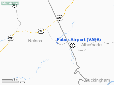
Location & QuickFacts
| FAA Information Effective: | 2008-09-25 |
| Airport Identifier: | VA96 |
| Airport Status: | Operational |
| Longitude/Latitude: | 078-43-54.0650W/37-49-31.5100N
-78.731685/37.825419 (Estimated) |
| Elevation: | 640 ft / 195.07 m (Estimated) |
| Land: | 31 acres |
| From nearest city: | 8 nautical miles NE of Lovingston, VA |
| Location: | Nelson County, VA |
| Magnetic Variation: | 08W (1985) |
Owner & Manager
| Ownership: | Privately owned |
| Owner: | Joyce T. & Roger F. Wood |
| Address: | Rt 1, Box 23
Faber, VA 22938 |
| Phone number: | 804-263-4512 |
| Manager: | Roger Wood & James Tinder |
| Address: | Rt 1, Box 23
Faber, VA 22938 |
| Phone number: | 804-263-4512 |
Airport Operations and Facilities
| Airport Use: | Private |
| Wind indicator: | Yes |
| Segmented Circle: | No |
| Control Tower: | No |
| Sectional chart: | Washington |
| Region: | AEA - Eastern |
| Boundary ARTCC: | ZDC - Washington |
| Tie-in FSS: | DCA - Leesburg |
| FSS on Airport: | No |
| FSS Toll Free: | 1-800-WX-BRIEF |
Airport Communications
Runway Information
Runway 17/35
| Dimension: | 1500 x 30 ft / 457.2 x 9.1 m |
| Surface: | TURF, |
| |
Runway 17 |
Runway 35 |
| Traffic Pattern: | Left | Left |
| Obstruction: | | 30 ft trees, 100.0 ft from runway |
|
Radio Navigation Aids
| ID |
Type |
Name |
Ch |
Freq |
Var |
Dist |
| AZS | NDB | Azalea Park | | 336.00 | 08W | 15.0 nm |
| FVX | NDB | Farmville | | 367.00 | 07W | 31.7 nm |
| VBW | NDB | Bridgewater | | 241.00 | 07W | 34.2 nm |
| LY | NDB | Bojar | | 385.00 | 08W | 41.7 nm |
| IQK | NDB | Louisa | | 382.00 | 09W | 43.0 nm |
| MOL | VOR/DME | Montebello | 100X | 115.30 | 05W | 18.4 nm |
| GVE | VORTAC | Gordonsville | 103X | 115.60 | 06W | 29.7 nm |
| LYH | VORTAC | Lynchburg | 029X | 109.20 | 05W | 41.9 nm |
| FAK | VORTAC | Flat Rock | 080X | 113.30 | 06W | 46.5 nm |
Remarks
- ALL LANDINGS/TAKEOFFS ON RY 17.
- PRVDD VFR; OPERS ARE CONDUCTED AS SUBMITTED ON 7480-1; ALL LANDINGS/DEPARTURES TO/FM RY 17.
Images and information placed above are from
http://www.airport-data.com/airport/VA96/
We thank them for the data!
| General Info
|
| Country |
United States
|
| State |
VIRGINIA
|
| FAA ID |
VA96
|
| Latitude |
37-49-31.510N
|
| Longitude |
078-43-54.065W
|
| Elevation |
640 feet
|
| Near City |
LOVINGSTON
|
We don't guarantee the information is fresh and accurate. The data may
be wrong or outdated.
For more up-to-date information please refer to other sources.
|
|


