 |
|
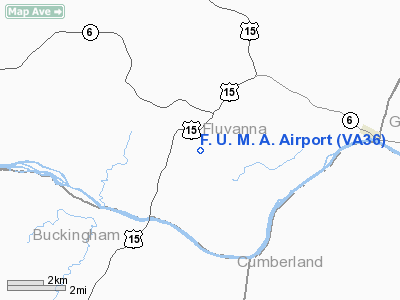
Location & QuickFacts
| FAA Information Effective: | 2008-09-25 |
| Airport Identifier: | VA36 |
| Airport Status: | Operational |
| Longitude/Latitude: | 078-16-13.0100W/37-44-40.5130N
-78.270281/37.744587 (Estimated) |
| Elevation: | 400 ft / 121.92 m (Surveyed) |
| Land: | 250 acres |
| From nearest city: | 1 nautical miles SW of Fork Union, VA |
| Location: | Fluvanna County, VA |
| Magnetic Variation: | 08W (1985) |
Owner & Manager
| Ownership: | Privately owned |
| Owner: | Fork Union Military Academy |
| Address: | Po Box 278
Fork Union, VA 23055 |
| Phone number: | 804-842-3212 |
| Manager: | J.c. Akers |
| Address: | Fork Union Military Academy
Fork Union, VA 23055 |
| Phone number: | 804-842-3212 |
Airport Operations and Facilities
| Airport Use: | Private |
| Wind indicator: | Yes |
| Segmented Circle: | No |
| Control Tower: | No |
| Landing fee charge: | No |
| Sectional chart: | Washington |
| Region: | AEA - Eastern |
| Boundary ARTCC: | ZDC - Washington |
| Tie-in FSS: | DCA - Leesburg |
| FSS on Airport: | No |
| FSS Toll Free: | 1-800-WX-BRIEF |
Runway Information
Runway 16/34
| Dimension: | 3575 x 100 ft / 1089.7 x 30.5 m |
| Surface: | TURF, |
| |
Runway 16 |
Runway 34 |
| Traffic Pattern: | Left | Left |
| Displaced threshold: | 700.00 ft | 600.00 ft |
| Obstruction: | 35 ft trees, 50.0 ft from runway | 35 ft trees, 75.0 ft from runway |
|
Radio Navigation Aids
| ID |
Type |
Name |
Ch |
Freq |
Var |
Dist |
| AZS | NDB | Azalea Park | | 336.00 | 08W | 19.8 nm |
| FVX | NDB | Farmville | | 367.00 | 07W | 24.9 nm |
| IQK | NDB | Louisa | | 382.00 | 09W | 25.6 nm |
| LJK | NDB | Ashey | | 280.00 | 09W | 37.6 nm |
| BKT | NDB | Blackstone | | 326.00 | 09W | 38.6 nm |
| MSQ | NDB | Nailr | | 351.00 | 10W | 46.0 nm |
| CF | NDB | Pubbs | | 392.00 | 09W | 46.1 nm |
| APH | NDB | A P Hill | | 396.00 | 10W | 49.3 nm |
| VBW | NDB | Bridgewater | | 241.00 | 07W | 49.6 nm |
| PTB | NDB | Petersburg | | 284.00 | 08W | 49.7 nm |
| EZF | NDB | Shannon | | 237.00 | 10W | 49.9 nm |
| MOL | VOR/DME | Montebello | 100X | 115.30 | 05W | 40.8 nm |
| GVE | VORTAC | Gordonsville | 103X | 115.60 | 06W | 17.1 nm |
| FAK | VORTAC | Flat Rock | 080X | 113.30 | 06W | 24.7 nm |
| RIC | VORTAC | Richmond | 088X | 114.10 | 09W | 47.5 nm |
Remarks
- PRVDD THR TO SE RY IS DSPLCD 700 FT; THR TO NE RY IS DSPLCD 600 FT; RY ENDS & THR MKD; ALL REASONABLE STEPS ARE TAKEN TO MAINTAIN & IMPROVE SAFETY THROUGH APPLICATION OF FAR PART 77.
Images and information placed above are from
http://www.airport-data.com/airport/VA36/
We thank them for the data!
| General Info
|
| Country |
United States
|
| State |
VIRGINIA
|
| FAA ID |
VA36
|
| Latitude |
37-44-40.513N
|
| Longitude |
078-16-13.010W
|
| Elevation |
400 feet
|
| Near City |
FORK UNION
|
We don't guarantee the information is fresh and accurate. The data may
be wrong or outdated.
For more up-to-date information please refer to other sources.
|
|


