 |
|
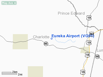
Location & QuickFacts
| FAA Information Effective: | 2008-09-25 |
| Airport Identifier: | VG01 |
| Airport Status: | Operational |
| Longitude/Latitude: | 078-33-42.1000W/37-03-44.5400N
-78.561694/37.062372 (Estimated) |
| Elevation: | 420 ft / 128.02 m (Estimated) |
| Land: | 7 acres |
| From nearest city: | 4 nautical miles SE of Keysville, VA |
| Location: | Charlotte County, VA |
| Magnetic Variation: | 08W (1995) |
Owner & Manager
| Ownership: | Privately owned |
| Owner: | John Watts |
| Address: | Route 2, P.o. Box 54
Keysville, VA 23947 |
| Phone number: | 804-736-8637 |
| Manager: | John Watts |
| Address: | Route 2, P.o. Box 54
Keysville, VA 23947 |
| Phone number: | 804-736-8637 |
Airport Operations and Facilities
| Airport Use: | Private |
| Wind indicator: | Yes |
| Segmented Circle: | No |
| Control Tower: | No |
| Sectional chart: | Washington |
| Region: | AEA - Eastern |
| Boundary ARTCC: | ZDC - Washington |
| Tie-in FSS: | DCA - Leesburg |
| FSS on Airport: | No |
| FSS Toll Free: | 1-800-WX-BRIEF |
Runway Information
Runway 18/36
| Dimension: | 2900 x 50 ft / 883.9 x 15.2 m |
| Surface: | TURF, |
| |
Runway 18 |
Runway 36 |
| Traffic Pattern: | Left | Left |
| Obstruction: | | 50 ft pline, 300.0 ft from runway |
|
Radio Navigation Aids
| ID |
Type |
Name |
Ch |
Freq |
Var |
Dist |
| FVX | NDB | Farmville | | 367.00 | 07W | 18.4 nm |
| BKT | NDB | Blackstone | | 326.00 | 09W | 25.1 nm |
| MBV | NDB | Mecklenburg/dcmsnd | | 356.00 | 08W | 32.9 nm |
| LY | NDB | Bojar | | 385.00 | 08W | 34.8 nm |
| AEA | NDB | Jones | | 373.00 | 09W | 36.4 nm |
| HXO | NDB | Huntsboro | | 271.00 | 07W | 45.9 nm |
| PTB | NDB | Petersburg | | 284.00 | 08W | 47.5 nm |
| DAN | VOR | Danville | | 113.10 | 06W | 47.7 nm |
| SBV | VORTAC | South Boston | 041X | 110.40 | 05W | 31.9 nm |
| LYH | VORTAC | Lynchburg | 029X | 109.20 | 05W | 34.3 nm |
| LVL | VORTAC | Lawrenceville | 076X | 112.90 | 08W | 34.9 nm |
| FAK | VORTAC | Flat Rock | 080X | 113.30 | 06W | 44.9 nm |
Remarks
- OWNER DESIRES AIRPORT NOT TO BE CHARTED.
- PRVDD DALGT OPNS ONLY; IFR OPNS ARE NOT CONDUCTED; COORD WITH OWNERS/OPERATORS OF LAYNE ARPT AND KEYSVILLE ARPT; ALL OPNS LAND TO S/DEP TO N; SNGL ENG LAND AIRPLANES ONLY.
Images and information placed above are from
http://www.airport-data.com/airport/VG01/
We thank them for the data!
| General Info
|
| Country |
United States
|
| State |
VIRGINIA
|
| FAA ID |
VG01
|
| Latitude |
37-03-44.540N
|
| Longitude |
078-33-42.100W
|
| Elevation |
420 feet
|
| Near City |
KEYSVILLE
|
We don't guarantee the information is fresh and accurate. The data may
be wrong or outdated.
For more up-to-date information please refer to other sources.
|
|


