 |
|
Location & QuickFacts
| FAA Information Effective: | 2008-09-25 |
| Airport Identifier: | VG39 |
| Airport Status: | Operational |
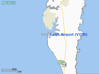
| Longitude/Latitude: | 076-00-27.0000W/37-13-15.0000N
-76.007500/37.220833 (Estimated) |
| Elevation: | 9 ft / 2.74 m () |
| Land: | 200 acres |
| From nearest city: | 3 nautical miles S of Cape Charles, VA |
| Location: | Northampton County, VA |
| Magnetic Variation: | 11W (2000) |
Owner & Manager
| Ownership: | Privately owned |
| Owner: | Patrick Hand |
| Address: | 2242 Arlington Chase
Cape Charles, VA 23310 |
| Phone number: | 757-331-1959 |
| Manager: | Patrick Hand |
| Address: | 2242 Arlington Chase
Cape Charles, VA 23310 |
| Phone number: | 757-331-1959 |
Airport Operations and Facilities
| Airport Use: | Private |
| Wind indicator: | Yes |
| Segmented Circle: | No |
| Control Tower: | No |
| Sectional chart: | Washington |
| Region: | AEA - Eastern |
| Boundary ARTCC: | ZDC - Washington |
| Tie-in FSS: | DCA - Leesburg |
| FSS Toll Free: | 1-800-WX-BRIEF |
Runway Information
Runway 10/28
| Dimension: | 2000 x 60 ft / 609.6 x 18.3 m |
| Surface: | TURF, |
| |
Runway 10 |
Runway 28 |
| Traffic Pattern: | Left | Left |
| Obstruction: | 50 ft trees, 400.0 ft from runway | |
|
Radio Navigation Aids
| ID |
Type |
Name |
Ch |
Freq |
Var |
Dist |
| BDB | NDB | Accomack | | 336.00 | 11W | 23.3 nm |
| PJS | NDB | Henry | | 375.00 | 09W | 23.9 nm |
| FAF | NDB | Felker | | 226.00 | 08W | 29.7 nm |
| PVG | NDB | Portsmouth | | 241.00 | 10W | 33.8 nm |
| EY | NDB | Chesi | | 233.00 | 09W | 41.4 nm |
| RK | NDB | Waley | | 249.00 | 10W | 48.4 nm |
| AKQ | NDB | Wakefield | | 274.00 | 09W | 49.7 nm |
| LFI | TACAN | Langley | 070X | | 10W | 18.7 nm |
| NGU | TACAN | Chambers | 048X | | 10W | 21.3 nm |
| NTU | TACAN | Oceana | 113X | | 10W | 23.9 nm |
| CCV | VORTAC | Cape Charles | 059X | 112.20 | 10W | 7.6 nm |
| ORF | VORTAC | Norfolk | 116X | 116.90 | 07W | 21.8 nm |
| HCM | VORTAC | Harcum | 025X | 108.80 | 07W | 36.3 nm |
Remarks
- PRVVD VFR; NO IFR OPNS; STOP SIGN AT RY END FOR VEHICULAR TFC; CLEAR 20:1 APCH/DEP SLOPE.
Images and information placed above are from
http://www.airport-data.com/airport/VG39/
We thank them for the data!
| General Info
|
| Country |
United States
|
| State |
VIRGINIA
|
| FAA ID |
VG39
|
| Latitude |
37-13-15.000N
|
| Longitude |
076-00-27.000W
|
| Elevation |
9 feet
|
| Near City |
CAPE CHARLES
|
We don't guarantee the information is fresh and accurate. The data may
be wrong or outdated.
For more up-to-date information please refer to other sources.
|
|


