 |
|
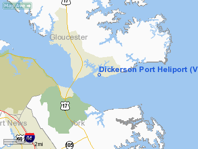
Location & QuickFacts
| FAA Information Effective: | 2008-09-25 |
| Airport Identifier: | VG44 |
| Airport Status: | Operational |
| Longitude/Latitude: | 076-28-20.4000W/37-15-09.1800N
-76.472333/37.252550 (Estimated) |
| Elevation: | 15 ft / 4.57 m () |
| Land: | 0 acres |
| From nearest city: | 10 nautical miles N of Gloucester, VA |
| Location: | Gloucester County, VA |
| Magnetic Variation: | 10W (2000) |
Owner & Manager
| Ownership: | Privately owned |
| Owner: | George & Pamela Dickerson |
| Address: | 8298 Blue Crab Ln
Hayes, VA 23061 |
| Phone number: | 804-642-5808 |
| Manager: | J.h. Wright |
| Address: | P.o. Box 723
Gloucester Point, VA 23062 |
| Phone number: | 804-642-5808 |
Airport Operations and Facilities
| Airport Use: | Private |
| Segmented Circle: | No |
| Control Tower: | No |
| Sectional chart: | Washington |
| Region: | AEA - Eastern |
| Boundary ARTCC: | ZDC - Washington |
| Tie-in FSS: | DCA - Leesburg |
| FSS Toll Free: | 1-800-WX-BRIEF |
Runway Information
Helipad H1
| Dimension: | 100 x 100 ft / 30.5 x 30.5 m |
| Surface: | TURF, |
| |
Runway H1 |
Runway |
| Traffic Pattern: | Left | Left |
|
Radio Navigation Aids
| ID |
Type |
Name |
Ch |
Freq |
Var |
Dist |
| PJS | NDB | Henry | | 375.00 | 09W | 7.3 nm |
| FAF | NDB | Felker | | 226.00 | 08W | 9.8 nm |
| PVG | NDB | Portsmouth | | 241.00 | 10W | 28.4 nm |
| AKQ | NDB | Wakefield | | 274.00 | 09W | 30.1 nm |
| BDB | NDB | Accomack | | 336.00 | 11W | 37.4 nm |
| EY | NDB | Chesi | | 233.00 | 09W | 39.5 nm |
| RK | NDB | Waley | | 249.00 | 10W | 40.2 nm |
| CF | NDB | Pubbs | | 392.00 | 09W | 47.2 nm |
| LFI | TACAN | Langley | 070X | | 10W | 11.4 nm |
| NGU | TACAN | Chambers | 048X | | 10W | 21.0 nm |
| NTU | TACAN | Oceana | 113X | | 10W | 33.2 nm |
| HCM | VORTAC | Harcum | 025X | 108.80 | 07W | 16.4 nm |
| CCV | VORTAC | Cape Charles | 059X | 112.20 | 10W | 23.4 nm |
| ORF | VORTAC | Norfolk | 116X | 116.90 | 07W | 25.3 nm |
| HPW | VORTAC | Hopewell | 057X | 112.00 | 06W | 31.1 nm |
| FKN | VORTAC | Franklin | 043X | 110.60 | 09W | 41.5 nm |
| RIC | VORTAC | Richmond | 088X | 114.10 | 09W | 43.2 nm |
Remarks
- PRVVD DALGT, VFR: CLEAR 8:1 APCH PATH; OPERATE IN A MANNER TO MINIMIZE NOISE; APPROPRIATE MKGS FOR INGRESS/EGRESS; LGT WINDSOCK FOR NGT OPNS.
Images and information placed above are from
http://www.airport-data.com/airport/VG44/
We thank them for the data!
| General Info
|
| Country |
United States
|
| State |
VIRGINIA
|
| FAA ID |
VG44
|
| Latitude |
37-15-09.180N
|
| Longitude |
076-28-20.400W
|
| Elevation |
15 feet
|
| Near City |
GLOUCESTER
|
We don't guarantee the information is fresh and accurate. The data may
be wrong or outdated.
For more up-to-date information please refer to other sources.
|
|


