 |
|
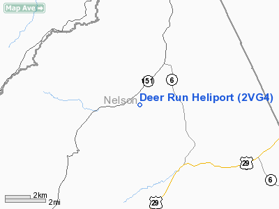
Location & QuickFacts
| FAA Information Effective: | 2008-09-25 |
| Airport Identifier: | 2VG4 |
| Airport Status: | Operational |
| Longitude/Latitude: | 078-51-42.9600W/37-53-15.8400N
-78.861933/37.887733 (Estimated) |
| Elevation: | 805 ft / 245.36 m (Estimated) |
| Land: | 117 acres |
| From nearest city: | 1 nautical miles E of Nelson County, VA |
| Location: | Nelson County, VA |
| Magnetic Variation: | () |
Owner & Manager
| Ownership: | Privately owned |
| Owner: | Dabney B Holt |
| Address: | 1800 S Woodside Lane
Virginia Beach, VA 23454 |
| Phone number: | 757-481-4176 |
| Manager: | Dabney B Holt |
| Address: | 1800 S Woodside Lane
Virginia Beach, VA 23454 |
| Phone number: | 757-481-4176 |
Airport Operations and Facilities
| Airport Use: | Private |
| Wind indicator: | Yes |
| Control Tower: | No |
| Sectional chart: | Washington |
| Region: | AEA - Eastern |
| Boundary ARTCC: | ZDC - Washington |
| Tie-in FSS: | DCA - Leesburg |
| FSS Toll Free: | 1-800-WX-BRIEF |
Runway Information
Helipad H1
| Dimension: | 50 x 50 ft / 15.2 x 15.2 m |
| Surface: | TURF, |
| |
Runway H1 |
Runway |
| Traffic Pattern: | Left | Left |
|
Radio Navigation Aids
| ID |
Type |
Name |
Ch |
Freq |
Var |
Dist |
| AZS | NDB | Azalea Park | | 336.00 | 08W | 17.9 nm |
| VBW | NDB | Bridgewater | | 241.00 | 07W | 29.1 nm |
| FVX | NDB | Farmville | | 367.00 | 07W | 38.0 nm |
| LY | NDB | Bojar | | 385.00 | 08W | 41.7 nm |
| IQK | NDB | Louisa | | 382.00 | 09W | 48.2 nm |
| MOL | VOR/DME | Montebello | 100X | 115.30 | 05W | 11.6 nm |
| GVE | VORTAC | Gordonsville | 103X | 115.60 | 06W | 34.4 nm |
| LYH | VORTAC | Lynchburg | 029X | 109.20 | 05W | 42.0 nm |
Remarks
- 1700 FT TWR 500 FT E OF HELIPAD.
- PRVDD A CLEAR 8:1 INGRESS/EGRESS; OPER IN A MANNER TO MINIMIZE NOISE OVER RESIDENCES; VEHICULAR TFC AROUND SITE CONTROLLED; AND IF NGT OPNS, A LGTD WINDSOCK IS INSTALLED.
Images and information placed above are from
http://www.airport-data.com/airport/2VG4/
We thank them for the data!
|
|


