 |
|
| Danville Regional Airport |
| IATA: DAN – ICAO: KDAN – FAA LID: DAN |
| Summary |
| Airport type |
Public |
| Owner |
City of Danville |
| Serves |
Danville, Virginia |
| Elevation AMSL |
571 ft / 174 m |
| Coordinates |
36°34′22″N 079°20′10″W / 36.57278°N 79.33611°W / 36.57278; -79.33611 |
| Website |
www.danville-va.gov/... |
| Runways |
| Direction |
Length |
Surface |
| ft |
m |
| 2/20 |
6,500 |
1,981 |
Asphalt |
| 13/31 |
4,020 |
1,225 |
Asphalt |
| Statistics (2008) |
| Aircraft operations |
18,238 |
| Based aircraft |
39 |
| Source: Federal Aviation Administration |
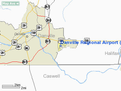
Danville Regional Airport (IATA: DAN, ICAO: KDAN, FAA LID: DAN) is a public use airport in Pittsylvania County, Virginia, United States. It is owned by the City of Danville and is located three nautical miles (6 km) east of its central business district.
Facilities and aircraft
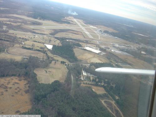
Danville Regional Airport covers an area of 800 acres (324 ha) at an elevation of 571 feet (174 m) above mean sea level. It has two asphalt paved runways: 2/20 is 6,500 by 150 feet (1,981 x 46 m) and 13/31 is 4,020 by 100 feet (1,225 x 30 m).
For the 12-month period ending February 29, 2008, the airport had 18,238 aircraft operations, an average of 49 per day: 99.7% general aviation and 0.3% military. At that time there were 39 aircraft based at this airport: 90% single-engine and 10% multi-engine.
The above content comes from Wikipedia and is published under free licenses – click here to read more.
 |
(Click on the photo to enlarge) |
 |
(Click on the photo to enlarge) |
Location & QuickFacts
| FAA Information Effective: | 2008-09-25 |
| Airport Identifier: | DAN |
| Airport Status: | Operational |
| Longitude/Latitude: | 079-20-10.0000W/36-34-22.3000N
-79.336111/36.572861 (Estimated) |
| Elevation: | 571 ft / 174.04 m (Surveyed) |
| Land: | 800 acres |
| From nearest city: | 3 nautical miles E of Danville, VA |
| Location: | Pittsylvania County, VA |
| Magnetic Variation: | 06W (1980) |
Owner & Manager
| Ownership: | Publicly owned |
| Owner: | City Of Danville |
| Address: | Po Box 3300
Danville, VA 24543 |
| Phone number: | 434-799-5110 |
| Manager: | Marc Adelman |
| Address: | 424 Airport Drive
Danville, VA 24540 |
| Phone number: | 434-799-5110 |
Airport Operations and Facilities
| Airport Use: | Open to public |
| Wind indicator: | Yes |
| Segmented Circle: | Yes |
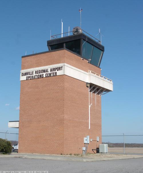
| Control Tower: | No |
| Lighting Schedule: | DUSK-DAWN
ACTVT HIRL RY 02/20, MIRL RY 13/31, REIL RYS 13, 31, & 20, MALSR RY 02, VASI RYS 13 & 31, & PAPIS RYS 02 & 20 - CTAF. |
| Beacon Color: | Clear-Green (lighted land airport) |
| Landing fee charge: | No |
| Sectional chart: | Cincinnati |
| Region: | AEA - Eastern |
| Boundary ARTCC: | ZDC - Washington |
| Tie-in FSS: | DCA - Leesburg |
| FSS Toll Free: | 1-800-WX-BRIEF |
| NOTAMs Facility: | DAN (NOTAM-d service avaliable) |
| Federal Agreements: | NGHVY3 |
Airport Communications
| CTAF: | 123.050 |
| Unicom: | 123.050 |
Airport Services
| Fuel available: | 100LLA |
| Airframe Repair: | MINOR |
| Power Plant Repair: | MINOR |
| Bottled Oxygen: | NONE |
| Bulk Oxygen: | NONE |
Runway Information
Runway 02/20
| Dimension: | 6500 x 150 ft / 1981.2 x 45.7 m |
| Surface: | ASPH, Fair Condition
RUNWAY 02/20 CRACKS IN PAVEMENT. |
| Surface Treatment: | Saw-cut or plastic Grooved |
| Weight Limit: | Single wheel: 90000 lbs.
Dual wheel: 130000 lbs. |
| Edge Lights: | High |
| |
Runway 02 |
Runway 20 |
| Longitude: | 079-20-29.3269W | 079-20-06.9519W |
| Latitude: | 36-33-46.5489N | 36-34-48.2313N |
| Elevation: | 535.00 ft | 558.00 ft |
| Alignment: | 16 | 127 |
| ILS Type: | ILS
| |
| Traffic Pattern: | Left | Left |
| Markings: | Precision instrument, Good Condition | Non-precision instrument, Good Condition |
| Crossing Height: | 54.00 ft | 50.00 ft |
| Displaced threshold: | 0.00 ft | 900.00 ft |
| VASI: | 4-light PAPI on left side | 4-light PAPI on left side |
| Visual Glide Angle: | 3.00° | 3.00° |
| Approach lights: | MALSR | |
| Runway End Identifier: | | Yes |
| Obstruction: | , 50:1 slope to clear | 28 ft tree, 1092.0 ft from runway, 6 ft right of centerline, 31:1 slope to clear |
| Decleard distances: | Take off run available 6500.00 ft
Take off distance available 6500.00 ft
Actual stop distance available 5600.00 ft
Landing distance available 5600.00 ft
| Take off run available 6500.00 ft
Take off distance available 6500.00 ft
Actual stop distance available 6500.00 ft
Landing distance available 5600.00 ft
|
|
Runway 13/31
| Dimension: | 4020 x 100 ft / 1225.3 x 30.5 m |
| Surface: | ASPH, Good Condition
RUNWAY 02/20 CRACKS IN PAVEMENT. |
| Weight Limit: | Single wheel: 90000 lbs.
Dual wheel: 130000 lbs. |
| Edge Lights: | Medium |
| |
Runway 13 |
Runway 31 |
| Longitude: | 079-20-17.0470W | 079-19-36.4438W |
| Latitude: | 36-34-41.4720N | 36-34-18.9432N |
| Elevation: | 571.00 ft | 526.00 ft |
| Alignment: | 125 | 127 |
| Traffic Pattern: | Left | Left |
| Markings: | Basic, Good Condition | Basic, Good Condition |
| VASI: | 2-box on left side | 2-box on left side |
| Visual Glide Angle: | 3.00° | 3.00° |
| Runway End Identifier: | Yes | Yes |
| Obstruction: | 105 ft tree, 2500.0 ft from runway, 400 ft left of centerline, 21:1 slope to clear | 6 ft road, 250.0 ft from runway, 253 ft right of centerline, 8:1 slope to clear |
| Decleard distances: | Take off run available 4021.00 ft
Take off distance available 4021.00 ft
Actual stop distance available 4021.00 ft
Landing distance available 4021.00 ft
| Take off run available 4021.00 ft
Take off distance available 4021.00 ft
Actual stop distance available 4021.00 ft
Landing distance available 4021.00 ft
|
|
Radio Navigation Aids
| ID |
Type |
Name |
Ch |
Freq |
Var |
Dist |
| OQA | FAN MARKER | Rockingham County | | | | 25.4 nm |
| SIF | NDB | Slammer | | 423.00 | 07W | 23.6 nm |
| HUR | NDB | Person | | 220.00 | 08W | 24.2 nm |
| UV | NDB | Bales | | 396.00 | 07W | 28.1 nm |
| HB | NDB | Himun | | 361.00 | 08W | 37.7 nm |
| HXO | NDB | Huntsboro | | 271.00 | 07W | 38.4 nm |
| LY | NDB | Bojar | | 385.00 | 08W | 41.7 nm |
| VIT | NDB | Vinton | | 277.00 | 06W | 46.1 nm |
| LE | NDB | Leevy | | 350.00 | 07W | 48.9 nm |
| TOX | NDB | Siler City | | 371.00 | 07W | 49.2 nm |
| DAN | VOR | Danville | | 113.10 | 06W | 0.2 nm |
| SBV | VORTAC | South Boston | 041X | 110.40 | 05W | 16.7 nm |
| LYH | VORTAC | Lynchburg | 029X | 109.20 | 05W | 41.3 nm |
| GSO | VORTAC | Greensboro | 109X | 116.20 | 03W | 44.3 nm |
| LIB | VORTAC | Liberty | 077X | 113.00 | 03W | 47.7 nm |
| RDU | VORTAC | Raleigh/durham | 119X | 117.20 | 04W | 49.9 nm |
Remarks
- BIRDS & DEER ON & INVOF ARPT.
- RY 02 IS DESIGNATED CALM WIND RY.
- CTC ARPT ADMIN PRIOR TO CONDUCTING SPECIALIZED AERO ACTIVITIES 434-799-5110.
- TREES PENETRATING 7:1 TRANSITIONAL SURFACE, RY 31 BOTH SIDES, FIRST 1000 FT.
- VFR DAYLIGHT USE ONLY; COORDINATION WITH DANVILLE MUNI ARPT; FOLLOW-ON FAA INSPECTION.
Images and information placed above are from
http://www.airport-data.com/airport/DAN/
We thank them for the data!
| General Info
|
| Country |
United States
|
| State |
VIRGINIA
|
| FAA ID |
DAN
|
| Latitude |
36-34-22.300N
|
| Longitude |
079-20-10.000W
|
| Elevation |
571 feet
|
| Near City |
DANVILLE
|
We don't guarantee the information is fresh and accurate. The data may
be wrong or outdated.
For more up-to-date information please refer to other sources.
|
|


