 |
|
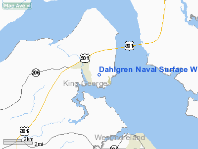
Dahlgren Naval Surface Warfare Center Airport |
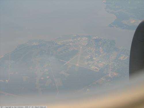 |
(Click on the photo to enlarge) |
Location & QuickFacts
| FAA Information Effective: | 2008-09-25 |
| Airport Identifier: | NDY |
| Airport Status: | Operational |
| Longitude/Latitude: | 077-02-13.2370W/38-19-58.3620N
-77.037010/38.332878 (Estimated) |
| Elevation: | 18 ft / 5.49 m (Estimated) |
| Land: | 0 acres |
| From nearest city: | 0 nautical miles E of Dahlgren, VA |
| Location: | York County, VA |
| Magnetic Variation: | 09W (1985) |
Owner & Manager
| Ownership: | Navy owned |
| Owner: | Us Navy |
| Address: | Oceanographic Ofc - Code 3142
Washington, DC 20373 |
| Address: |
|
Airport Operations and Facilities
| Airport Use: | Private |
| Segmented Circle: | No |
| Control Tower: | No |
| Lighting Schedule: | 24 HRS
CONTROLLED BY BASE OPS. |
| Sectional chart: | Washington |
| Region: | AEA - Eastern |
| Boundary ARTCC: | ZDC - Washington |
| Tie-in FSS: | DCA - Leesburg |
| FSS Toll Free: | 1-800-WX-BRIEF |
Airport Communications
Runway Information
Runway 16/34
| Dimension: | 4191 x 150 ft / 1277.4 x 45.7 m |
| Surface: | ASPH, |
| Weight Limit: | Single wheel: 35000 lbs.
Dual wheel: 85000 lbs.
Dual tandem wheel: 92000 lbs. |
| Edge Lights: | Low |
| |
Runway 16 |
Runway 34 |
| Longitude: | 077-02-27.1321W | 077-01-59.3433W |
| Latitude: | 38-20-15.9486N | 38-19-40.7755N |
| Elevation: | 18.00 ft | 16.00 ft |
| Alignment: | 127 | 127 |
| Traffic Pattern: | Right | Left |
| VASI: | 2-light PAPI on left side | 2-light PAPI on left side |
| Approach lights: | ODALS | |
| Runway End Identifier: | | Yes |
|
Radio Navigation Aids
| ID |
Type |
Name |
Ch |
Freq |
Var |
Dist |
| EZF | NDB | Shannon | | 237.00 | 10W | 19.9 nm |
| APH | NDB | A P Hill | | 396.00 | 10W | 20.0 nm |
| VKX | NDB | Potomac | | 241.00 | 10W | 25.3 nm |
| DC | NDB | Oxonn | | 332.00 | 11W | 26.0 nm |
| NHK | NDB | Patuxent | | 400.00 | 10W | 30.0 nm |
| GTN | NDB | Georgetown | | 323.00 | 09W | 36.1 nm |
| LJK | NDB | Ashey | | 280.00 | 09W | 39.6 nm |
| CJR | NDB | Culpeper | | 252.00 | 09W | 40.5 nm |
| MSQ | NDB | Nailr | | 351.00 | 10W | 41.6 nm |
| IQK | NDB | Louisa | | 382.00 | 09W | 43.1 nm |
| BUH | NDB | Anne Arundel | | 260.00 | 10W | 47.0 nm |
| CGE | NDB | Cambridge | | 355.00 | 10W | 48.9 nm |
| DCA | VOR/DME | Washington | 047X | 111.00 | 09W | 31.7 nm |
| BRV | VORTAC | Brooke | 092X | 114.50 | 09W | 14.9 nm |
| OTT | VORTAC | Nottingham | 084X | 113.70 | 10W | 26.3 nm |
| ADW | VORTAC | Andrews | 078X | 113.10 | 10W | 29.6 nm |
| PXT | VORTAC | Patuxent | 123X | 117.60 | 10W | 30.2 nm |
| AML | VORTAC | Armel | 082X | 113.50 | 08W | 41.4 nm |
| CSN | VORTAC | Casanova | 110X | 116.30 | 06W | 43.2 nm |
| ADW | VOT | Andrews Afb | | 109.60 | | 28.3 nm |
| DCA | VOT | Washington National | | 109.40 | | 30.8 nm |
Remarks
- GUN TESTS CONDUCTED OVER RIVER RANGE TO SE & EXPLOSIVE TESTS OVER LAND TO SOUTH.
- NO SERVICES.
- (A17-1) PPR, 24 HR ADVANCE NTC, V249-8638. OFFL BUS ONLY. C703-663-8638/8639.
- RSTD: DAY VFR HELICOPTER USE ONLY. NO FUEL OR MAINT SVC AVBL.
Images and information placed above are from
http://www.airport-data.com/airport/NDY/
We thank them for the data!
| General Info
|
| Country |
United States
|
| State |
VIRGINIA
|
| FAA ID |
NDY
|
| Latitude |
38-19-57.456N
|
| Longitude |
077-02-13.907W
|
| Elevation |
20 feet
|
| Near City |
DAHLGREN
|
We don't guarantee the information is fresh and accurate. The data may
be wrong or outdated.
For more up-to-date information please refer to other sources.
|
|


