 |
|
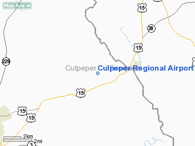
| Culpeper Regional Airport |
| IATA: none – ICAO: KCJR – FAA LID: CJR |
| Summary |
| Airport type |
Public |
| Owner |
County of Culpepper |
| Serves |
Culpeper, Virginia |
| Location |
Brandy Station, Virginia |
| Elevation AMSL |
316 ft / 96 m |
| Coordinates |
38°31′32″N 077°51′35″W / 38.52556°N 77.85972°W / 38.52556; -77.85972 |
| Runways |
| Direction |
Length |
Surface |
| ft |
m |
| 4/22 |
5,000 |
1,524 |
Asphalt |
| Statistics (2007) |
| Aircraft operations |
55,767 |
| Based aircraft |
117 |
| Source: Federal Aviation Administration |
Culpeper Regional Airport (ICAO: KCJR, FAA LID: CJR) is a county-owned public-use airport located seven nautical miles (13 km) northeast of the central business district of Culpeper, a city in in Culpeper County, Virginia, United States. Located in Brandy Station, Virginia, the airport opened in 1968. The runway originally measured 3200 ft. by 75 ft. In 1983, the runway was lengthened to 4000 ft. In 2004, the runway was expanded to 5000 ft. by 100 ft. It can handle corporate size jets and large twin engine aircraft. The airport has an airfest every October since 1998, with performances such as aerobatics .
Although most U.S. airports use the same three-letter location identifier for the FAA and IATA, this airport is assigned CJR by the FAA but has no designation from the IATA. Brandy Station Battlefield
The Brandy Station Battlefield is located almost right across the street from the airport. It was the site of the largest cavalry battle in the western hemisphere. In the first phase of the Battle of Brandy Station, Confederate artillery was set up in a line, the east end of which was on the current site of the airport. Union cavalry charged on their position, but was repulsed, and the fighting went on further to the north.
Facilities and aircraft
Culpeper Regional Airport covers an area of 301 acres (122 ha) at an elevation of 316 feet (96 m) above mean sea level. It has one asphalt paved runway deisgnated 4/22 which measures 5,000 by 100 feet (1,524 x 30 m).
For the 12-month period ending March 30, 2007, the airport had 55,767 aircraft operations, an average of 152 per day: 94% general aviation, 5% military and 1% air taxi. At that time there were 117 aircraft based at this airport: 93% single-engine, 3% multi-engine, 2% helicopter and 2% ultralight.
The above content comes from Wikipedia and is published under free licenses – click here to read more.
 |
(Click on the photo to enlarge) |
 |
(Click on the photo to enlarge) |
Location & QuickFacts
| FAA Information Effective: | 2008-09-25 |
| Airport Identifier: | CJR |
| Airport Status: | Operational |
| Longitude/Latitude: | 077-51-34.7000W/38-31-31.7000N
-77.859639/38.525472 (Estimated) |
| Elevation: | 316 ft / 96.32 m (Surveyed) |
| Land: | 301 acres |
| From nearest city: | 7 nautical miles NE of Culpeper, VA |
| Location: | Culpeper County, VA |
| Magnetic Variation: | 10W (2005) |
Owner & Manager
| Ownership: | Publicly owned |
| Owner: | County Of Culpepper |
| Address: | 302 N Main St
Culpeper, VA 22701
ADMIN BLDG, C/O FRANK BOSSIO. |
| Phone number: | 540-727-3427 |
| Manager: | Tanya Woodward |
| Address: | 12517 Beverly Ford Road
Brandy Station, VA 22714 |
| Phone number: | 540-825-8280 |
Airport Operations and Facilities
| Airport Use: | Open to public |
| Wind indicator: | Yes |
| Segmented Circle: | Yes |
| Control Tower: | No |
| Lighting Schedule: | DUSK-DAWN
ACTVT MIRL RY 04/22, REIL RY 4, PAPI RY 4, REIL RY 22, PAPI RY 22 & TWY LGTS - CTAF. |
| Beacon Color: | Clear-Green (lighted land airport) |
| Landing fee charge: | No |
| Sectional chart: | Washington |
| Region: | AEA - Eastern |
| Boundary ARTCC: | ZDC - Washington |
| Tie-in FSS: | DCA - Leesburg |
| FSS on Airport: | No |
| FSS Toll Free: | 1-800-WX-BRIEF |
| NOTAMs Facility: | CJR (NOTAM-d service avaliable) |
| Federal Agreements: | NGY |
Airport Communications
| CTAF: | 123.075 |
| Unicom: | 123.075 |
Airport Services
| Fuel available: | 100LLA |
| Airframe Repair: | MAJOR |
| Power Plant Repair: | MAJOR |
| Bottled Oxygen: | NONE |
| Bulk Oxygen: | NONE |
Runway Information
Runway 04/22
| Dimension: | 5000 x 100 ft / 1524.0 x 30.5 m |
| Surface: | ASPH, Good Condition |
| Weight Limit: | Single wheel: 40000 lbs. |
| Edge Lights: | Medium |
| |
Runway 04 |
Runway 22 |
| Longitude: | 077-51-49.5319W | 077-51-19.7598W |
| Latitude: | 38-31-09.9294N | 38-31-53.4687N |
| Elevation: | 315.00 ft | 314.00 ft |
| Alignment: | 28 | 127 |
| ILS Type: | LOCALIZER
| |
| Traffic Pattern: | Left | Left |
| Markings: | Non-precision instrument, Good Condition | Non-precision instrument, Good Condition |
| Crossing Height: | 40.00 ft | 40.00 ft |
| VASI: | 4-light PAPI on left side | 4-light PAPI on left side |
| Visual Glide Angle: | 3.00° | 3.00° |
| Runway End Identifier: | Yes | Yes |
| Obstruction: | 36 ft pole, 1483.0 ft from runway, 81 ft right of centerline, 35:1 slope to clear | 15 ft fence, 338.0 ft from runway, 264 ft right of centerline, 9:1 slope to clear |
|
Radio Navigation Aids
| ID |
Type |
Name |
Ch |
Freq |
Var |
Dist |
| CJR | NDB | Culpeper | | 252.00 | 09W | 0.3 nm |
| MSQ | NDB | Nailr | | 351.00 | 10W | 4.8 nm |
| EZF | NDB | Shannon | | 237.00 | 10W | 24.8 nm |
| GDX | NDB | Goodwin Lake | | 227.00 | 08W | 25.8 nm |
| IQK | NDB | Louisa | | 382.00 | 09W | 30.4 nm |
| LUA | NDB | Caverns | | 245.00 | 09W | 30.6 nm |
| TZ | NDB | Cogan | | 364.00 | 10W | 35.1 nm |
| APH | NDB | A P Hill | | 396.00 | 10W | 36.4 nm |
| DC | NDB | Oxonn | | 332.00 | 11W | 41.7 nm |
| GTN | NDB | Georgetown | | 323.00 | 09W | 42.2 nm |
| AZS | NDB | Azalea Park | | 336.00 | 08W | 43.9 nm |
| VKX | NDB | Potomac | | 241.00 | 10W | 44.5 nm |
| LJK | NDB | Ashey | | 280.00 | 09W | 48.7 nm |
| DCA | VOR/DME | Washington | 047X | 111.00 | 09W | 43.5 nm |
| CSN | VORTAC | Casanova | 110X | 116.30 | 06W | 7.0 nm |
| LDN | VORTAC | Linden | 090X | 114.30 | 06W | 25.6 nm |
| BRV | VORTAC | Brooke | 092X | 114.50 | 09W | 26.4 nm |
| AML | VORTAC | Armel | 082X | 113.50 | 08W | 30.7 nm |
| GVE | VORTAC | Gordonsville | 103X | 115.60 | 06W | 33.7 nm |
| ADW | VORTAC | Andrews | 078X | 113.10 | 10W | 49.6 nm |
| DCA | VOT | Washington National | | 109.40 | | 43.3 nm |
| ADW | VOT | Andrews Afb | | 109.60 | | 48.6 nm |
Remarks
- DEER ON AND INVOF ARPT.
- GCO AVBL ON FREQ 135.075 THRU PCT CLEARANCE DELIVERY.
Images and information placed above are from
http://www.airport-data.com/airport/CJR/
We thank them for the data!
| General Info
|
| Country |
United States
|
| State |
VIRGINIA
|
| FAA ID |
CJR
|
| Latitude |
38-31-36.147N
|
| Longitude |
077-51-31.879W
|
| Elevation |
313 feet
|
| Near City |
CULPEPER
|
We don't guarantee the information is fresh and accurate. The data may
be wrong or outdated.
For more up-to-date information please refer to other sources.
|
|


