 |
|
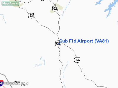
Location & QuickFacts
| FAA Information Effective: | 2008-09-25 |
| Airport Identifier: | VA81 |
| Airport Status: | Operational |
| Longitude/Latitude: | 077-53-57.9830W/37-56-43.5070N
-77.899440/37.945419 (Estimated) |
| Elevation: | 396 ft / 120.70 m (Surveyed) |
| Land: | 0 acres |
| From nearest city: | 4 nautical miles S of Mineral, VA |
| Location: | Louisa County, VA |
| Magnetic Variation: | 08W (1985) |
Owner & Manager
| Ownership: | Privately owned |
| Owner: | Doris E. Mccray |
| Address: | 15434 Cross County Rd
Mineral, VA 23117 |
| Phone number: | 703-894-4465 |
| Address: |
|
Airport Operations and Facilities
| Airport Use: | Private |
| Wind indicator: | Yes |
| Segmented Circle: | No |
| Control Tower: | No |
| Landing fee charge: | No |
| Sectional chart: | Washington |
| Region: | AEA - Eastern |
| Boundary ARTCC: | ZDC - Washington |
| Tie-in FSS: | DCA - Leesburg |
| FSS on Airport: | No |
| FSS Toll Free: | 1-800-WX-BRIEF |
Airport Services
| Airframe Repair: | NONE |
| Power Plant Repair: | NONE |
Runway Information
Runway 18/36
| Dimension: | 1400 x 80 ft / 426.7 x 24.4 m |
| Surface: | TURF, |
| |
Runway 18 |
Runway 36 |
| Traffic Pattern: | Left | Left |
|
Radio Navigation Aids
| ID |
Type |
Name |
Ch |
Freq |
Var |
Dist |
| IQK | NDB | Louisa | | 382.00 | 09W | 4.9 nm |
| LJK | NDB | Ashey | | 280.00 | 09W | 22.4 nm |
| APH | NDB | A P Hill | | 396.00 | 10W | 28.5 nm |
| EZF | NDB | Shannon | | 237.00 | 10W | 28.7 nm |
| AZS | NDB | Azalea Park | | 336.00 | 08W | 29.6 nm |
| MSQ | NDB | Nailr | | 351.00 | 10W | 30.6 nm |
| CJR | NDB | Culpeper | | 252.00 | 09W | 35.2 nm |
| CF | NDB | Pubbs | | 392.00 | 09W | 42.5 nm |
| FVX | NDB | Farmville | | 367.00 | 07W | 43.9 nm |
| BKT | NDB | Blackstone | | 326.00 | 09W | 49.7 nm |
| GVE | VORTAC | Gordonsville | 103X | 115.60 | 06W | 12.7 nm |
| FAK | VORTAC | Flat Rock | 080X | 113.30 | 06W | 25.3 nm |
| BRV | VORTAC | Brooke | 092X | 114.50 | 09W | 34.9 nm |
| RIC | VORTAC | Richmond | 088X | 114.10 | 09W | 38.3 nm |
| CSN | VORTAC | Casanova | 110X | 116.30 | 06W | 41.9 nm |
Remarks
Images and information placed above are from
http://www.airport-data.com/airport/VA81/
We thank them for the data!
| General Info
|
| Country |
United States
|
| State |
VIRGINIA
|
| FAA ID |
VA81
|
| Latitude |
37-56-43.507N
|
| Longitude |
077-53-57.983W
|
| Elevation |
396 feet
|
| Near City |
MINERAL
|
We don't guarantee the information is fresh and accurate. The data may
be wrong or outdated.
For more up-to-date information please refer to other sources.
|
|


